Ringstead Bay Walk
![]()
![]() This walk takes you along a particularly lovely section of the Jurassic coastline near Weymouth in Dorset.
This walk takes you along a particularly lovely section of the Jurassic coastline near Weymouth in Dorset.
The circular walk starts at Southdown at the good sized National Trust car park. It's also a terrific viewpoint with views over Weymouth Bay to Portland. A good footpath then takes you down to Burning Cliff where you pick up the South West Coast Path to White Nothe. The cliffs and views at White Nothe are particularly special. You can then return the same way or pick up the altrenative bridleway to take you back to the car park.
This stretch has some wonderful coastal scenery with bays, beaches and spectacular cliffs. There is also some lovely countryside to enjoy and the option of following a steep track down to the shingle beach.
You can extend your walk by continuing a few miles east and visiting the beautiful Lulworth Cove and Durdle Door. Another good option is to head west along the coast path an visit Osmington Mills and Osmington Bay. From here you can climb to the Osmington White Horse and enjoy more fabulous views of the area.
Postcode
BA12 0AP - Please note: Postcode may be approximate for some rural locationsRingstead Bay Ordnance Survey Map  - view and print off detailed OS map
Ringstead Bay Open Street Map  - view and print off detailed map
Ringstead Bay OS Map  - Mobile GPS OS Map with Location tracking
Ringstead Bay Open Street Map  - Mobile GPS Map with Location tracking
Explore the Area with Google Street View 
Pubs/Cafes
Head west from the bay and you will find the noteworthy Smuggler's Inn. Situated on the cliff tops of the South West Coast Path, just outside the village of Osmington, the Smugglers Inn is a traditional English pub with stunning views overlooking the Isle of Portland. The pub also has an interesting history having been the headquarters of the French smuggler Pierre Latour and one of the main landing places for smuggled goods in the 17th century. Notably the Inn was originally built in the 13th century, with its own brewery at the rear. There's a lovely large garden area which is perfect for relaxing in when the weather is fine. You can fine the pub right on the coast at a postcode of DT3 6HF for your sat navs.
Dog Walking
The beach at Ringstead is dog friendly all year round. It's a great place for them to have a run and a swim.
Cycle Routes and Walking Routes Nearby
Photos
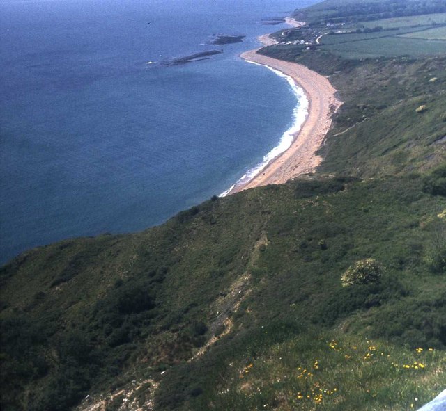
Ringstead Bay. View west from above White Nothe cliffs showing Ringstead Bay in the foreground with the village of Ringstead just beyond.
Rocky beach exposed at low tide, Ringstead Bay. This rocky beach is below the outer cliff below the White Nothe undercliff. The view is looking down from the top of the wooden ladder up the cliff to the start of the Smugglers Path to the White Nothe headland. Across the bay are the chalk hills above Ringstead. The cliff with the houses on top is known as the "Burning Cliff" following a fire that started in the shale in 1826, and burned for several years.
Coastal view east from White Nothe. From the eastern side of the tip of White Nothe a lot of this section of impressive chalk coastline can be seen. The chalk headland on the right is Bat's Head, with the top of Durdle Door (in shadow) sticking up above it. The headland beyond is Dungy Head, and in the far distance is the Isle of Purbeck coastline (Swyre Head, Houns-Tout cliff and St Aldhelms Head). The long hill in the distance on the left is Bindon Hill, Lulworth Cove is in the gap to the right of this, and Hambury Tout is on the right of the gap.
View towards White Nothe. The broad sweep of Ringstead Bay to the east of Ringstead Ledge is a shingle beach beneath the Kimmeridge clay of the Burning Cliff. On the far side of the bay is the landslip undercliff of White Nothe where the beach becomes rocky and is completely submerged at high tide.


