Templer Way
![]()
![]() Follow the Templer Way from Haytor on Dartmoor to the seaport of Teignmouth via Newton Abbot. The walk includes a wooded section through Yarner Woods near the route start and also visits the delightful Stover Country Park. With 14 acres of woodland, heathland, grassland, lake and marsh and a substantial variety of wildlife it is a real highlight on the walk.
Follow the Templer Way from Haytor on Dartmoor to the seaport of Teignmouth via Newton Abbot. The walk includes a wooded section through Yarner Woods near the route start and also visits the delightful Stover Country Park. With 14 acres of woodland, heathland, grassland, lake and marsh and a substantial variety of wildlife it is a real highlight on the walk.
Shortly after passing Newton Abbot you will join the River Teign for a beautiful waterside section that leads to the finish point at Teignmouth.
The walk is named after the Templer family who constructed the Stover Canal and Tramway to transport granite from Haytor Quarry to the coast at Teignmouth.
Templer Way Ordnance Survey Map  - view and print off detailed OS map
Templer Way Open Street Map  - view and print off detailed map
Templer Way OS Map  - Mobile GPS OS Map with Location tracking
Templer Way Open Street Map  - Mobile GPS Map with Location tracking
Pubs/Cafes
On the route in the village of Haytor Vale you can visit the Rock Inn, an impressive 18th century former coaching inn. The inn has a lot of character with a cosy interior and a nice sunny beer garden to relax in on warmer days. There's a very good menu and an on-site restaurant featuring local meat, game and fish. The Rock also has a free car park and is dog friendly with a separate dining area where you can eat with your dog. They provide good quality accommodation too, if you need to stay over. It's a popular place for walkers to go after climbing Hound Tor and Haytor being located just a short distance from both. Postcode for your sat navs is TQ13 9XP.
Further Information and Other Local Ideas
In Newton Abbot you could pay a visit to Decoy Country Park. There's a Wildlife Discovery Centre, Nature Reserve and a watersports centre next to a pretty lake to enjoy here.
Cycle Routes and Walking Routes Nearby
Photos
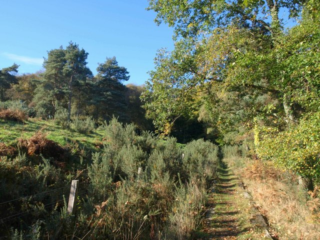
View of the trail near Brimley. The Way, following the Haytor granite tramway, within sight of the eastern edge of Yarner Wood, with gorse and pines on the slopes of Lower Down.
These duckboards take the Templer Way across the point where a drain from the Teign floodplain meets the disused Stover canal.
Reed beds by the Way. A large pond is beyond the reed beds, although its size seems to have shrunk in recent years. On the far slope is part of the Orleigh development north of Jetty Marsh.
Elevation Profile


