Isle of Man Walks

Use the links to view full route information including elevation profiles, interactive maps and GPS downloads.
You can also view an overview map of all the routes in the using the Isle of Man Walk Map>>
*New* - Walks and Cycle Routes Near Me Map - Waymarked Routes and Mountain Bike Trails>>
| Route Name | Photo | Distance | Description |
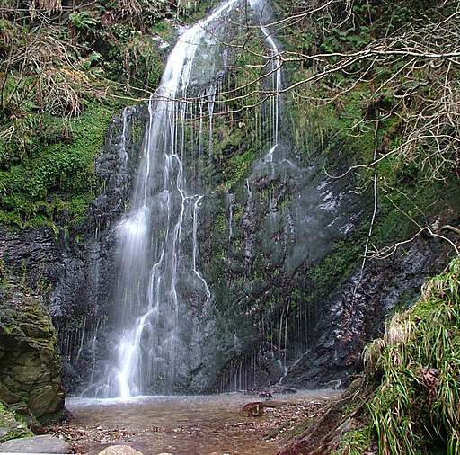
| Dhoon Glen | 1.1 miles (1.8 km) | This walk visits a delightful wooden glen on the east coast of the Isle of Man, a few miles south of Ramsey. View Full Details>> | |
| Douglas | 1.5 miles (2.4 km) | This walk takes you along the coastal path in Douglas with fine views out to the historic castle on St Mary's Isle in Douglas Bay. View Full Details>> | |
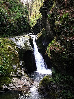
| Glen Maye | 1.2 miles (2 km) | This pretty glen on the Isle of Man is perfect for a peaceful stroll in beautiful surroundings. In the glen you will find woodland paths taking you to a delightful waterfall and a pebble beach on the coast. It's a very pretty area with the rushing water of the Rushen River surrounded by lush vegetation such as wild garlic and ferns. The striking cliffs at the western end of the glen have wonderful views across the coast. They are also a good place to look out for sea birds, fulmars and hawks. There is a good sized car park on Shore Road at the eastern end of the glen. From here you can directly pick up the footpaths through the glen. At the beach the glen links with the Raad ny Foillan (Isle of Man Coastal Path). If you pick this up and head north you can visit Peel Castle. View Full Details>> | |
| Groudle Glen | 1.1 miles (1.8 km) | This walk visits Groudle Glen just north of Douglas on the Isle of Man. View Full Details>> | |
| Raad ny Foillan - Isle of Man Coastal Path | 95.1 miles (153 km) | Follow the Isle of Man Coast path along the beautiful Manx coast and enjoy some stunning coastal scenery. The 95 mile (153km) walk is waymarked with a White gull on blue sign. This is beacause in English the route is known as 'The Way of the Gull'. The island is wonderful for flora and fauna. Look out for grey seals and a variety of seabirds including kittiwakes, Manx shearwaters, puffins and guillemots. The walk starts in Douglas, the capital and largest town on the island. The first section heads south west to Castletown passing Santon Head and the lovely Langness peninsula. You'll also pass Dreswick Point the southernmost point of the main island of the Isle of Man. From Castletown you continue west to Port St Mary and Spanish Head where there are views to the Calf of Man. The route turns north to Port Erin where you will find the Isle of Man Railway Museum. From Port Erin you head to Peel climbing Bradda Hill and Cronk ny Arrey Laa where there are great cliff top views. You will also pass the magical Glen Maye with its picturesque waterfall and lush woodland trails. View Full Details>> | |
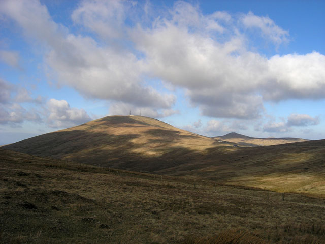
| Snaefell | 1.9 miles (3 km) | Climb to the peak of the highest mountain on the Isle of Man on this short climb from the Bungalow station. It's about a one mile climb from the station which is on the excellent Snaefell Mountain Railway. Catch the railway from the town of Laxey then alight at Bungalow to climb the rest of the way. You can also drive to the Bungalow car park and start the walk from there. The trail has sections of gravel, slate stones, grass and rock. It's a short path but quite steep near the summit. From the 2,037 feet (620.9 m) high summit it is said you can see the six kingdoms of the Isle of Man, England, Ireland, Scotland, Wales and Heaven. A plaque points out the directions of landmarks and their distances from the summit. At Laxey you can pick up the Isle of Man Coastal Path to extend your walk. View Full Details>> |