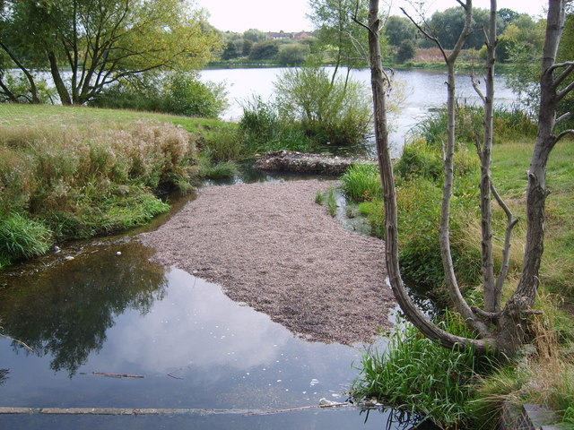
River Cole Valley

 This easy cycling and walking route runs along the River Cole through Birmingham.
The waterside route follows a nice flat path suitable for both cyclists and walkers. It runs for a distance of about 10 miles, passing through several Birmingham suburbs with parks, lakes and a canal to see on the way.
You can start off at Bacon's End, near Meriden Park in Chelmsley Wood. There's a lake here, the Kinghurst Brook and a small car park at an address of Moorend Avenue, Chelmsley Wood with a postcode of B37 5TB for your sat navs. From here follow the trail west through Kingfisher Country Park and the Babb's Mill Nature Reserve. There's some pretty lakes here with lots of wildlife to see as well. The car park here makes for an alternative start point if you prefer.
The trail continues west through Colehall and Shard End to Stechford Bridge. Here you turn south through Alum Rock, Bordesley Green and Hay Mills. At this point the route links with the Grand Union Canal Walk which you could follow west into Birmingham or east towards Solihull. This route continues south past Sparkhill and Springfield before finishing at Yardley Wood. The final section passes the noteworthy Sarehole Mill. The 16th century mill is notable as Birmingham's last surviving water mill.
Postcode
B37 5TB - Please note: Postcode may be approximate for some rural locationsCole Valley Ordnance Survey Map  - view and print off detailed OS map
Cole Valley Open Street Map  - view and print off detailed map
Cole Valley OS Map  - Mobile GPS OS Map with Location tracking
Cole Valley Open Street Map  - Mobile GPS Map with Location tracking
Pubs/Cafes
At Sarehole Mill you could stop off and enjoy delicious freshly baked pizza in the pleasant courtyard at the site.
Further Information and Other Local Ideas
Near the start of the route you can pick up the Solihull Way and follow the waymarked trail south to visit Sheldon Country Park.
Near Sarehole Mill there's the Moseley Bog Nature Reserve to visit. Here you can enjoy more easy trails around the ancient woodland with lots of wildlife to see on the way.
For more walking and cycling ideas in the area see the West Midlands Walks and the West Midlands Cycle Routes pages.
Cycle Routes and Walking Routes Nearby
Photos
Sarehole Mill, Hall Green, Birmingham. There has been a mill on this site since 1542. It has been rebuilt since that time and was used by Matthew Boulton for sheet metal rolling during the 18th century. It was also used for grinding tools, making gun barrels and finally as a flour mill. It is Birmingham's last surviving water mill, and flour making demonstrations are still held occasionally. It is open to the public free of charge and deserves a visit if you're ever in the area.
This mosaic is near the entrance to the valley walk by the Stratford Road crossing on the River Cole. It looks like a dragon fly in a heart shape. The River Cole is now in what is the Shire Country Park. It was the Millstream Way at one point. Named in honour of J R R Tolkien who used to live in the village of Sarehole (now part of the Moseley / Hall Green border).
This is the old four arches bridge. Previously, this used to link Webb Lane and the Old Brook Lane. There is evidence of a tunnel under the railway line, but this eventually became disused. The Four Arches bridge now provides a footpath between Coleside Avenue and the Dingles Recreation ground in Hall Green across the River Cole.


