Solihull Walks - Canal and Country
![]()
![]() This large town is located in the West Midlands, near Birmingham. It is notable as the most affluent town in the West Midlands region and in 2013 was named the "best place to live" in the United Kingdom by a uSwitch Quality of Life survey. For walkers there's a wide range of options with two canals, local country parks, wildlife filled nature reserves, peaceful local woods, historic National Trust properties and several waymarked walks taking you into the surrounding Warwickshire countryside.
This large town is located in the West Midlands, near Birmingham. It is notable as the most affluent town in the West Midlands region and in 2013 was named the "best place to live" in the United Kingdom by a uSwitch Quality of Life survey. For walkers there's a wide range of options with two canals, local country parks, wildlife filled nature reserves, peaceful local woods, historic National Trust properties and several waymarked walks taking you into the surrounding Warwickshire countryside.
This long circular walk explores the countryside, canals, villages and parks to the south of the town. You'll use sections of the waymarked Solihull Way, the Heart of England Way, the Grand Union Canal Walk and the Stratford Upon Avon Canal as you make your way through the area. Highlights on the route include the pretty village of Knowle, the National Trust's Baddesley Clinton, the bluebells in Hay Wood and the lovely Earlswood Lakes.
The walk starts in the town centre where you can pick up the Solihull Way and follow the waymarked footpath north east to the Grand Union Canal, passing the pretty Malvern and Brueton Park on the way. Follow the towpath east and it will take you to Catherine-de-Barnes, Henwood Mill, Copt Heath, the Grade I listed Grimshaw Hall and Knowle. Here you'll pass a series of pretty locks on a particularly picturesque section of the canal.
From Knowle you continue south past Netherwood Heath before coming to Kingswood. Here you can take slight detour east to visit Baddesley Clinton where you will find an historic moated manor house surrounded by lovely grounds which include a walled garden and a lake. Also near Kingswood there's another National Trust Property in the shape of Packwood House to visit.
At Kingswood you pick up a section of the Stratford Upon Avon Canal and follow the towpath south to Lowsonford. Here you pick up the Heart of England Way and follow the waymarked trail west to Henley in Arden. This charming Warwickshire town includes a magnificent one mile high street with a collection of medieval buildings. In the town you can pick up the Arden Way and follow this trail north west to Ullenhall. You then head north west along Forde Hall Lane to Aspley Heath. Country Lane will then take you to Gilbert's Green and Wood end where you turn north to visit Earlswood Lakes. There's some nice footpaths around the large lakes and into the adjacent Clowes Wood. At the lakes you can pick up the Solihull Way again and follow it north east back into the town.
Solihull Ordnance Survey Map  - view and print off detailed OS map
Solihull Open Street Map  - view and print off detailed map
Solihull OS Map  - Mobile GPS OS Map with Location tracking
Solihull Open Street Map  - Mobile GPS Map with Location tracking
Walks near Solihull
- Solihull Way - Starting at Earlswood Lakes head through Solihull to Castle Bromwich Hall
- Malvern and Brueton Park - This lovely park in Solihull has nice footpaths and a cycle trail to follow
- Knowle Canal Walk - A waterside walk along the Grand Union Canal starting from the village of Knowle near Solihull
- Earlswood Lakes - Enjoy a stroll along these three reservoirs and into the adjacent woodland on this lovely walk in Solihull
- Kingfisher Country Park - Enjoy walking and cycling along the River Cole in this pretty country park in South Birmingham
- Sheldon Country Park - A short walk or cycle through the pretty Sheldon Country Park in Birmingham
- Packwood House - This tudor house in Lapworth has nice footpaths to follow through the grounds and surrounding countryside
- Heart of England Way - Follow the Heart of England Way through the Midlands of England
- Grand Union Canal Walk - Follow the towpath of Britain's longest canal from London to Birmingham on this fabulous waterside walk
- Stratford Upon Avon Canal - Enjoy waterside cycling and walking on this 26 mile canal which runs from Stratford Upon Avon to Birmingham
- Baddesley Clinton - Enjoy a circular walk through the delightful grounds surrounding this moated manor house near Warwick
- Henley in Arden Circular Walk - This circular walk explores the villages, rivers, canals and countryside surrounding the charming town of Henley in Arden in Warwickshire
- Arden Way - This circular walk takes you on a tour of the beautiful Forest of Arden in Warwickshire
- Clowes Wood - Enjoy miles of cycling and walking trails in this area of woodland near Whitstable
- Cole Valley - This easy cycling and walking route runs along the River Cole through Birmingham.
- Sarehole Mill - This walk visits the pretty Sarehole Mill in Birmingham
- Moseley Bog - This local nature reserve in the Moseley area of Birmingham is a nice place for an easy stroll in the city
- Olton Reservoir - Olton Reservoir or Mere is located in the Solihull area.
- Dorridge - This West Midlands based village is located just south of Solihull.
Pubs/Cafes
Back in the town the Beech House is a good choice for some post walk refreshment. They have a great menu and a popular covered and heated outdoor dining area. You can find them in the town centre at 727 Warwick Rd, B91 3DA.
On the route you could stop off at The Boat in Catherine de Barnes. The 19th century pub is nicely situated next to the canal and has a nice garden area for warmer weather. You can find them at 222 Hampton Lane with a postcode of B91 2TJ for your sat navs.
In Lowsonford there's the noteworthy Fleur De Lys. The pub is well known for its quality pies and its delightful canalside garden. It's a great spot to relax and watch the boats go by on a fine day. The pub has some history too, dating back to the 16th century with a charming old interior which includes wooden beams, a real fire and quirky corners. You can find them on Lapworth Street with postcode B95 5HJ for your sat navs. They have a car park and are also dog friendly.
Dog Walking
The country trails, woodland areas and waterside paths are great for dog walking. The two pubs mentioned above are also very dog friendly.
Further Information and Other Local Ideas
Just to the south is the village of Dorridge. The village is noted for its high property prices and the pretty Dorridge Park where there's woodland trails, a nature reserve and a children's play area. For more walking ideas in the area see the West Midlands Walks page.
Photos
Elmdon Park, Solihull. The western side of Elmdon Park, Solihull. (Birmingham City Centre can be seen on the horizon).
Stratford-upon-Avon Canal at Kingswood Junction. Looking along the canal towards Stratford-upon-Avon. Just below the lock, and to the left is a link across to the Grand Union canal. This was only recently re-instated to save water. Since the early days of the canal boats travelling from the GU had to go up one lock, do a U turn around Kingswood Junction and then drop back down this lock.
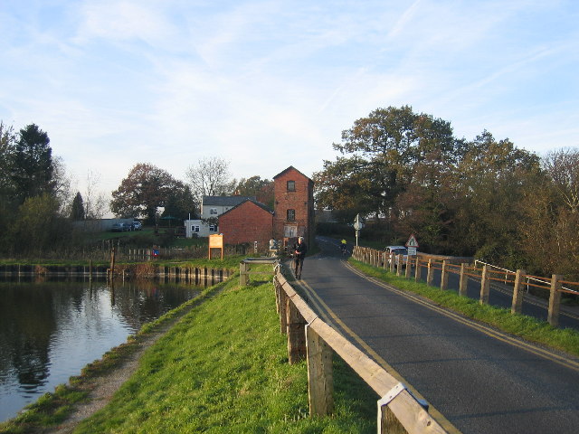
Earlswood Lakes - Engine House. The lakes are located a few miles south west of Solihull and are a popular place for walkers.
Earlswood Lakes were built to provide water for the Stratford-upon-Avon Canal. This view is looking NW along to the dam towards the old engine house at the point at which the canal feeder leaves the lakes. The lakes are divided into three pools and the one seen here is known as Engine Pool.
Stratford Canal, Dickens Heath nature reserve, near Solihull. Approaching some very "ambitious" apartment developments by the canal.
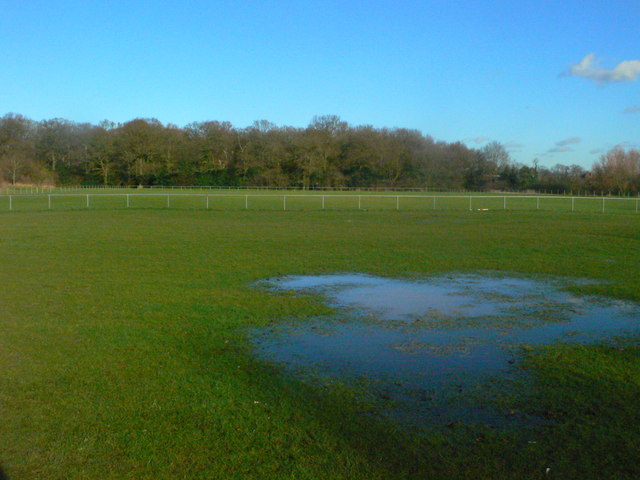
Hillfield Park and Widney Woods Hillfield Park, with the woodland correctly named Parish Poles, and known locally as Widney Woods, in the background. Now public open space, it was until the 1970s used as a landfill site for Solihull's domestic waste. A tributary of the Cran Brook lies buried several feet below. It's located on the southern outskirts of the town.


