GPS Cycle and Walking Routes

Lancashire Cycleway Northern Loop

130 miles (209 km)

This is the northern section of the epic Lancashire Cycleway. The circular ride runs for about 130 miles, taking you on a tour of some of the county's best scenery.
The trail uses a series of quiet country lanes with highlights including the Forest of Bowland AONB, a series of pretty rural villages and coastal sections around Silverdale, Cockerham and Carnforth. In this area you can also enjoy views to the mountains in the nearby Cumbrian Lake District.
The route links with National Cycle Route 6 in the western section and National Cycle Route 69 in the northern section.
Scroll down for maps, a video and the gpx file for the route.

Lancashire Cycleway Northern Loop OS Map - Mobile GPS OS Map with Location tracking

Lancashire Cycleway Northern Loop Open Street Map - Mobile GPS Map with Location tracking

Photos

Waddington, Waddington Brook - geograph.org.uk - 3085854

Waddington, Waddington Brook. This pretty village is just north of Clitheroe in the Ribble Valley.

Salley Abbey - geograph.org.uk - 1736378

The ruins of Sawley Abbey or Salley Abbey - it is known by both names. Founded by William de Percy in 1147 as a Cistercian Monastery and operated for nearly 400 years - although never enjoying much wealth. This did not stop the tyrant Henry VIII dissolving the house, and executing the last abbot for his involvement in the Pilgrimage of Grace. The photograph shows what is left of the chapel.

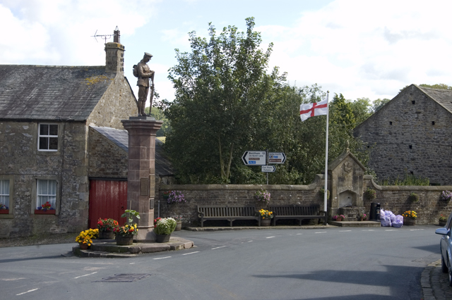
War Memorial and road junction Slaidburn - geograph.org.uk - 2555340

War Memorial and road junction Slaidburn

Gressingham - geograph.org.uk - 2898418

Gressingham

Relaxing at Silverdale - geograph.org.uk - 3335840

Relaxing at Silverdale Beach.

Cockerham Sands Caravan Park - geograph.org.uk - 1958983

Cockerham Sands Caravan Park

Wrea Green village green - geograph.org.uk - 2629824

Wrea Green village green. There's a nice pub and a cricket pitch in this pretty village near Lytham and Kirkham on the southern part of the ride.

The garden in Myerscough College - geograph.org.uk - 3126209

The garden in Myerscough College. You can stop off at this lovely garden centre which includes extensive gardens and a cafe. It is located on the route east of Kirkham.

Video

GPS Files

GPX File

Lancashire Cycleway Northern Loop.gpx (On Desktop:Right Click>'Save As. On Ipad/Iphone:Click and hold>Share>Save to Files')