National Cycle Route 54

 This Sustrans cycle route runs from Worcestershire based Stourport on Severn to Parsley Hay.
Please note as of time of writing the route is only open in sections. The route on the map below uses other open NCN routes and minor roads to create a complete linear route.
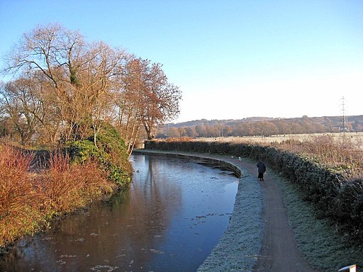
On the way you will pass Kidderminster and Kinver on the lovely opening traffic free section along the Staffordshire and Worcestershire Canal.
The trail continues north through the Midlands and Derbyshire to Dudley, Lichfield, Burton and Derby.
Towards the end of the route there's another fine traffic free section along the High Peak Trail. This section exposes you to some wonderful Peak District scenery before finishing at the village of Parsley Hay. Here you can link up with the popular Tissington Trail to explore the area further.
See the list below for day rides along the route:
Cycle Routes along National Cycle Route 54
- Stourport To Kinver - This route follows National Cycle Network Route 54 from Stourport to Kidderminster and Kinver.
- Derby to Ashbourne - Follow the trail through Derbyshire on this lovely route
- Burton-Upon-Trent to Derby - Travel through Staffordshire into Derbyshire along the trail on this pleasant short route
- Burton-Upon-Trent to Uttoxeter - Travel through Staffordshire and Derbyshire along the trail on this interesting route
- High Peak Trail - This splendid, shared walking and cycle trail follows a disused railway line from Cromford to Dowlow through the beautiful Peak District.
The trail starts near Cromford railway station and climbs through the stunning High Peak area of Derbyshire giving fabulous views of the area.
The trail links with the popular Tissington Trail at High Peak Junction - Staffordshire and Worcestershire Canal - Follow the Staffordshire and Worcestershire Canal from Stourport-on-Severn to Great Haywood on this easy waterside walking and cycling route


