Pleasley Pit Country Park
![]()
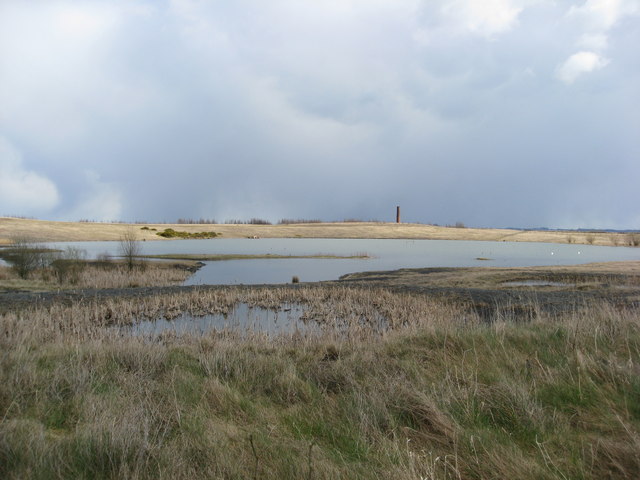
![]() This former colliery site in Mansfield has been converted into a lovely country park and local nature reserve. There are a series of nice walking trails taking you to ponds, reed beds, grassland and woodland. It's great for flora and fauna with orchids, butterflies and dragonflies. There's also a bird hide where you can look out for Sand Martins and the various other species that visit the park.
This former colliery site in Mansfield has been converted into a lovely country park and local nature reserve. There are a series of nice walking trails taking you to ponds, reed beds, grassland and woodland. It's great for flora and fauna with orchids, butterflies and dragonflies. There's also a bird hide where you can look out for Sand Martins and the various other species that visit the park.
The park also includes a cycle path so you can bring your bike. Parking is available at the south eastern end of the park.
You can also learn about the history of the site by touring the engines and south shaft pit top on open days. The remaining pit buildings are an impressive sight and are now a Scheduled Ancient Monument (SAM).
If you would like to extend your walk you could head a mile to the east and visit Pleasley Woods. Here you will find more good walking trails within broadleaved and coniferous woodland.
Also nearby is the wonderful Hardwick Hall Park where you will find miles of footpaths taking you around 2,500 acres of parkland, woodland, wetland and farmland. This is located just a couple of miles west of Pleasley.
The Teversal Trail passes the southern end of the park. This shared cycling and walking trail uses disused colliery lines to form a circular route around the villages of Teversal and Skegby.
You can follow it south and visit Silverhill Wood. The country park was also built on former colliery sites and includes the highest point in Nottinghamshire.
Postcode
NG19 7PH - Please note: Postcode may be approximate for some rural locationsPlease click here for more information
Pleasley Pit Country Park Ordnance Survey Map  - view and print off detailed OS map
Pleasley Pit Country Park Open Street Map  - view and print off detailed map
Pleasley Pit Country Park OS Map  - Mobile GPS OS Map with Location tracking
Pleasley Pit Country Park Open Street Map  - Mobile GPS Map with Location tracking
Further Information and Other Local Ideas
Just east of the park you can extend your walk around Pleasley Vale. The vale includes a River Meden path which will take you to several old mill buildings and a nature reserve with lots more wildlife to see. On the southern side of the river there's also a cycle path along the River Meden Railway Trail which leads towards Mansfield.


