Plymouth to Tavistock
![]()
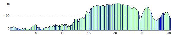
![]() Follow National Cycle Route 27 from Plymouth to Tavistock on this attractive largely traffic free route. The route starts near the Plymouth town centre and then heads north along the River Plym and the West Devon Way, passing by the impressive Saltram House - a George II era mansion. There is then a long traffic free stretch through woodland taking you through Bickleigh Vale to Clearbrook and Yelverton. You then cross the Grenofen Bridge over the River Walkham before an on road section takes you to Tavistock on the River Tavy.
Follow National Cycle Route 27 from Plymouth to Tavistock on this attractive largely traffic free route. The route starts near the Plymouth town centre and then heads north along the River Plym and the West Devon Way, passing by the impressive Saltram House - a George II era mansion. There is then a long traffic free stretch through woodland taking you through Bickleigh Vale to Clearbrook and Yelverton. You then cross the Grenofen Bridge over the River Walkham before an on road section takes you to Tavistock on the River Tavy.
Plymouth to Tavistock Ordnance Survey Map  - view and print off detailed OS map
Plymouth to Tavistock Open Street Map  - view and print off detailed map
Plymouth to Tavistock OS Map  - Mobile GPS OS Map with Location tracking
Plymouth to Tavistock Open Street Map  - Mobile GPS Map with Location tracking
Further Information and Other Local Ideas
At the end of the route you can pick up with the 22 mile Drakes Trail. It starts in Tavistock and visits the Tavistock Canal and Grenofen Bridge before linking up with the popular Plym Valley Trail. The shared cycling and walking route is named after the explorer Sir Francis Drake who was born in Tavistock and has a statue at the other end of the route in Plymouth.
Elevation Profile