Shipwrights Way

 A long distance cycling and walking trail running from Alice Holt Forest to Portsmouth along the imagined route a tree may have taken from forest to warship.
The varied trail includes woodland sections, country parks and coastal paths.
On the way you'll pass Bordon, Liphook, Liss, Petersfield, Queen Elizabeth Country Park, Staunton Country Park, Langstone Harbour, Havant and Hayling Island. There's splendid views of the South Downs and lovely views over to the Isle of Wight on the final coastal section. A lot of the route takes place on nice off road trails but there are some on road sections which are less suitable for walkers.
The route starts from Bentley Rail Station on the edge of Alice Holt Forest. You then head south, following the woodland trails through the forest.
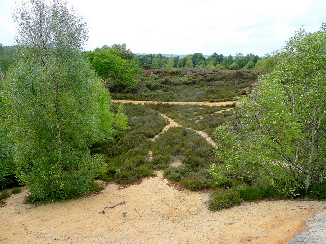
You continue south past Broxhead Common to Bordon, where you skirt the edge of Woolmer Forest.
The expansive site includes oak-birch woodland, conifer plantations, open sandy heaths, and rough grazed pastures.
The route continues through Liss and Petersfield before coming to the splendid Queen Elizabeth Country Park. The large park is one of the highlights of the trail with 2000 acres of open access woodland and downland. There's also great views over the South Downs as you make your way through this area.
The next stage runs from the park to Havant passing Rowland's Castle and Staunton Country Park. The 1000 acre park includes a farm, two lakes, a maze, a walled garden and glasshouses containing exotic tropical flowers and plants from around the world.
You continue south through Havant to Hayling Island where you pick up the Hayling Billy Trail to take you along the western side of the island. The trail provides great views of Langstone Harbour which is an internationally important site for its wildfowl and wading birds.
The final section takes you over the ferry to Portsea Island where you run along the coast through Southsea to the finish point at Portsmouth Docks. There's some fine views over Portsmouth Harbour and the option of catching the ferry over to Gosport.
Shipwrights Way Ordnance Survey Map  - view and print off detailed OS map
Shipwrights Way Open Street Map  - view and print off detailed map
Shipwrights Way OS Map  - Mobile GPS OS Map with Location tracking
Shipwrights Way Open Street Map  - Mobile GPS Map with Location tracking
Pubs/Cafes
In Petersfield you can stop for refreshments at The Old Drum on Chapel St at postcode GU32 3DP. The contemporary country pub is located in the centre of Petersfield and has a lovely beer garden. Built in the 18th Century, it is the oldest in the area and has been beautifully restored to keep its character and charm.
The Ship Inn in Langstone is wonderfully positioned for a pit stop. The family-friendly seaside pub overlooks Sweare Deep and Emsworth Harbour. There's a fantastic outdoor area right next to the water and a cosy interior with a warming fire. You can find the pub in Langstone with a postcode of PO9 1RD for your sat navs.
At the other end of the route you could head to the Ferryboat Inn at Sinah on the south western tip of the island. It's another fine waterside pub with views over Langstone Harbour. The pub has a good sized car park, a fine menu and is also dog friendly. You can find the pub at postcode PO11 0DG.


Pictured above the Ship Inn and the beach at Sinah near the Ferryboat Inn. Both great waterside places to relax outside with a drink on a summer day.
In Liphook there's the 17th century Deers Hut to investigate. The historic pub is set in a former Queen Anne Hunting Lodge dating back to the 1600's. They serve a delicious Sunday lunch and have a lovely garden to sit out in on warmer days. You can find them at Longmoor Rd, Griggs Green, GU30 7PD.
Further Information and Other Local Ideas
In Bordon you could stop off to visit the Hogmoor Inclosure. The area has lots of family activities with woodland walking and cycling paths plus a sculpture trail.
Just to the south of QE Country Park you can pick up the Clanfield Walk and visit Butser Ancient Farm and Windmill Hill. The farm is one of the area highlights and includes an archaeological open-air museum with reconstructions of Neolithic dwellings, Iron Age roundhouses, a Romano-British villa and an early Saxon house.


