Southampton to Portsmouth
![]()
![]() Follow National Cycle Route 2 between these two major Hampshire ports. The route starts on the Itchen bridge in Southampton following the Solent Way to Netley where you will find the lovely Royal Victoria Country Park overlooking Southampton Water and the historic Netley Abbey. From there you continue to Hamble-le-Rice where you can catch the ferry over the River Hamble to Warsash. The route then continues along the coast, passing the beautiful Titchfield Haven Nature Reserve and Alver Valley Country Park, before joining the Gosport Ferry which will take you to the finish point near Portsmouth Harbour.
Follow National Cycle Route 2 between these two major Hampshire ports. The route starts on the Itchen bridge in Southampton following the Solent Way to Netley where you will find the lovely Royal Victoria Country Park overlooking Southampton Water and the historic Netley Abbey. From there you continue to Hamble-le-Rice where you can catch the ferry over the River Hamble to Warsash. The route then continues along the coast, passing the beautiful Titchfield Haven Nature Reserve and Alver Valley Country Park, before joining the Gosport Ferry which will take you to the finish point near Portsmouth Harbour.
Southampton to Portsmouth Ordnance Survey Map  - view and print off detailed OS map
Southampton to Portsmouth Open Street Map  - view and print off detailed map
Southampton to Portsmouth OS Map  - Mobile GPS OS Map with Location tracking
Southampton to Portsmouth Open Street Map  - Mobile GPS Map with Location tracking
Pubs/Cafes
On the ride you could stop at Titchfield Haven's on site cafe for refreshments. In the visitor centre there's also interesting exhibitions of local artists work and nature photography.
For some lovely sea views while you eat head to The Osborne View, just to the east of the reserve. It's the only remaining pub along Hill Head Beach front, with direct access to the shingle beach. Affording stunning views across the Solent (on a clear day of course!) the pub is named after Osborne House (residential home of HM Queen Victoria) on the Isle of Wight. With over 400 outside covers spanning a raised decked patio and large garden, together with a separate outside bar, it's the perfect place to enjoy a meal outside in the summer. You can find the pub on Hill Head Road with a postcode of PO14 3JP for your sat navs.
Cycle Routes and Walking Routes Nearby
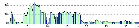
Elevation Profile