Stroud Valleys Trail
![]()
![]() This route runs from Stonehouse to Nailsworth following a disused railway line. The route is traffic free with splendid views of the Cotswolds and makes for a pleasant afternoon's cycling or walking particularly for families.
This route runs from Stonehouse to Nailsworth following a disused railway line. The route is traffic free with splendid views of the Cotswolds and makes for a pleasant afternoon's cycling or walking particularly for families.
Click here for more information on this route.
You can further explore the area by following our walk to King's Stanley on the Stroud Canal.
Near the start of the walk at Stonehouse you can link up with the Cotswold Way National Trail.
The route also passes close to the expansive Woodchester Park where there's miles of woodland trails to try.
Stroud Valleys Trail Ordnance Survey Map  - view and print off detailed OS map
Stroud Valleys Trail Open Street Map  - view and print off detailed map
Stroud Valleys Trail OS Map  - Mobile GPS OS Map with Location tracking
Stroud Valleys Trail Open Street Map  - Mobile GPS Map with Location tracking
Further Information and Other Local Ideas
Just to the east of the route end you'll find Minchinhampton Common. There's miles of good footpaths here with fine viewpoints commanding views over the surrounding Cotswolds Hills.
Cycle Routes and Walking Routes Nearby
Photos

Stonehouse Wharf. This former canal and rail wharf area by the Stroudwater Canal has been redeveloped as part of a modern housing estate.

Dudbridge station (remains), 1990. View westward, towards Stonehouse: ex-Midland Stonehouse - Nailsworth branch, junction of branch to Stroud (Midland). The station and both branches were closed to passengers 16/6/47, to goods 1/6/66

Frogmarsh Mill. The mill was already in use by 1658 and continued producing cloth until mid 1800s. In the late 19th and early 20th century it was used for the manufacture of pins. Today it is occupied by a soft-drinks manufacturer and a variety of small businesses and studios. The buildings date from the 19th Century, and incorporate a much earlier clothier's house dating from the 17th century . The Woodchester area was ideal for cloth manufacture because of deep valleys and rapid streams in this part of the Cotswolds.

Cycle Track Tunnel. This tunnel takes the cyclists under the B4066, on their way to Nailsworth.

Dunkirk Mills. Former woollen cloth mill, now housing. Various date stones indicate 1798, 1818, 1827 and 1855. Had a Boulton & Watt beam engine supplied in 1820. Still retains several waterwheels and a little museum area. The visit was on a Heritage Open Day but the museum had closed by then - doing far too much as usual.

Nailsworth, converted mill
,_Gloucestershire_(geograph_7015946).jpg)
Nailsworth railway station (site), Gloucestershire. Opened in 1867 by the Stonehouse & Nailsworth Railway, very soon to become part of the Midland Railway, as the southern terminus of the line, this station closed to passengers in 1947 and completely in 1966. View north west at the forecourt, and towards Woodchester and Stonehouse. The building, now a private residence, and platform (out of sight to the left of the building) were both well looked after when this image was taken.

Woodchester village. Looking directly west from the edge of Minchinhampton Common. The lower large field to the right is adjacent to the famous Woodchester Orpheus mosaic, part of possibly the biggest and most opulent Roman Villa in the UK. A replica of the mosaic is on display nearby at Prinknash Abbey. Villa May have been home to the governing family of this important area, with Cirencester only 14 miles away and Bath 27 miles.
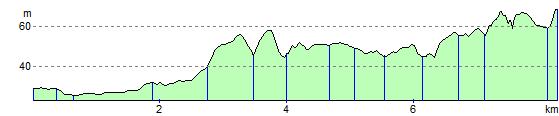
Elevation Profile