Abbotsbury Castle Walk
![]()
![]() This walk from the pretty Dorset village of Abbotsbury visits the Iron Age Hillfort of Abbotsbury Castle. The route makes use of two long distance trails to take you to the site, where there are fine coastal views to enjoy. It's only about a two mile walk from the village but there is a fair climb to the hill's peak which stands at a height of almost 700ft.
This walk from the pretty Dorset village of Abbotsbury visits the Iron Age Hillfort of Abbotsbury Castle. The route makes use of two long distance trails to take you to the site, where there are fine coastal views to enjoy. It's only about a two mile walk from the village but there is a fair climb to the hill's peak which stands at a height of almost 700ft.
The walk starts in the centre of the village and immediately picks up the Macmillan Way which starts in Abbotsbury. You follow the waymarked trail north fo about half a mile until you link with the South Dorset Ridgeway. Follow the path west for about 1.5 miles and you will come to the hill fort. The castle's position high above the Channel made it a first-line defence against invasion. The fort was occupied by the Celtic Durotriges tribe, but when the Romans invaded in AD 43, the second Augustian legion of Vespasian took the fort quickly with little struggle before moving on to Maiden Castle.
You can return the same way or continue west along the path and then head south to the coast. In this way you can turn it into a long circular walk.
The area is great for walkers with lots of options for extending your walk. You could head to the delightful Abbotsbury Subtropical Gardens or head to the wonderful Chesil Beach.
Abbotsbury Castle Ordnance Survey Map  - view and print off detailed OS map
Abbotsbury Castle Open Street Map  - view and print off detailed map
*New* - Walks and Cycle Routes Near Me Map - Waymarked Routes and Mountain Bike Trails>>
Abbotsbury Castle OS Map  - Mobile GPS OS Map with Location tracking
Abbotsbury Castle Open Street Map  - Mobile GPS Map with Location tracking
Further Information and Other Local Ideas
Just a few miles to the south east there's the worthy village of Langton Herring to explore. The settlement includes a 17th century village pub and nice trails leading to the Moonfleet Manor Hotel. The coastal hotel is in a fine position with wonderful views to enjoy with your delicious afternoon tea.
To the north there's Littlebredy which is something of a hidden gem. The delightful village includes the Little Bredy Walled Garden, a waterfall, a lake, an old church and footpaths along the River Bride which runs through the village.
For more walking ideas in the area see the Dorset Walks page.
Cycle Routes and Walking Routes Nearby
Photos
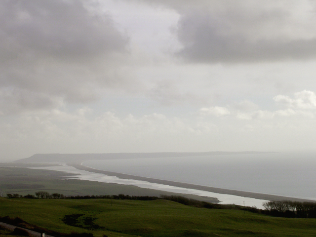
View of the Fleet, Chesil Beach and the Isle of Portland from Abbotsbury Castle. The trig point (215m above sea level but only 1.5km inland!) provides a great view southeast towards the Isle of Portland.
View southwest from the Kingston Russell stone circle towards Abbotsbury Castle. Everything in the lower half of the photo is in the grid square. Beyond that are the many coppices in grid squares SY5686 and SY5687. In the middle on the horizon are the ramparts of the iron age hillfort - the large bowl barrow in its interior and the defences at its SE end (on the left) are quite obvious against the sky even from this distance.


