Langton Herring Walks
![]()
![]() This delightful little village sits close to the Jurassic Coast in Dorset. There's some fine countryside, picturesque 18th century thatched cottages, a 17th century village pub and a noteworthy coastal hotel to visit in the area.
This delightful little village sits close to the Jurassic Coast in Dorset. There's some fine countryside, picturesque 18th century thatched cottages, a 17th century village pub and a noteworthy coastal hotel to visit in the area.
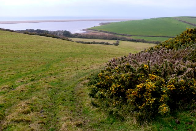
This circular walk from the village takes you to the coast at Chesil Beach. On the route you'll visit Langton Hive Point, Herbury and Gore Cove before heading to the splendidly positioned Moonfleet Manor Hotel. Here you could enjoy a lovely Afternoon Tea before heading back to the village.
Postcode
DT3 4HU - Please note: Postcode may be approximate for some rural locationsLangton Herring Ordnance Survey Map  - view and print off detailed OS map
Langton Herring Open Street Map  - view and print off detailed map
Langton Herring OS Map  - Mobile GPS OS Map with Location tracking
Langton Herring Open Street Map  - Mobile GPS Map with Location tracking
Walks near Langton Herring
- Chesil Beach - This walk takes you along Chesil Beach to St Catherine's Chapel in Weymouth, Dorset
- Abbotsbury Castle - This walk from the pretty Dorset village of Abbotsbury visits the Iron Age Hillfort of Abbotsbury Castle
- Abbotsbury Subtropical Gardens - Enjoy a short walk around these beautiful gardens in Abbotsbury, Dorset
- Weymouth Circular Walk - A circular walk around the seaside town of Weymouth, visiting the promenade, the ruins of Sandsfoot Castle and the pretty Radipole Lake Nature Reserve.
The walk starts on the front, near to the train station - Weymouth to Durdle Door - Follow the coast path from Weymouth to one of the geological highlights of the Jurassic Coast on this Dorset walk
- Weymouth to Swanage Coastal Walk - Explore the Jurassic Coast on this coastal walk between Weymouth and Swanage
- Weymouth - This seaside resort in Dorset has some fine coastal walks to try
- Maiden Castle Dorset - Climb to this Iron Age hill fort near Dorchester and enjoy wonderful views over the surrounding countryside
- Burton Bradstock - There are a number of lovely coastal walking trails around this pretty National Trust run estate in Dorset.The estate is part of the Jurassic Coast and includes cliff-top trails along Burton cliff and the popular shingle Hive beach
- Eggardon Hill - Climb to this Iron Age hill fort and enjoy wonderful views over Marshwood Vale on this hilltop walk near Bridport.
The walk starts from the roadside parking area shown on the google street view link below - Hardy Monument - Enjoy wonderful views over the Dorset countryside from this historical viewpoint near Portesham and Abbotsbury
- Powerstock Common - This pretty nature reserve is located close to the town of Bridport in Dorset
- Littlebredy - This delightful village in Dorset is a lovely place for an easy stroll.
- Shipton Gorge - This small village is located just east of Bridport in the county of Dorset
- St Catherine's Chapel - This circular walk takes you to the historic St Catherine's Chapel in Abbotsbury
Pubs/Cafes
Back in the village head to the Elm Tree Inn for some post exercise rest and refreshment. The historic inn dates back to the 17th century when it was frequented by smugglers and “wreckers”. During the second world war, Barnes Wallis stayed there when the bouncing bomb was being tested on the Fleet; and it was even the secret rendezvous for Russian spies during the Cold War. The interior is full of character and olde worlde charm. If the sun is shining then the lovely garden is very inviting. You can find them at postcode DT3 4HU.
Dog Walking
The coast and country trails make for a fine dog walk. The Elm Tree mentioned above is also dog friendly.
Further Information and Other Local Ideas
Head west along the coast and you could visit neighbouring Abbotsbury. Here you can visit Abbotsbury Castle and Abbotsbury Subtropical Gardens.
To the north of here there's Littlebredy which is something of a hidden gem. The delightful village includes the Little Bredy Walled Garden, a waterfall, a lake, an old church and footpaths along the River Bride which runs through the village.
Heading east will take you to Weymouth.
Photos
Langton Herring Church and village. View to St.Peter's Church, Langton Herring - rising above the village
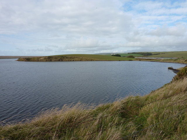
Herbury and Gore Cove. Herbury is a small peninsula jutting out into The Fleet. Taken from the South West Coast Path near to Moonfleet Manor Hotel.
The Moonfleet Manor Hotel. The hotel dates back to 1603. It is named after J Meade Falkner’s novel 'Moonfleet', a classic tale of smuggling, treasure, and shipwreck set in 18th-century England. Falkner uses the local geography of Dorset and the Isle of Wight in the book, only changing some of the place names. The village of Moonfleet is based on East Fleet in Dorset by Chesil Beach. Dorset's Corfe Castle and Carisbrooke Castle on the Isle of Wight are also key plot locations.


