Ashdown Forest Walks
![]()
![]() Explore the 'home' of Winnie-the-Pooh in this large area of woodland and heathland near Crowborough. The expansive forest has miles of good footpaths to try. This route makes use of the Wealdway long distance footpath which runs through the woods from south to north. There are car parks near Duddleswell which give direct access to the forest paths. You then head north passing Camp Hill and Wren's Warren before finishing at Five Hundred Acre Wood. Hundred Acre Wood in the Pooh stories is based on this area. From here you can return the same way or continue north to the nearby village of Hartfield for refreshments.
Explore the 'home' of Winnie-the-Pooh in this large area of woodland and heathland near Crowborough. The expansive forest has miles of good footpaths to try. This route makes use of the Wealdway long distance footpath which runs through the woods from south to north. There are car parks near Duddleswell which give direct access to the forest paths. You then head north passing Camp Hill and Wren's Warren before finishing at Five Hundred Acre Wood. Hundred Acre Wood in the Pooh stories is based on this area. From here you can return the same way or continue north to the nearby village of Hartfield for refreshments.
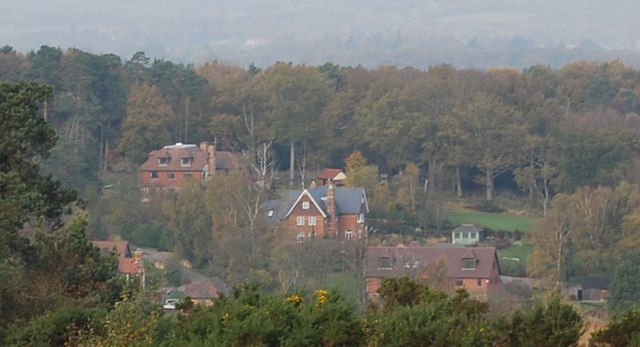
The forest consists of open heathland, woodland trails and a series of hills where you can enjoy splendid views over the Weald to the chalk escarpments of the North Downs and South Downs.
The area is great for wildlife. Look out for several species of deer including roe, muntjac and sika deer. Keen eyed birdwatchers can spot Dartford warbler, yellowhammer and stonechat.
There's also a wide variety of flora to look out for with Oak and Beech Woods, interesting vegetation around the streams and ponds and a variety of heathland plants and flowers.
Ashdown Forest is well known as the setting for the Winnie-the-Pooh stories by A. A. Milne, who lived on the northern edge of Ashdown forest. The illustrations in the Pooh books are based on areas of the woods you will see on this walk. You can visit the A.A Milne memorial and some other sites from the stories on our Pooh Walk from Gills Lap. Near here at Chuck Hatch you can try the short stroll to Pooh Sticks Bridge. It's thought to be the location where authour A.A Milne and his son first played the game which appears in the book 'The House at Pooh Corner'. You can also visit the area from Hartfield village (home of A.A Milne) on our Hartfield Winnie the Pooh Walk.
This route is designed for walkers but the area is also very popular with cyclists. You could start your ride from the same start point as this walk and then follow the country lanes through the forest. See the link below for more details or download one of the maps below for all the tracks, lanes and routes in the area.
The long distance Vanguard Way also runs right through the forest. You could pick it up and head north west towards Forest Row to extend your walk. Following it south will take you towards Buxted.
Postcode
RH18 5JP - Please note: Postcode may be approximate for some rural locationsAshdown Forest Ordnance Survey Map  - view and print off detailed OS map
Ashdown Forest Open Street Map  - view and print off detailed map
*New* - Walks and Cycle Routes Near Me Map - Waymarked Routes and Mountain Bike Trails>>
Ashdown Forest OS Map  - Mobile GPS OS Map with Location tracking
Ashdown Forest Open Street Map  - Mobile GPS Map with Location tracking
Explore the Area with Google Street View 
Pubs/Cafes
On the route you'll pass Fairwarp where you can stop for refreshments at the Foresters Arms (Postcode:TN22 3BP). The dog friendly pub has a nice beer garden and a wide selection of on tap beers.
To the west of the forest in nearby Danehill there's the Coach and Horses (Postcode:RH17 7JF). The family run, traditional pub is located in the heart of the Sussex countryside and has a great menu and lovely beer garden to relax in.
Dog Walking
The forest is perfect for dog walking and you will likely see many other people walking their dogs on the forest's many wide tracks. The forest does recommend keeping dogs under close control, preferably on a lead, when walking in heathland or near any grazing sheep or cattle.
Further Information and Other Local Ideas
The forest has a very good visitor centre with maps, guides, and displays detailing the forest's history and wildlife. It's open 7 days a week during the summer, weekends in the winter, and on bank holidays except Christmas Day and Boxing Day. You can find it on Colemans Hatch Rd, Forest Row RH185JP.
The circular Forest Row Walk visits the nearby Weir Wood Reservoir before heading to the northern edge of the forest. The large reservoir has a nice waterside rail running alongside it.
Head a few miles to the west and you could pick up the Chelwood Vachery Walk. The peaceful circular route explores an ancient estate which includes the pretty Millbrook Stream and Braberry Hatch Ponds.
For more walking ideas in the area see the High Weald Walks page.
Cycle Routes and Walking Routes Nearby
Photos
View from Pylons Car Park - Ashdown Forest. The bracken in the foreground was once so useful for bedding down animals in the winter, but now widely regarded as a pest. In the distance is the old radio station near Duddleswell cross-roads and built by the Canadians. Currently used as a training ground by the Sussex police


