High Weald AONB Walks

Use the links to view full route information including elevation profiles, interactive maps and GPS downloads.
You can also view an overview map of all the routes in the using the High Weald Walk Map>>
*New* - Walks and Cycle Routes Near Me Map - Waymarked Routes and Mountain Bike Trails>>
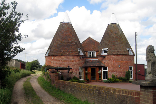
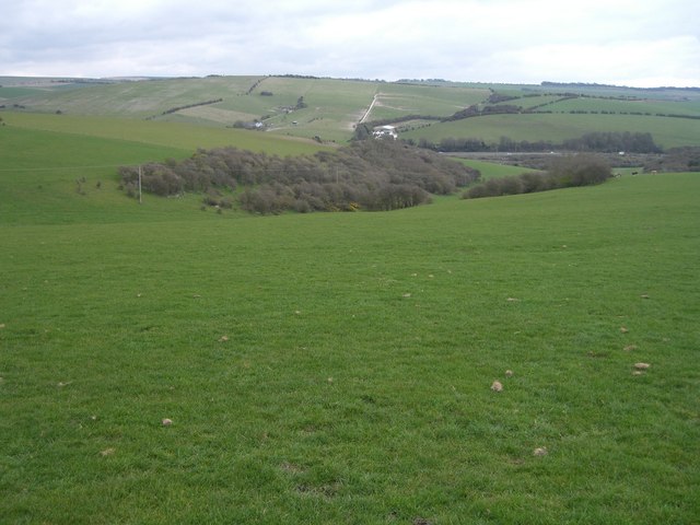
| Route Name | Photo | Distance | Description |
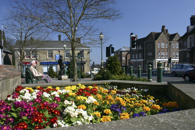
| Ardingly Reservoir | 5 miles (8 km) | This 198 acre reservoir and nature reserve has a lovely waterside walking path ideal for an easy stroll. The walk starts at the parking lot at the southern end of the reservoir and take you along the eastern side of the water to the village of Balcombe before returning to the start point. As a nature reserve you will pass through a variety of habitats including wetland, reedbed, deciduous woodland, hazel coppice and haymeadow. Look out for Great crested grebe and kingfishers as you make your way round the reservoir. Our circular Ouse Valley Viaduct Walk also starts from the same car park. It is a short walk along the river to the impressive structure which is a highlight of the area. View Full Details>> | |
| Ashdown Forest | 7.5 miles (12 km) | Explore the 'home' of Winnie-the-Pooh in this large area of woodland and heathland near Crowborough. The expansive forest has miles of good footpaths to try. This route makes use of the Wealdway long distance footpath which runs through the woods from south to north. There are car parks near Duddleswell which give direct access to the forest paths. You then head north passing Camp Hill and Wren's Warren before finishing at Five Hundred Acre Wood. Hundred Acre Wood in the Pooh stories is based on this area. From here you can return the same way or continue north to the nearby village of Hartfield for refreshments. The forest consists of open heathland, woodland trails and a series of hills where you can enjoy splendid views over the Weald to the chalk escarpments of the North Downs and South Downs. The area is great for wildlife. Look out for several species of deer including roe, muntjac and sika deer. Keen eyed birdwatchers can spot Dartford warbler, yellowhammer and stonechat. There's also a wide variety of flora to look out for with Oak and Beech Woods, interesting vegetation around the streams and ponds and a variety of heathland plants and flowers. Ashdown Forest is well known as the setting for the Winnie-the-Pooh stories by A. A. Milne, who lived on the northern edge of Ashdown forest. The illustrations in the Pooh books are based on areas of the woods you will see on this walk. You can visit the A.A Milne memorial and some other sites from the stories on our Pooh Walk from Gills Lap. Near here at Chuck Hatch you can try the short stroll to Pooh Sticks Bridge. It's thought to be the location where authour A.A Milne and his son first played the game which appears in the book 'The House at Pooh Corner'. You can also visit the area from Hartfield village (home of A.A Milne) on our Hartfield Winnie the Pooh Walk. View Full Details>> | |
| Ashdown Forest Pooh Walk | 0.9 miles (1.5 km) | This short walk visits some of the places made famous in A.A Milne's Winnie the Pooh stories. The walk starts from the Gills Lap car park (Postcode:TN22 3JD) located where Chuck Hatch Road and Kid's Hill meet. The area around Gills Lap has some lovely trails with great views over the forest from the elevated position. On the way you'll pass a clump of trees near a trig point called 'Enchanted Place' where Christopher Robin could sit down here without getting prickled, unlike the rest of the forest! You'lll also pass a memorial plaque, unveiled by Christopher Robin in 1979, commemorating the work of A. A. Milne and EH Shepard, the illustrator. Milne once wrote of Ashdown Forest: 'In that enchanted place on the top of the forest a little boy and his bear will always be playing.' The trail also passes a hollow thought to be the cunning trap Pooh used to capture that rare beast, the Heffalump. A disused quarry is thought to represent the Roo's sandy pit in the stories. You can extend the walk by heading east to Five Hundred Acre Wood which corresponds to Hundred Acre Wood in the book. Pooh went to visit Owl for for advice on the subject of Eeyore's lost tail. If you head a short distance north to Chuck Hatch you can try the short stroll to Pooh Sticks Bridge. It's thought to be the location where authour A.A Milne and his son first played the game which appears in the book 'The House at Pooh Corner'. View Full Details>> | |
| Balcombe Circular Walk | 5.9 miles (9.5 km) | This circular walk explores the lakes and woods to the east of the West Sussex village of Balcombe. On the route you'll visit the lovely Ardingly Reservoir and the beautiful gardens at the historic Wakehurst Place. There's also a waterside stretch along the pretty Balcombe Lake to enjoy. View Full Details>> | |
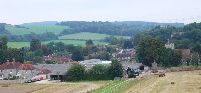
| Battle | 1.9 miles (3 km) | This fascinating East Sussex town is a fine place to explore on foot. As well as its historical sites there are also fine trails into the surrounding countryside of the High Weald Area of Outstanding Natural Beauty. View Full Details>> | |
| Bedgebury Forest | 6.2 miles (10 km) | Bedgebury is a great place for cyclists with miles of family cycle tracks and a more challenging mountain bike trail. The gentle 10km trail is perfect for exploring the 2000 acre forest at a leisurely pace on generally flat surfaced paths. Adrenalin junkies can enjoy 13km of single-track mountain biking. It's generally graded as a red trail and has fast sweeping gradual descents and some challenging climbs. There's also cycle shop where you can hire a bike. The forest is also great for walkers with miles of peaceful woodland trails to follow. You can enjoy a stroll around the beautiful Bedgebury Pinetum. This recreational and conservational arboretum has 10,000 trees growing across 320 acres including the most complete collection of conifers on one site in the world. View Full Details>> | |
| Bewl Water | 12.4 miles (20 km) | This is a walking and cycling route around the beautiful Bewl Water reservoir near Lamberhurst. The route runs alongside the reservoir for most of the way though there is an inland section on quiet country lanes around Tolhurst. It runs for about 12.5 miles with great views of the High Weald AONB. Bike hire is available during the summer months from the Boat House Bistro. The area is also great for wildlife watching with Goldcrests, Long Tailed Tits, Wagtails, Skylarks and Lapwings in the woodland. Also look out for Kingfishers, Herons and the Great Crested Grebe on the water. Please note the route is not always open for cyclists during the winter months - please check the Bewl Water website before setting off. View Full Details>> | |
| Biddenden | 5.7 miles (9.2 km) | This delightful Kent village is a splendid place for an afternoon stroll. In the village there's a picturesque village green, a fine 15th century pub and a photogenic High Street with a number of old Flemish weavers cottages to admire. View Full Details>> | |
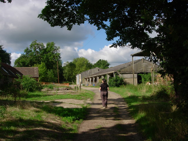
| Brede High Woods | 4 miles (6.5 km) | This large area of ancient woodland consists of hundreds of acres of walking trails, a variety of wildlife and the pretty Powdermill Reservoir. There's a circular waymarked trail and a number other permissive footpaths to follow through the 262 hectares (647 acres). It's a lovely place for a peaceful stroll with heathland, coppice, ghyll woodland, broadleaf woodland, ponds, springs and streams to enjoy. You can start your walk from the car park off Chitcombe Rd at the northern end of the woods. The site is great for wildlife enthusiasts with glow worms, great crested newts, lampreys, dormouse, badgers and fallow deer to look out for. Also keep your eyes peeled for birds including woodcock, nightingales and buzzards. The attractive woodland includes conifers, spruces, oak, Hornbeam and sweet chestnut coppice. Also look out for bluebells and wood anemones in the spring months. If you would like to continue your walking in the area then you could head south to Battle and pick up the 1066 Country Walk. The long distance trail will take you through the nearby Battle Great Wood where there are more nice trails to try. A few miles to the west you will find Vinehall Forest and beyond that the pretty Darwell Reservoir. Here you can enjoy footpaths through Darwell Wood with views across the water. View Full Details>> | |
| Brighton Way | 54.1 miles (87 km) | A super route though the South Downs from Horley to Brighton. The trail passes Crawley, Haywards Heath and Burgess Hill before finishing on the south coast. The walk has several train stations dotted along the route so you can easily do this one in manageable sections. Highlights include the Ardingly Nature Reserve and Ardingly Reservoir near Balcombe. Near here there's also fine views of the impressive Ouse Valley Viaduct, one of the most photographed sites on the path. The walk also climbs Ditchling Beacon where there are fabulous views of the South Downs. View Full Details>> | |
| Burwash | 1.9 miles (3 km) | This picturesque East Sussex based village is surrounded by some lovely High Weald countryside. View Full Details>> | |
| Chailey Common | 2.5 miles (4 km) | This pretty area of common land near Haywards Heath has a series of nice footpaths to try. You can start the walk from the car park on Warrs Hill Lane next to Red House Common. From here there's nice trails heading south west mast the Old Heritage Windmill. You can then continue across the A272 to Pound Common and Chailey Common where there's a nature reserve with wildlife and wildflowers to look out for. You can see lots of Bell and Cross-Leaved Heather with birds such as Nightjar, Stonechat, Yellowhammer and Linnet regular winged visitors. View Full Details>> | |
| Cranbrook | 5.6 miles (9 km) | This pretty Kent based town is surrounded by some lovely High Weald countryside and several large areas of woodland. It's an interesting town to stroll around too with several medieval buildings, a church known as the 'Cathedral of the Weald' and a very photogenic working windmill. View Full Details>> | |
| Crawley | 1.2 miles (2 km) | This Sussex based town has two lovely local country parks and miles of woodland trails in the forests to the south. There's also a fine local nature reserve and the nearby High Weald AONB to explore on foot. View Full Details>> | |
| Crawley Greenway | 4.2 miles (6.7 km) | The Crawley Greenway runs along leafy paths through the Sussex town of Crawley. View Full Details>> | |
| Crowborough | 3.7 miles (6 km) | The town of Crowborough is nicely positioned for exploring the expansive Ashdown Forest and the High Weald AONB. There's also some fine waymarked trails running through the area including the Vanguard Way and the Wealdway. This circular walk takes you around Crowborough Common. The common is located just to the south west of the town centre and includes 220 acres of heathland and woodland. It's a nice place for a stroll with a number of trails to follow around the site. There's also picturesque streams and in the autumn months there is lots of pretty heather to see. You can pick up the footpaths just west of Whitehill and follow them south past the golf club to Sweethaws Wood and Piping Wood. Other bridleways will then take you past Redbridge Farm on the eastern side of the common. View Full Details>> | |
| Cuckfield | 14.9 miles (24 km) | This pretty Mid Sussex based village is close to some fine High Weald countryside walking. View Full Details>> | |
| Diamond Way | 60.3 miles (97 km) | This is a fairly easy walk from West to East Sussex through heathland, farmland and forest. The walk runs from Midhurst to Heathfield and passes through Petworth, Billinghurst, Haywards Heath, Lindfield and Nutley. It was created by the Sussex Ramblers Association to celebrate their 60th anniversary. Highlights on the walk include Petworth Park which holds the 'National Trust's finest art collection displayed in a magnificent 17th century mansion within a beautiful 700-acre park'. This can be found on the first leg of the journey from Midhurst to Petworth. View Full Details>> | |
| East Grinstead | 7.1 miles (11.5 km) | The town of East Grinstead is located in the Mid Sussex District of West Sussex. It's nicely situated on the edge of the High Weald AONB where there are great opportunities for walking. It's also located close to a number of historic houses and a splendid reservoir and nature reserve. This circular walk from the town uses the High Weald Landscape Trail, the Sussex Border Path and the Forest Way to visit the nearby Weir Wood Reservoir. The route runs for about 7 miles with countryside, woodland and waterside footpaths to enjoy on the way. There's also a visit to the National Trust's lovely Standen House. View Full Details>> | |
| Eden Valley Walk | 14.9 miles (24 km) | Travel through the beautiful Eden Valley and the High Weald on this 15 mile walk through Kent. The route starts at Edenbridge and heads towards Hever and the excellent Hever Castle with its double-moated castle and 125 acres of spectacular gardens. You continue east passing the delightful village of Chiddingstone. This National Trust owned village includes a number of quaint timber framed Tudor buildings, a picturesque village pond, an ancient pub and the 15th century Chiddingstone Castle with its beautiful grounds and gardens. A small detour north from the route at Hill Hoath will take you to the worthy settlement. The next stage takes you to Penshurst and the 14th century Penshurst Place. Again there is plenty to see here including the State Rooms, Gallery and wonderful gardens. The final section heads to Tonbridge passing through the Haysden Country Park and Barden Lake before finishing at the castle in Tonbridge. View Full Details>> | |
| Edenbridge | 14.3 miles (23 km) | The Kent town of Edenbridge is located in a lovely spot for exploring the Eden Valley and the High Weald areas of the county. This walk uses the Eden Valley Walk to visit two highlights of the area at Hever Castle and Penshurst Place. View Full Details>> | |
| Elham Valley Way | 21.7 miles (35 km) | Explore the Kent Downs Area of Outstanding Natural Beauty on this delightful railway walk through Kent. The route starts on the coast at Hythe and heads north to Canterbury via Elham and Barham. Highlights on the route include stretches through the seabrook valley near Hythe, ancient woodland (dating from before the 17th century), beautiful orchards, views of the Nailbourne river and the famous Cathedral at Canterbury at the end of the route. View Full Details>> | |
| Fairlight | 5.9 miles (9.5 km) | This East Sussex based village has some lovely coastal trails, a fine local country park and a canalside path for walkers to try. View Full Details>> | |
| Forest Row | 7.3 miles (11.7 km) | This large East Sussex based village is in a good spot for exploring the countryside and woodland of the High Weald. Several waymarked footpaths run past the village and the expansive Ashdown Forest is also nearby. View Full Details>> | |
| Goudhurst | 10.6 miles (17 km) | This pretty Kent based village is located in a fine spot in the Weald. The elevated settlement commands fine views over the area and also includes a picturesque village pond, rows of ancient cottages and a noteworthy 14th century church. View Full Details>> | |
| Handcross | 8.7 miles (14 km) | This walk from the West Sussex village of Handcross explores the public footpaths surrounding the lovely Hyde Estate. It then goes on to explore the expansive Tilgate Country Park to the north. The Hyde Estate is a wonderful secluded estate currently used for weddings but there are some public access trails you can follow around the site. View Full Details>> | |
| Hargate Forest | 1.9 miles (3 km) | These peaceful woods are located on the edge of Tunbridge Wells. There's a series of footpaths taking you around the site which includes a mixture of broadleaf and conifer woodland. The area is good for widlife spotting with lots of woodland birds and the possibility of spotting fallow or roe deer. Tunbridge Wells West train station is a short walk from the woods so you can easily come by public transport. View Full Details>> | |
| Hartfield Winnie the Pooh Walk | 9.9 miles (16 km) | This walk takes you to some of the locations associated with A.A Milne's Winnie the Pooh books in Ashdown Forest. The route starts in the village of Hartfield where Milne bought the country home of Cotchford Farm in 1925. From here you can pick up the Wealdway long distance footpath and follow it all the way to the forest. You'll pass through Five Hundred Acre Wood which corresponds to Hundred Acre Wood in the book. It's where Pooh went to visit Owl for for advice on the subject of Eeyore's lost tail. The trail passes through the wood on a series of nice trails before heading west over a more open area to Gills Lap. This elevated part of the forest commands lovely views over the surrounding area. There's also a number of interesting locations associated with the Pooh stories. This includes a trig point called 'Enchanted Place' where Christopher Robin could sit down here without getting prickled, unlike the rest of the forest! You'lll also pass a memorial plaque, unveiled by Christopher Robin in 1979, commemorating the work of A. A. Milne and EH Shepard, the illustrator. At nearby Chuck Hatch you can try the short stroll to Pooh Sticks Bridge. It's thought to be the location where authour A.A Milne and his son first played the game which appears in the book 'The House at Pooh Corner'. The Vanguard Way also runs through this part of the forest. The long distance footpath will take you north west to Newbridge and Forest Row. View Full Details>> | |
| Hastings Circular Walk | 5.8 miles (9.4 km) | This fine circular walk around Hastings visits the coast and countryside to the east of the town. The route runs for about 6 miles with some moderate climbs along the way. It's a varied walk with woodland trails, hill climbs and coastal sections to enjoy. The walk starts at the harbour in Hastings and heads east along the Saxon Shore Way long distance footpath. The trail takes you along the coast to Hastings Country Park. Here you'll find 600 acres of parkland and woodland to explore on a number of paths. Features in the park include sandstone cliffs, shady glens covered with gorse and trees, nature trails and picnic areas. It's also great for wildlife with Peregrines, black redstarts and fulmars to look out for. After passing through the park you continue along Covehurst Bay before turning north toward Fairlight. You then turn west through farmland where you pick up a section of the 1066 Country Walk to take you past Ecclesbourne Reservoir and High Wickham. At Ecclesbourne Glen you can visit the waterfalls and interesting rock formations. The final section descends past East Hill back to the sea front and the finish point of the walk. View Full Details>> | |
| Hastings Country Park | 3.1 miles (5 km) | Enjoy over 600 acres of beautiful parkland and coast on this circular route in Hastings. The park is located in the High Weald Area of Outstanding Natural Beauty, most of the park has been designated a Special Area of Conservation and a Local Nature Reserve. Peregrines, black redstarts and fulmars can be seen on the coastal cliffs, while Dartford warblers, stonechats and yellowhammers can be seen on the gorse covered hills. The route below is most suitable for walkers but National Cycle Network route 2 also runs through the park and is a short cycle from Hastings. See the Eastbourne to Rye Cycle Route for more details. View Full Details>> | |
| Hastings to Winchelsea Coastal Walk | 8.1 miles (13 km) | This lovely walk follows the Saxon Shore Way and the Royal Military Canal Path from Hastings to Winchelsea. It's an 8 mile route, running along two good waymarked trails with some moderate cliff top climbs along the way. It's a really beautiful part of the country with splendid views of the High Weald from the wonderful cliff tops. The walk starts on the seafront in Hastings and heads east to Hastings Country Park. The park is located in the High Weald Area of Outstanding Natural Beauty, with most of the site designated as a Special Area of Conservation and a Local Nature Reserve. It's a great place for wildlife watching with Peregrines, black redstarts and fulmars on the coastal cliffs, while Dartford warblers, stonechats and yellowhammers can be seen on the gorse covered hills. After leaving the park you continue to the picturesque Fairlight Cove where there's a nice beach and more stunning cliffs. The route then passes Cliff End where you pick up a flat section along the Royal Military Canal to Winchelsea. View Full Details>> | |
| Haysden Country Park | 3.4 miles (5.5 km) | Haysden country park is located near Tonbridge in Kent and consists of a number of delightful walking trails. In the park you will find Barden Lake and Haysden Lake while the River Medway also runs through the park. The lakes and river offer great opportunities for wildlife watching with a variety of wildfowl visitors all year round. The Eden Valley Walk long distance footpaths runs through the park. You can pick this up and head west to visit the lovely Penshurst Place. There's nice trails to follow around the estate's parkland and woodland with the option of visiting the fine house and gardens. The Tonbridge to Penshurst Cycle Route runs through the park on Regional Route 12. View Full Details>> | |
| Haywards Heath | 9.3 miles (15 km) | This walk from Haywards Heath visits two of the highlights of the area at Ardingly Reservoir and Wakehurst Place. The walk uses a section of the High Weald Landscape Trail to take you to the lovely lake and the wonderful Botanic Gardens. The walk starts in the town centre, near to the train station. From here you head north, passing the golf course before coming to Copyhold Lane. Here you pick up the High Weald Landscape Trail which continues north through River's Wood to Ardingly Reservoir. The 198 acre reservoir is also a nature reserve with a variety of habitats including wetland, reedbed, deciduous woodland, hazel coppice and haymeadow. You can look out for wildlife such as Great crested grebe and kingfishers in this area. There's a nice footpath running along the eastern side of the water which will lead you up to Wakehurst Place which is the country estate of the Royal Botanic Gardens, Kew. There are 465 acres to explore on a series of delightful footpaths. Features include beautiful botanic gardens, woodland, lakes, formal gardens and an Elizabethan house. After exploring the park, the walk returns to Haywards Heath on the same paths. View Full Details>> | |
| Heathfield | 5.6 miles (9 km) | This East Sussex market town is in a good location for exploring the woods and countryside of the High Weald. The impressive country views of the local area inspired painter Joseph Mallord William Turner to paint The Vale of Heathfield which now hangs in the Tate Gallery. View Full Details>> | |
| Hemsted Forest | 3.4 miles (5.5 km) | This forest in Kent has mile of good walking and cycling trails taking you through attractive conifer, pine and douglas fir plantations. It's great for wildlife watching with lots of woodland birds to look out for on the way. View Full Details>> | |
| High Weald Landscape Trail | 93.8 miles (151 km) | Explore the High Weald AONB on this fabulous 90 mile walk that links the ridge-top villages and historic gardens for which the area is famous. The walk starts at the rail station in Horsham, West Sussex, and heads east to Rye in East Sussex. Walk highlights include
Horsham to Cuckfield- 23.3km (14.5 miles) View Full Details>> | |
| Horley | 11.2 miles (18 km) | This Surrey based town is located just north of Gatwick Airport in the borough of Reigate and Banstead. There's some nice trails in the local riverside park, views of the River Mole and three noteworthy waymarked footpaths running through the countryside surrounding the town. View Full Details>> | |
| Horsham | 9 miles (14.5 km) | This fine circular walk around Horsham makes use of three of the walking trails running through the town. You'll follow sections of the Horsham Riverside Walk, the High Weald Landscape Trail and the West Sussex Literary Trail to visit some of the highlights of the area. On the way there's waterside paths along the River Arun, a visit to Warnham Nature Reserve and fine views of the surrounding High Weald countryside. The walk starts in Horsham Park, just to the west of the train station. Head south through the town and you will soon come to the river. Follow the path round to the west and it will take you up to Warnham Mill Pond and Nature Reserve. It's a lovely spot with a 17 acre millpond, marshes, grassland, reed beds, hedges and woodlands. Look out for a variety of wildlife including heron, wildfowl, three species of Woodpecker and kingfisher. After exploring the reserve the walk then picks up a section of the West Sussex Literary Trail to take you through the town and back to the park. You then pick up the High Weald Landscape Trail to take you east towards the river. Following the river round will take you past Hornbrook Farm and Chesworth Farm before returning to the finish point at Horsham Park. View Full Details>> | |
| Horsham Riverside Walk | 11.8 miles (19 km) | This popular circular walk around Horsham includes some lovely waterside trails and fine scenery. The waymarked route runs for about 12 miles, visiting some of the nature reserves, waterways and woodland surrounding the town. It's a fairly flat route but with some moderate climbs on the eastern section toward Roffey Park. The walk starts from the car park at the pretty Warnham Nature Reserve on the western fringes of the town. It's a lovely place for a stroll with a large mill pond, marshes, grassland, reed beds, hedges and woodlands. There's also lots of wildlife to see with a thriving Heronry, wildfowl, kingfishers and all three species of Woodpecker. From the reserve you follow roads south east and then north to meet with the Chennells Brook at Pondtail Bridge. You then follow a path east along the brook before heading into the countryside at Owlcastle Farm. Footpaths then take you up to Roffey Park and then onto the woodland trails in High Wood and Owlbeech Wood. Here you follow paths along the Horn Brook to Leechpool Woods with attractive woodland and ponds to see. The woods are very pretty with several waymarked trails, a sculpture trails and lots of wildlife to see. After passing south through the woods you meet up with the River Arun around Chesworth House. This former Tudor manor house is a Grade II listed building, so designated on account of its architectural interest and its historical association with three queens of England. This section also passes the Huxley Birds of Prey Centre. This attraction features falcon & owl flying demonstrations & hands-on visitor encounters. It's also a good area to stop for refreshments at the Hornbrook Inn. This rustic pub has a good menu, beamed ceilings, wood panelling, stone floors and a beer garden to relax in. The next section follows the River Arun west toward Highwood. Here you join with the Red River which you follow north back to the finish point at Warnham. View Full Details>> | |
| Horsted Keynes | 4.8 miles (7.7 km) | This pretty West Sussex village has some good walking country trails and a couple of fine old pubs for post exercise refreshment. There is also a historic church dating from the Norman period. The Grade I listed church is notable as the burial place of Harold Macmillan, ex-prime minster of Britain. View Full Details>> | |
| Lamberhurst | 3.9 miles (6.2 km) | This Kent based village has some nice walking trails through the valley of the River Teise and two noteworthy historic ruins to visit nearby. There's also a fine 15th century pub to relax in after your exercise. View Full Details>> | |
| Leechpool Woods | 2 miles (3.2 km) | A woodland walk through Leechpool Woods and Owlbeech Woods in Horsham. The woodland is mixed and includes many mature broadleaved deciduous trees in the Leechpool area. Facilities include a car park, information board, metalled path circuit and a permanent orienteering course. It's also a very popular area for dog walkers. The walk starts from the Leechpool Woods car park off Harwood Road on the eastern fringe of the town. From here you can pick up trails heading north east toward Owlbeech Woods. Leechpool is characterised by mixed woodland while Owlbeech by heathland where you can see hebridean sheep, cattle and llamas grazing at certain times of the year. It's a nice area for walkers with several waymarked paths to try, including a sculpture trail representing the wildlife you can see in the woods. Look out for various butterflies and birds such as siskins and woodlarks as you make your way along the trails. You can also see lots of pretty bluebells in the spring months. View Full Details>> | |
| Lindfield | 5.9 miles (9.5 km) | This attractive Sussex based village has a lovely large village pond and an historic High Street. View Full Details>> | |
| Lingfield | 10.3 miles (16.5 km) | This attractive Surrey village has a number of local walking highlights including two nature reserves and a wonderful wildlife park. In the village there are also a number of photogenic tudor buildings, a historic Grade I listed church and several decent pubs to investigate. View Full Details>> | |
| Nymans Gardens | 2.5 miles (4 km) | Explore the gardens and woodland walk of this delightful estate on this short route in Handcross, near Haywards Heath. View Full Details>> | |
| Peasmarsh | 9.2 miles (14.8 km) | This pretty East Sussex village is located in a lovely spot in the High Weald AONB near Rye. View Full Details>> | |
| Pembury | 5.6 miles (9 km) | This circular walk around Pembury takes you through some of the woodland to the north of the village before picking up a waymarked trail to explore the countryside. The fairly easy route runs for just over 5 miles, visiting farmland, orchards, peaceful woods and a nice farm shop on the way. The route starts in the village and heads north to Marshleyharbour Wood and Forest Wood before picking up the Tunbridge Wells Circular Walk at Downingbury. This waymarked footpath takes you south through Snipe Wood to Romford and Henwood Green. You'll then pass through the farmland to the south of Pembury before turning north to return to the village. To continue your walking in the area you could head to the nearby Tunbridge Wells Common or pick up the long distance High Weald Landscape Trail to further explore the lovely High Weald AONB. Also nearby is the splendid Dunorlan Park where you'll find wide lawns, waterside paths along the large lake, attractive woodland and a Grecian Temple containing the Dancing Girl Statue. View Full Details>> | |
| Penshurst Place | 3.1 miles (5 km) | This 3 mile circular walk takes you around the lovely Penhurst Estate near Tonbridge in Kent. Although there is an admission charge to access the house and gardens you can follow public footpaths through the wider estate's parkland and woodland. There's much to enjoy with fine views of the medieval manor house and the River Medway. There's also several pretty lakes and nice woodland trails in the north eastern section of the park. The 14th century house has a fascinating history, having been the birthplace of the great Elizabethan poet, courtier and soldier, Sir Philip Sidney who was a favourite of Elizabeth I. You can explore the house and see fine furniture and portraits. The house is also surrounded by wonderful Grade I listed Gardens with an Arboretum, Trout Lakes, Lake Park and Lancup Well. The Eden Valley Walk long distance trail runs through the park with this route using a section of the path. You could extend your walk by continuing east along the path and visiting Haysden Country Park just outside Tonbridge. There's nice views of the River Medway and two pretty lakes to enjoy. The trail continues into Tonbridge itself where you can pick up the Wealdway. View Full Details>> | |
| Pooh Sticks Bridge | 0.9 miles (1.5 km) | Walk to the bridge where where Winnie the Pooh invented the game of Pooh Sticks on this lovely little literary walk in Ashdown Forest. Start the walk from the Pooh Car Park at Chuck Hatch Lane, TN7 4DN. From here you can pick up woodland trails heading north through Posingford Woods to Pooh Sticks Bridge. It's about a half a mile walk from the car park to the bridge. The game is first mentioned in the book 'The House at Pooh Corner'. It's a simple game in which each player drops a stick on the upstream side of a bridge and the one whose stick first appears on the downstream side is the winner. The bridge itself was built in 1907 and originally called Posingford Bridge. It's thought to be the location where authour A.A Milne and his son first played the game so is a popular destination for fans of the books. After playing a game you can also enjoy a stroll around the surrounding woodlands. Head south east and you will soon come to Five Hundred Acre Wood. Hundred Acre Wood in the Pooh stories is based on this area. Due south of the car park you can try the Ashdown Forest Pooh Walk. The walk visits some more of the locations associated with the books, such as the 'Enchanted Place' and Roo's Sandy Pit. There's also the A.A Milne memorial and fabulous views from the lovely Gills Lap to experience here. View Full Details>> | |
| Rotherfield | 1.9 miles (3 km) | This village is located just east of Crowborough in the Wealden District of East Sussex. View Full Details>> | |
| Rye Circular Walk | 6.5 miles (10.5 km) | This route from Rye uses two of the area's long distance footpaths to create a circular walk around the town. You'll follow sections of the 1066 Country Walk and Saxon Shore Way waymarked trails to visit the lovely Rye Harbour, the ruins of Camber Castle and the nearby town of Winchelsea. The route starts near the train station in the town and heads south along the River Brede to the Martello Tower and the nature reserve. Here you will find a wide range of habitats including saltmarsh, lagoons, grazing marsh, shingle and reedbeds. Keep your eyes peeled for wildlife including ringed plover, avocet, oystercatcher, redshank, lapwing, and sandwich terns. The path also passes close to the noteworthy Camber Castle. You can visit the interesting ruins of this 16th century Device Fort, built by Henry VIII to protect the Sussex coast against French attack. The trail bends round to the west to visit the small town of Winchelsea which makes a great place to stop for refreshments at one of the pubs or cafes. In the town you pick up the 1066 Country Walk to take you along Cadborough Cliff back into Rye. The final section crosses the pretty River Tillingham and the Rye Windmill before returning to the town centre. View Full Details>> | |
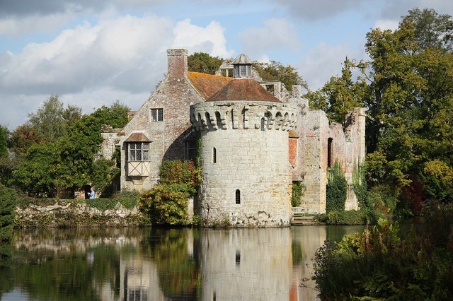
| Scotney Castle | 3.1 miles (5 km) | Explore the 770 acres of woodland and parkland surrounding this 14th century moated castle near Tunbridge Wells. The gardens are stunning with rhododendrons and azaleas and the ruins of the Old Castle at the centre. The new house was built in the 19th century and overlooks the castle. It has grand rooms with fine furniture and paintings. After explorling the gardens you can follows miles of footpaths into the wider estate. You will pass woodland, ponds and also cross the River Bewl which flows through the grounds. If you would like to continue your outing you could head to the nearby Bewl Water where you will find a circular walking route around a large reservoir. The Sussex Border Path also runs just to the south of Scotney Castle and can be easily picked up. View Full Details>> | |
| Sheffield Forest | 1.9 miles (3 km) | This circular walk explores a peaceful area of woodland near Nutley and Horsted Keynes in the High Weald. View Full Details>> | |
| Sheffield Park | 1.2 miles (2 km) | Explore the beautiful Sheffield Park and Gardens on this circular walk near Haywards Heath in Sussex. The gardens were laid out in the 18th century by 'Capability' Brown with four delightful lakes as the centrepiece. There are also a number of peaceful woodland paths and South Park - 265 acres of wide open spaces. The Sussex Ouse Valley Way long distance trail passes the park so you could pick this up to extend your walk. The lovely waterside walk follows the River Ouse from its source near Lower Beeding to the coast at Seaford Bay. View Full Details>> | |
| Sissinghurst Castle | 2.8 miles (4.5 km) | Explore the 460 acres of gorgeous Wealden countryside in the Sissinghurst Castle Estate on this walk in Kent. View Full Details>> | |
| Southborough Common | 0.9 miles (1.5 km) | Enjoy woodland trails, heathland and pretty streams in this area of common land near Tunbridge Wells and Tonbridge. A section of the long distance Tunbridge Wells Circular Walk crosses the common so there is scope for extending your walk into the surrounding countryside. You could follow the trail south west and visit Rusthall Common and Tunbridge Wells Common where there are more nice trails to try. View Full Details>> | |
| St Leonard's Forest | 2.5 miles (4 km) | This large area of woodland is located just to the east of Horsham. There are miles of cycling and walking trails to explore with attractive pine woodland, a series of pretty streams with little waterfalls and the Whitevane Pond at the north western end of the forest. There are good wide tracks ideal for a mountain bike or hybrid. There's some steep climbs to try with fun descents. For walkers there are miles of easy flat tracks to enjoy. Look out for wildlife including peacocks and wood warblers. View Full Details>> | |
| Sussex Border Path | 136.7 miles (220 km) | A fabulous long distance walk following the Sussex county border from Thorney Island in West Sussex to Rye in East Sussex. You begin on Thorney Island with a lovely section along the coast from Emsworth. The route then heads through the South Downs to South Hartingand Liphook before continuing to Gospel Green, Rudgwick, Gatwick Airport, Horley and East Grinstead. You then head through the beautiful High Weald, passing Groombridge, Bewl Water and Northiam before finishing in Rye. The walk is well waymarked throughout. Route highlights include a climb to the highest point on the South Downs at Black Down in West Sussex. You'll also visit the lovely Weir Wood Reservoir and the interesting Bodiam Castle. View Full Details>> | |
| Tenterden | 7.1 miles (11.5 km) | This Kent town has some nice walks to try around the High Weald AONB in which it sits. This walk makes use of the waymarked High Weald Landscape Trail to take you through the countryside to Chapel Down Vineyard and the historic Smallhythe Place to the south of the town. The walk starts just to the south of the town where you can pick up the High Weald Landscape Trail. This signed, long distance path will take you south to Belcot Manor Farm, passing the Tilder Gill on the way. You then head past more farmland and some peaceful woodland before coming to Small Hythe Place. This National Trust half-timbered house was built in the late 15th or early 16th century. It was the home of the Victorian actress Ellen Terry from 1899 to her death in the house in 1928. The house contains Ellen Terry's theatre collection, while the cottage grounds include her rose garden, orchard, nuttery and the working Barn Theatre. There's also a nice tea room in the pretty garden for refreshments. After exploring the house the route then follows a public footpath west past the Chapel Down vineyard and Pheasantry, before looping round through Ashenden to rejoin the trail. You can then follow this north back into Tenterden. View Full Details>> | |
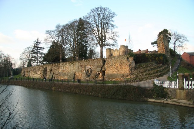
| Tonbridge | 11.8 miles (19 km) | This long circular walk explores the parks, woods, commons, rivers and countryside surrounding the market town of Tonbridge in Kent. It makes use of three long distance waymarked trails to visit some of the highlights of the area. The walk starts on the River Medway, next to Tonbridge Castle. The castle is one of England's finest examples of a Motte and Bailey Castle and includes a 13th Century Gatehouse. You can tour the castle and learn all about the fascinating history for a fee. The castle grounds are free to enter though. From the castle you pick up the Eden Valley Walk and head west along the river to Barden Park where you will pass the pretty Barden Lake. There's a nice circular trail around the water here and an information board showing all the water loving wildlife you can see here. The path then continues past the lake into Haysden Country Park where there's another large lake and lots of wildfowl to look out for on the water. Here you have the option of continuing west and visiting the lovely Penshurst Place where there's lovely gardens, parkland and woodland to explore. After visiting Haysden Lake the route then heads south along the Wealdway through Lower Haysden to Bidborough and Southborough Common. Here you'll pass through the common with its woodland trails and pretty streams. The route then picks up a section of the Tunbridge Wells Circular Walk to take you east and then north through woodland and farmland. The path passes the Grade I listed Jacobean mansion of Somerhill House with its attractive grounds and lake. Other public footpaths then take you around the eastern side of the town before returning you to Tonbridge. There's lots of good options for continuing your walking in the beautiful High Weald. One favourite is the Medway Valley Walk which starts at Tonbridge Castle and follows the river to Rochester. View Full Details>> | |
| Tudeley Woods | 1 mile (1.6 km) | This walk explores the Tudeley Woods RSPB Nature Reserve, near the village of Tudeley in Kent. View Full Details>> | |
| Tunbridge Wells Circular Walk | 27.3 miles (44 km) | Explore the beautiful countryside around Royal Tunbridge Wells on this circular walk through the High Weald AONB. The walk passes through a series of steep ridges and valleys used by climbers including Eridge Rocks and Harrison's Rocks. Other highlights include the woodland through Eridge park and Groombridge Place with its moated manor house and beautiful gardens. You'll also pass Tunbridge Wells Common, Pembury Woods and the delightful Dunorlan Park as you pass through the town. View Full Details>> | |
| Uckfield | 17.1 miles (27.5 km) | The East Sussex based town of Uckfield has some fine walking trails to follow into the lovely countryside of the High Weald AONB. This long circular walk makes use of the Wealdway and Vanguard Way long distance footpaths to take you on a tour of the countryside, woodland and hills surrounding the town. You'll enjoy fine views from the high points and also pass through a section of the expansive Ashdown Forest. View Full Details>> | |
| Wadhurst | 13.4 miles (21.5 km) | This East Sussex town is in a good location for exploring the High Weald AONB on foot. It's also located very close to the lovely Bewl Water and the expansive Bedgebury Forest, which are both great places for walkers. This circular walk from the town takes you around Bewl Water, running for a distance of just over 13 miles and using a mixture of waymarked trails, public footpaths and quiet country lanes. The reservoir is a great place for wildlife spotting so be sure to bring your binoculars. Birds you may spot include Goldcrests, Long Tailed Tits, Wagtails, Skylarks and Lapwings in the woodland. Also look out for Kingfishers, Herons and the Great Crested Grebe on the water. The walk starts from the car park in the town centre and then follows footpaths north east through the countryside to the lake. Here you pick up the Sussex Border Path to take you around the northern and eastern side of the water. You'll pass Chingley Wood and come close to Bedgebury Forest on the eastern side. On the southern side, public footpaths and country lanes takes you past Tolhurst before returning to the towb. View Full Details>> | |
| Wakehurst Place | 2.2 miles (3.5 km) | Located in Haywards Heath, Wakehurst is the country estate of the Royal Botanic Gardens, Kew. There are 465 acres to explore on a series of delightful footpaths. The walk will take you to beautiful botanic gardens, woodland, lakes, formal gardens, an Elizabethan house and the Kew Millennium Seed Bank - the largest seed conservation project in the world. The aim of the Millennium Seed Bank is to collect seeds from all of the UK's native flora and conserve seeds from 25% of the world's flora by 2020, in the hope that this will save species from extinction in the wild. Wakehurst was the National Trust's most visited property in 2008-2009 (for which admission was charged), with 439,627 visitors. A visit will soon show you why with so many attractions. Highlights include the Southern Hemisphere Garden with 16 beds exhibiting plants from South America, South Africa, Australia and New Zealand. The delightful Water Garden is another major attraction with ponds, streams and a variety of water-based garden features. There are many super options if you wish to continue your walk. The High Weald Landscape Trail runs past the edge of the estate so can picked up quite easily. Ardingly Reservoir is right next to Wakehurst and has a lovely waterside walking path to follow. View Full Details>> | |
| Warnham | 4.1 miles (6.6 km) | Enjoy a plesant walk around Warnham Nature Reserve and Warnham Park on this easy route near Horsham. View Full Details>> | |
| Wealdway | 82 miles (132 km) | Follow the Wealdway from the River Thames at Gravesend to Eastbourne on the Sussex coast. The route crosses the chalk ridges of the North and South Downs and passes through the lovely Weald AONB and the expansive Ashdown Forest. After starting at Gravesend the walk heads through Tonbridge, Royal Tunbridge Wells with its famous Pantiles, Uckfield before finishing at Eastbourne with its splendid views from Beachy Head. View Full Details>> | |
| West Sussex Literary Trail | 55.3 miles (89 km) | This walk runs from Horsham to Chichester with many literary connections along the way. The walk begins at Horsham, near Percy Bysshe Shelley's millennium fountain, and heads through the South Downs to Chichester with its connections to William Blake and John Keats. You will pass through a series of interesting and picturesque towns and villages including Sinfield, Storrington, Amberley and Duncton before finishing near the iconic cathedral in Chichester. View Full Details>> |