Ben Macdui Walk
![]()
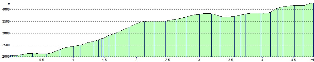
![]() Climb to the summit of the second highest mountain in Britain on this challenging walk in the Cairngorms. The walk starts from the Cairngorm Ski Centre car park and climbs to the summit via the Miadan Creag an Leth-choin ridge, passing Lochan Buidhe on the way. You can return the same way or head to the nearby Cairn Gorm by taking the north east path at Lochan Buidhe.
Climb to the summit of the second highest mountain in Britain on this challenging walk in the Cairngorms. The walk starts from the Cairngorm Ski Centre car park and climbs to the summit via the Miadan Creag an Leth-choin ridge, passing Lochan Buidhe on the way. You can return the same way or head to the nearby Cairn Gorm by taking the north east path at Lochan Buidhe.
Postcode
PH22 1RB - Please note: Postcode may be approximate for some rural locationsBen Macdui Ordnance Survey Map  - view and print off detailed OS map
Ben Macdui Open Street Map  - view and print off detailed map
Ben Macdui OS Map  - Mobile GPS OS Map with Location tracking
Ben Macdui Open Street Map  - Mobile GPS Map with Location tracking
Further Information and Other Local Ideas
Just to the north there's some nice trails around the stunning Loch Avon and the smaller Loch Etchachan to try. The latter being a popular place with wild swimmers and wild campers.
A few miles to the north west there's nice trails around Loch Morlich and the unusual Green Loch in the Glenmore Forest Park. There's good facilities here with a visitor centre and car park.
For more walking ideas in the area see the Cairngorms Walks
Cycle Routes and Walking Routes Nearby
Photos

Trig Pillar, at the summit

Scottish burn on the way down

Topograph on summit of Ben Macdui. It was erected in 1925 by the Cairngorm Club in memory of Alexander Copeland

Rocky terrain on the approach to the summit

Reindeer grazing at 1150m, just below the summit of Ben Macdui. Behind gare boulder fields show areas that are buried in snow for much of the year. The first snows of this winter should fall here soon.

Sappers Bothy. Never mind the source of the Nile, a big geographical controversy of the 18th Century was which was the highest hill in Great Britain. Both Ben Nevis and Ben Macdui had their fans, but it was not until the 1840s that the argument was settled. Surveyors from the Ordnance Survey spent a fair bit of time on the hill and finally calculated that Ben Nevis was just higher. The surveyors built a hut near the top, it's still there and although a roofless ruin, can be a useful shelter when snow comes in horizontally in this terrifyingly hostile environment. If you are coming up from Derry, and meet this hut, you are nearly there. Meanwhile even after the question was settled, many locals refused to believe that their hill was not the highest.

Carn Etchachan. 1120m summit of an outlying top of the mountain, just rising above the plateau. The hill ends in some famous climbing crags overlooking Loch Avon.

Roof of Scotland. Twinned with Mars. The barren lands around the head of the Allt a' Choire Mor just north of the summit. The usual route up passes through here, a tricky navigational challenge on a tourist hill. There is a higher place, but it's the area of very high ground that impresses here.
Elevation Profile