Glenmore Forest Park
![]()
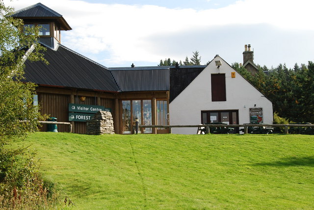
![]() This forest in the Cairngorms National Park has miles of fantastic cycling and walking trails to enjoy. This circular route starts at the excellent visitor centre and follows cycle and walking trails into the forest and alongside the lovely Loch Morlich. The loch has a pretty beach perfect for relaxing on after your ride/walk, while the visitor centre has a great cafe with refreshments. There's also a wide variety of wildlife to look out for including Scottish Crossbill, Crested Tit, Capercaillie and Red Deer. The magnificent Cairngorms mountains make a wonderful backdrop for the route.
This forest in the Cairngorms National Park has miles of fantastic cycling and walking trails to enjoy. This circular route starts at the excellent visitor centre and follows cycle and walking trails into the forest and alongside the lovely Loch Morlich. The loch has a pretty beach perfect for relaxing on after your ride/walk, while the visitor centre has a great cafe with refreshments. There's also a wide variety of wildlife to look out for including Scottish Crossbill, Crested Tit, Capercaillie and Red Deer. The magnificent Cairngorms mountains make a wonderful backdrop for the route.
From the nearby town of Aviemore you could pick up the excellent Speyside Way for more cycling and walking in the area.
Glenmore Forest Park Ordnance Survey Map  - view and print off detailed OS map
Glenmore Forest Park Open Street Map  - view and print off detailed map
Glenmore Forest Park OS Map  - Mobile GPS OS Map with Location tracking
Glenmore Forest Park Open Street Map  - Mobile GPS Map with Location tracking
Further Information and Other Local Ideas
If you head east from the visitor centre you could visit the unusual Green Loch. The small lake is a popular spot to visit in the park with its photogenic turquoise hue.
To the south east there's the challenging climb to Cairn Gorm and the beautiful Loch Avon to explore.
Loch an Eilein can be found to the west.
Just west of Aviemore there's the wonderful Craigellachie Nature Reserve. The reserve includes a series of lochans, fascinating plantlife and a wonderful viewpoint towards the nearby Cairn Gorm.
For more walking ideas in the area see the Cairngorms Walks page.
Cycle Routes and Walking Routes Nearby
Photos
Glenmore and the forest road to Ryvoan. You park your car just east of Glenmore Lodge and within minutes you are in this marvellous countryside.
Allt Mor trail with Meall a' Bhuachaille in view. View of Meall a' Bhuachaille, a Corbett at 810 metres, from the Allt Mor trail. This short trail follows the Allt Mor from Coire Cas car park to Loch Morlich. An easy walk downhill with fine views of Meall a' Buachaille as here. More strenuous in reverse uphill but with views of the Northern corries of Cairngorm beckoning. Capercaillie country too!
Memorial to Norwegian forces at Glenmore Centre The plaque states:- "Kompani Linge This stone was erected by the people of Badenoch in honour of the gallant company of Norwegian patriots who lived among them & trained in these mountains 1941-1945 to prepare for operations in occupied Norway. By skilful & daring raids on military & industrial targets they harassed the enemy & denied them vital supplies. These dangerous missions were not carried out without losses, 37 brave men of Kompani Linge gave their lives in our common cause."


