Ben Venue Walk
![]()
![]() This challenging walk climbs the popular mountain of Ben Venue in the Trossachs. There's fabulous views over the surrounding mountains, lochs and forestry from the high points.
This challenging walk climbs the popular mountain of Ben Venue in the Trossachs. There's fabulous views over the surrounding mountains, lochs and forestry from the high points.
The route starts from the Ben Venue car park off the A821 at the western end of Loch Achray. From here you can pick up woodland trails along Achray Water to Gleann Riabhach. As you ascend the mountain you can enjoy wonderful views back down to the huge Loch Katrine and Loch Venachar. There's also far reaching views of the area's other mountains, particularly Ben Lomond. At the 729 m (2,392 ft) summit you can see as far as the Firth of Forth, the Isle of Arran and the Paps of Jura on a clear day. See the drone footage video below to appreciate the majestic surroundings.
The mountain sits in the wonderful Queen Elizabeth Forest Park where there are miles of other cycling and walking trails to try. For example you can extend your exercise by following the wonderful cycle and walking path along the northern side of Loch Katrine.
Glen Finglas is also nearby. Here you can enjoy woodland trails, open heathland, rushing streams, waterfalls and challenging hill climbs.
Ben Venue Ordnance Survey Map  - view and print off detailed OS map
Ben Venue Open Street Map  - view and print off detailed map
Ben Venue OS Map  - Mobile GPS OS Map with Location tracking
Ben Venue Open Street Map  - Mobile GPS Map with Location tracking
Further Information and Other Local Ideas
For more walking ideas in the area see the Loch Lomond and the Trossachs Walks page.
Cycle Routes and Walking Routes Nearby
Photos

Top of Ben Venue. Loch Achray and Loch Vennacher can be seen in the distance.

Looking down the steep northern slopes of Ben Venue towards the eastern end of Loch Katrine.

Feral goat below the summit. This was one of a small herd of feral goats I came across, grazing in Bealach Mor na Beinne, below and southwest of the summit.

Clearfell, Gleann Riabhach. Most lowlevel land in the Trossachs is forestry, once uniform same age plantations. Now that a crop has been taken from most of the Achray Forest, a mosaic of different age blocks is appearing, opening up views and habitats. This is a new path, replacing a notorious boggy path to Ben Venue.

Cairn on the path. This is the point where the paths from Loch Ard and Loch Achray meet for the final steep climb to the summit.

Gleann Riabhach

Head of Gleann Riabhach. Glen Riabhach ends as a corrie surrounded by schist peaks of the mountain. Ben Venue is only 729m but a rugged beast, typical of the West of Scotland, although there is hardly any high ground to its east. A corrie like this would be ideal for stashing other people's cattle, or hiding your own, a use to which it was probably put.

Looking up at the summit from the western path.
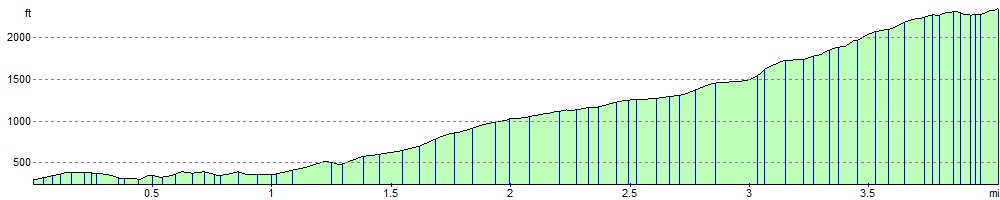
Elevation Profile