Bennerley Viaduct Walk
![]()
![]() This circular walk visit the Bennerley Viaduct, a now disused railway viaduct spanning the Erewash Valley between Awsworth and Ilkeston. The route runs for about 3.5 miles with nice waterside sections along the Erewash Canal and the River Erewash. It's a fairly flat, easy walk, taking place on mostly waymarked public footpaths.
This circular walk visit the Bennerley Viaduct, a now disused railway viaduct spanning the Erewash Valley between Awsworth and Ilkeston. The route runs for about 3.5 miles with nice waterside sections along the Erewash Canal and the River Erewash. It's a fairly flat, easy walk, taking place on mostly waymarked public footpaths.
The walk starts from Ilkeston Train Station on the Erewash Valley Line. Head west from the station and you will soon come to the Erewash Canal which you can follow north toward the viaduct. The viaduct was built between May 1876 and November 1877 and forms part of the Great Northern Railway Derbyshire Extension which was built in part to exploit the coalfields in Derbyshire and Nottinghamshire. Shortly after passing the structure you can pick up footpaths heading east toward Awsworth. Here you can pick up the Erewash Valley Trail, a waymarked long distance trail.
This will take you south along the River Erewash towards Cossall Common and Cossal Marsh. Turn west here and you will soon return to the train station.
Postcode
DE7 8PX - Please note: Postcode may be approximate for some rural locationsBennerley Viaduct Ordnance Survey Map  - view and print off detailed OS map
Bennerley Viaduct Open Street Map  - view and print off detailed map
*New* - Walks and Cycle Routes Near Me Map - Waymarked Routes and Mountain Bike Trails>>
Bennerley Viaduct OS Map  - Mobile GPS OS Map with Location tracking
Bennerley Viaduct Open Street Map  - Mobile GPS Map with Location tracking
Pubs/Cafes
The Dewdrop Inn is located just south of the viaduct, next to Ilkeston rail station. The friendly pub has a fine selection of real ales and serves a popular cheese cob. You can find them at 24 Station with postcode DE7 5TE for your sat navs. They are dog friendly and also have a garden area for warmer days.
Cycle Routes and Walking Routes Nearby
Photos
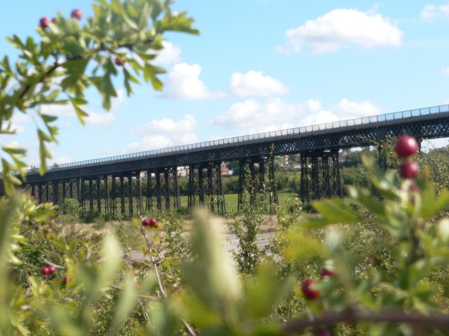
Bennerley Viaduct. The viaduct crosses the River Erewash and carried trains until Dr Beeching's axe fell in the 1960s. The wrought iron viaduct was built in 1879 and is now a listed structure.
Bennerley Viaduct Bridge. This 1400 feet long, wrought iron bridge was built in 1877 and is one of only two of it's kind in England. It was constructed to carry the Great Northern Railway, over the River Ereash and was closed to traffic in 1973 and is now classed as a Grade II listed building.
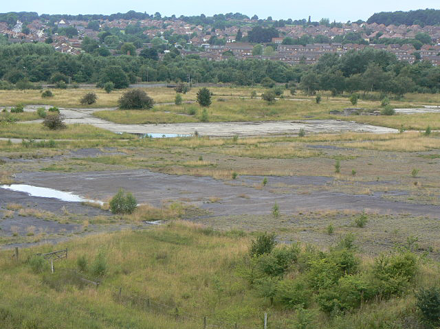
Bennerley Marshes, just south of the viaduct. The River Erewash winds its way through an area of low-lying land subject to flooding due to mining subsidence. View looking south from the Viaduct.


