High Bentham Walks - Riverside Walk

 This North Yorkshire town sits in a prime spot for walkers, close to the edge of both the Forest of Bowland AONB and the Yorkshire Dales National Park.
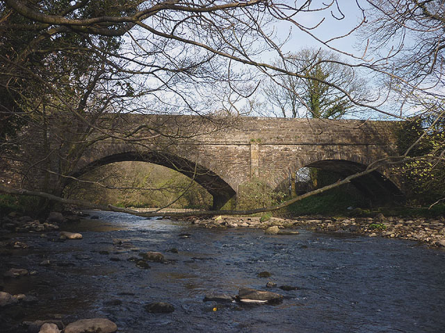
This circular walk from the town takes you along the River Wenning to the neighbouring village of Low Bentham. You can follow footpaths along both sides of the river with the start point close to the train station in Higher Bentham. The walk runs for just over 3 miles on fairly flat footpaths.
To continue your walking in the area head a few miles north east to visit Ingleton Falls. This walk is one of the major highlights of the area, visiting a series of picturesque waterfalls around the village of Ingleton. Near here you can also climb to Twistleton Scar and Ingleborough Mountain for some amazing views over the area.
Postcode
LA2 7HE - Please note: Postcode may be approximate for some rural locationsBentham Ordnance Survey Map  - view and print off detailed OS map
Bentham Open Street Map  - view and print off detailed map
Bentham OS Map  - Mobile GPS OS Map with Location tracking
Bentham Open Street Map  - Mobile GPS Map with Location tracking
Walks near Bentham
- Ingleton Falls - One of the loveliest walks in England, this circular trail visits a series of beautiful waterfalls in Ingleton in the Yorkshire Dales
- Clapham Yorkshire - The popular village of Clapham makes a great base for exploring the Yorkshire Dales
- Ingleborough Mountain - This walk climbs to Ingleborough, one of Yorshire's Three Peaks, standing at a height of 723 metres (2,372 ft)
- Norber Erratics - This walk climbs to this geologically significant set of glacial erratic boulders in the Yorkshire Dales
- Twistleton Scar - Enjoy wonderful views towards Ingleborough and Whernside on this circular walk in the Yorkshire Dales
- Whernside Ingleborough Circular Walk - This challenging circular walk visits two of the famous Yorkshire Three Peaks
- Ribblehead Viaduct - Enjoy a circular walk around this famous landmark in the Yorkshire Dales
- Whernside - Climb to the highest point in North Yorkshire on this challenging circular walk in the Yorkshire Dales
- Ingleborough Walk from Clapham - This walk climbs to Ingleborough Cave and Ingleborough Mountain from the Yorkshire village of Clapham
- Burton in Lonsdale - This North Yorkshire based village sits in a lovely spot close to the Lake District National Park, the Forest of Bowland AONB and the Yorkshire Dales.
- Gaping Gill - This walk takes you to the wonderful Gaping Gill cave from the village of Clapham in the Yorkshire Dales.
Pubs/Cafes
Visit the historic Coach House for some post walk refreshment. The ancient inn dates all the way back to 1625 and includes a charming interior with a traditional beamed ceiling and stone fire places with a restaurant. They serve high quality home cooked food and also provide rooms if you would like to stay in the area. You can find them on the Main Street in High Bentham, with a postcode of LA2 7HE for your sat navs.
Dog Walking
The river trails make for a fine dog walk and the Coach House mentioned above is also dog friendly.
Further Information and Other Local Ideas
To the north you'll find neighbouring Burton in Lonsdale where there's nice walks along the River Greta in this historical pottery village.
For more walking ideas in the area see the Forest of Bowland Walks and the Yorkshire Dales Walks pages.
Photos
River Wenning, just south west of High Bentham. The culmination of 5 becks that combine to create this tributary of the Lune, including Clapham Beck which is the one that drops down Gaping Gill below Ingleborough.


