Blackwater Valley Path
![]()
![]() This is a nice easy waterside walk along the Blackwater River from Aldershot to Swallowfield.
This is a nice easy waterside walk along the Blackwater River from Aldershot to Swallowfield.
The walk starts at the delightful Rowhill Nature Reserve in Aldershot and heads along the river to Farnborough, passing Gold Valley Lakes and Willow Park on the way. From Farnborough you continue through Frimley Hatches Nature Reserve and Blackwater to the splendid Tri Lakes Country Park near Yately. The final section takes you on to Swallowfield via Eversley.
With lakes, wetlands, rivers, canals and ponds there is a huge variety of water loving wildlife to look out for on this super walk through the beautiful Blackwater Valley.
Please click here for more information
Blackwater Valley Footpath Ordnance Survey Map  - view and print off detailed OS map
Blackwater Valley Footpath Open Street Map  - view and print off detailed map
*New* - Walks and Cycle Routes Near Me Map - Waymarked Routes and Mountain Bike Trails>>
Blackwater Valley Footpath OS Map  - Mobile GPS OS Map with Location tracking
Blackwater Valley Footpath Open Street Map  - Mobile GPS Map with Location tracking
Pubs/Cafes
The Queen's Oak in Finchampstead is a worthy place for a pit stop on the route. The historic pub was originally called The White Horse, but renamed after Queen Victoria planted an oak tree opposite the pub. There's a cosy log fire indoors while outside you can enjoy your meal in the garden area in finer weather. It's located in a lovely spot, close to the pretty village green on Church Lane. Postcode for your sat navs is RG40 4LS.
In Farnborough there's The Prince of Wales to consider. The Victorian pub serves good home-cooked food and has a nice garden area. You can find them near the train stations just to the west of the trail as it passes through the Hampshire town. The address is 184 Rectory Rd, GU14 8AL. They are also dog friendly if you have your canine friend with you.
Further Information and Other Local Ideas
At the start/end of the route in Aldershot the Gold Valley Lakeside Nature Reserve is worth a visit. There's some easy lakeside trails, lots of wildlife and a lovely cafe to rest in here.
Near Finchampstead you could take a small detour north from the path to visit Finchampstead Ridges. The attractive National Trust owned area includes woodland trails, heather, bracken and two tranquil ponds.
Near the end of the route at Swallowfield you could extend your walk by visiting the nearby Wellington Country Park. The 350 acre park includes several nature trails where you can look out for the resident Red and Fallow deer. The miles of woodland trails in Bramshill Forest and the RSPB's Hazeley Heath are also located near here. In nearby Hook there's also some pleasant trails along the River Whitewater in the pretty Bassets Mead park on the eastern side of the town.
Cycle Routes and Walking Routes Nearby
Photos
Ash, Surrey. This very pleasant path follows the Blackwater River for several kilometres northwards from Aldershot.
The path passes through a variety of habitats, supporting a rich diversity of flora and fauna. Along the riverbanks, you’ll encounter common wetland plants like yellow flag iris, water forget-me-not, and marsh marigold, which thrive in the damp soil. In the meadows, wildflowers such as oxeye daisy, red clover, and meadow buttercup add vibrant colours, especially in spring and summer. Patches of woodland provide shade, with trees like alder, willow, and oak dominating. Heathland areas near sections of the path are home to gorse, heather, and broom, giving the landscape a distinct character.
Finchampstead view. The Blackwater Valley Path was created in the 1980s as part of a collaborative effort to improve the Blackwater River and its surrounding environment. Once a heavily polluted area due to industrial and urban runoff, the valley underwent significant restoration, transforming into a haven for wildlife and a resource for public enjoyment.
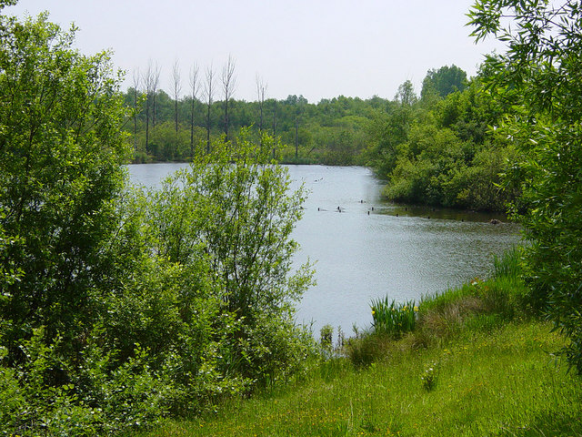
Frimley Bridge Lake taken from the Blackwater Valley Path (a long distance route following the Surrey, Berkshire and Hampshire borders, with many sections easily accessible for cyclists, the mobility impaired and young families).
The area has a rich historical tapestry. Along the route, you might encounter remnants of old mills that once harnessed the river for grain production or watercress farming, a significant industry in the region during the 19th century. Place names such as “Eversley” and “Swallowfield” hint at their medieval origins.
The River Blackwater near North Camp Station. The river and its adjacent wetlands attract a wide variety of bird species. Kingfishers, with their striking blue and orange plumage, are a highlight for many walkers, often seen darting low over the water. Herons and egrets are also common sights, wading in the shallows. The meadows and woodland edges support smaller birds such as wrens, robins, and warblers. In summer, swallows and martins can be seen swooping over open fields and water in pursuit of insects.
Gold Valley Lakes. A complex of small lakes to the west of the Blackwater Valley Road - seen from the towpath on the Basingstoke Canal. An angling competition seems to be in progress, judging by the number of fishermen.
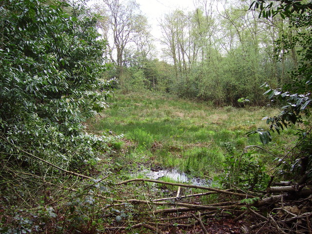
Source of the River Blackwater. This spot in Rowhill Copse Nature Reserve marks the start of the River Blackwater. The river is formed by water accumulating in a bog. The bog is much bigger than it appears - about the size of a football pitch. It remains wet throughout the year and is surprisingly deep.
Farnham. The water itself is home to fish species like chub, roach, and perch, which in turn attract predators like otters, a species increasingly spotted along this stretch of the river. Amphibians such as frogs and newts may be seen in the quieter, marshy areas. The path’s heathland sections provide a habitat for reptiles like slow worms and common lizards, particularly in sunnier spots. Butterflies, including common blue, speckled wood, and peacock, are abundant in summer, and dragonflies patrol near the riverbanks.
Where Cove Brook joins the River Blackwater. This is Hawley Meadows, a peaceful haven between the busy Blackwater Valley Road and the Railway line.
Spring sees a burst of colour with bluebells carpeting wooded areas and blossom appearing on blackthorn and hawthorn trees. In autumn, the path is rich with fungi, and trees like oak and beech display vivid colours. Winter brings a more subdued but equally striking atmosphere, with bare branches revealing the landscape’s contours and increased chances of spotting overwintering birds such as redwings and fieldfares.
Elevation Profile


