Bonnie Prince Charlie Walk
![]()
![]() Follow in the footsteps of Bonnie Prince Charlie on this walk which traces the route of his march from Ashbourne to Derby in 1745.
Follow in the footsteps of Bonnie Prince Charlie on this walk which traces the route of his march from Ashbourne to Derby in 1745.
The path passes through Derbyshire farmland and woodland starting in Ashbourne town centre and heading south to Shirley via Osmaston and Osmaston park. You continue to Longford following the Shirley brook before turning east to Radbourne, where you will pass the 18th century Radbourne Hall. From here you head to Mackworth, passing the castle ruins, and entering the delightful Markeaton park on the outskirts of Derby. Just to the north of Mackworth is the delightful Kedleston Hall which is well worth a short detour if you have time.
The final stretch runs into Derby finishing near the cathedral.
Bonnie Prince Charlie Walk Ordnance Survey Map  - view and print off detailed OS map
Bonnie Prince Charlie Walk Open Street Map  - view and print off detailed map
Bonnie Prince Charlie Walk OS Map  - Mobile GPS OS Map with Location tracking
Bonnie Prince Charlie Walk Open Street Map  - Mobile GPS Map with Location tracking
Pubs/Cafes
In Osmaston we recommend a pit stop at the Shoulder of Mutton. The pub dates back to at least 1783 and serves good quality dishes. They have a particularly lovely, large lawned garden area with views of the surrounding countryside. You can find them on Moor Lane at postcode DE6 1LW for your sat navs.
Cycle Routes and Walking Routes Nearby
Photos

On the Bonnie Prince Charlie Walk west of Markeaton

This green lane between Shirley and Longford now forms part of the Bonnie Prince Charlie Walk between Ashbourne and Derby.

Path near Silverhill Farm near Radbourne in Derbyshire on the Bonnie Prince Charlie Walk

Field with footpath at Thurvaston.

Osmaston Hall Terraced Garden. Osmaston Manor was designed by Henry Isaac Stevens for Francis Wright of the Butterley Iron Company and completed in 1849. The house was used as a Red Cross hospital during World War II, and demolished in 1964. The terraces of the house's gardens are still apparent today and shown in this lovely photo.

Osmaston Pond. You'll pass through this delightful old estate village which includes a pretty village pond, historic church, quaint thatched cottages and a fine 18th century pub.
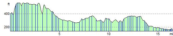
Elevation Profile