Box Hill and Westhumble Walks
![]()
![]() This circular walk starts from the Box Hill and Westhumble train station in the Surrey Hills.
This circular walk starts from the Box Hill and Westhumble train station in the Surrey Hills.
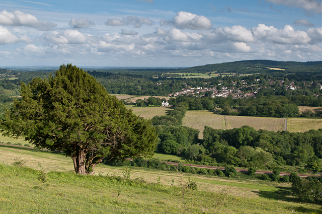
The station is located just to the east of the small village of Westhumble. It is reachable from London Victoria via Sutton, London Waterloo via Wimbledon and Dorking. The area is great for walkers with several waymarked trails, woodland, common land and hill climbs with wonderful views over the Surrey Hills.
The route starts by heading west to take you through the village of Westhumble to visit the interesting ruins of the ancient chapel which dates from the 12th century.
The trail then takes you into the expansive Ranmore Common where there are miles of woodland trails and a fine viewpoint at the southern edge. You'll also pass Denbies Hillside, part of the Denbies wine estate which contains the largest vineyard in England.
You can then pick up a section of the North Downs Way and follow it east to explore Box Hill Country Park. The park has more fine woodland and parkland trails with viewpoints and cycle tracks as well. On the western side of the park there's the famous stepping stones walk, a well known local beauty spot on the River Mole.
After exploring the park the route heads west to return you to the train station.
To continue your walking you can pick up the Mole Gap Trail in Westhumble and enjoy a pleasant waterside walk along the River Mole. The station is also the endpoint for the Thames Down Link which runs to Kingston upon Thames.
Postcode
RH5 6BT - Please note: Postcode may be approximate for some rural locationsBox Hill and Westhumble Ordnance Survey Map  - view and print off detailed OS map
Box Hill and Westhumble Open Street Map  - view and print off detailed map
*New* - Walks and Cycle Routes Near Me Map - Waymarked Routes and Mountain Bike Trails>>
Box Hill and Westhumble OS Map  - Mobile GPS OS Map with Location tracking
Box Hill and Westhumble Open Street Map  - Mobile GPS Map with Location tracking
Walks near Box Hill and Westhumble
- Box Hill Country Park - This park is run by the National Trust and has a number of splendid walking trails to enjoy
- North Downs Way - This beautiful trail starts in Farnham, Surrey and heads east through the stunning North Downs to the historic city of Canterbury in Kent
- Stanmore Common - This is a walk across Stanmore Common to Aldenham Country Park using part of the London Loop long distance trail
- Denbies Hillside - Explore this lovely area of the North Downs on this short circular walk
- Ranmore Common - This circular walk explores Ranmore Common in the North Downs, near Dorking
- Mole Gap Trail - Follow the Mole Gap Trail from Leatherhead to Dorking on this pleasant short walk through the Surrey countryside
- Thames Down Link - This walk links the Thames Path and North Downs Way National Trails
- Norbury Park - This large area of woodland, grassland and farmland has miles of tracks and trails suitable for cyclists and walkers.
In the park you'll find a Georgian manor house, peaceful woodland trails and chalk grassland with lots of wildflowers and butterflies to see
Pubs/Cafes
The Stepping Stones is a nice place to stop for some refreshments on the walk. They serve good quality food which you can enjoy in the lovely garden area. They are located just east of the train station at Westhumble Street with postcode RH5 6BS for your sat navs.
Dog Walking
The woodland and heathland trails in the area are ideal for dog walking. The Stepping Stones mentioned above is also dog friendly.
Further Information and Other Local Ideas
Just north of Westhumble there's the 18th century manor house and gardens at Norbury Park to explore. The estate of the historic Georgian manor is great for walks and wildlife with roe deer, badgers, foxes and woodpeckers to look out for.
Photos
Box Hill and Westhumble railway station. Rural station with much character, lying on the Dorking - Leatherhead line through the Mole Gap.


