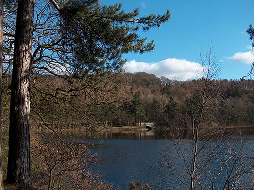
Bradfield Walk
![]()
![]() The area of Bradfield in the Peak District is a fine place for a walk. There's pretty villages, peaceful woodland and several lovely reservoirs to visit. The two villages are also very appealing with a medieval church, picturesque village cricket pitch and some classic old pubs to try.
The area of Bradfield in the Peak District is a fine place for a walk. There's pretty villages, peaceful woodland and several lovely reservoirs to visit. The two villages are also very appealing with a medieval church, picturesque village cricket pitch and some classic old pubs to try.
This circular walk visits High Bradfield, Low Bradfield, Agden Reservoir, Dale Dike Reservoir, Strines Reservoir and Damflask Reservoir. There's lots of nice waterside paths, woodland trails and moderate hill climbs to enjoy on the way.
The walk starts in High Bradfield and first heads west to visit Agden Reservoir. You head along Windy Bank on the southern side of the water before turning south to visit Dale Dike Reservoir. You can follow a path along the western side of the water which will take you to Strines Reservoir. There's lovely views across the water to the surrounding Peak District hills.
The route then turns north east to follow country and woodland trails through Bradfield Dale. You then follow the Dale Dike east to visit the western end of Damflask Reservoir before heading through Low Bradfield to return to High Bradfield.
Bradfield Ordnance Survey Map  - view and print off detailed OS map
Bradfield Open Street Map  - view and print off detailed map
Bradfield OS Map  - Mobile GPS OS Map with Location tracking
Bradfield Open Street Map  - Mobile GPS Map with Location tracking
Pubs/Cafes
In High Bradfield you'll find the Old Horns Inn, a traditional English pub. Located in an enviable position with views over the Bradfield Moors and next to St. Nicholas' church, the Old Horns is established as one of the best pubs in England, having won a number of Thwaites Awards including ‘Pub of the Year’ and ‘Best Food.’ There's also a fantastic outdoor terrace and beer garden to relax in on warmer days. The pub is very walker and dog friendly and can be found just to the east of the reservoir on Towngate, with a postcode of S6 6LG for your sat navs.
In Low Bradfield the Plough Inn is another fine option. There's an open fire, with a large beer garden and a great menu. It's located close to the village green, with a picturesque stream, picnic area and fantastic cricket pitch. You can find it with a postcode of S6 6HW.
Dog Walking
The moorland and woodland trails surrounding the villages are ideal for dog walking. The Old Horns pub mentioned above is also dog friendly.
Further Information and Other Local Ideas
Head north and you can visit Stocksbridge and enjoy a walk to Broomhead Reservoir and Moor Hall Reservoir. Near here there's miles of trails in Wharncliffe Woods and Grenoside Woods too.
Head south east and you can pay a visit to the popular Rivelin Dams, Wyming Brook and Redmires Reservoir. The circular walk from Lodge Moor takes in all these local walking highlights.
For more walking ideas in the area see the Yorkshire Walks and Peak District Walks pages.
Cycle Routes and Walking Routes Nearby
Photos
Down the hill to High Bradfield. The old Church Hall is on the left, the Old Horns Inn and Jane Street are in the middle. The road junction to Low Bradfield can be seen on the left.
High Bradfield. This short road leads to the church. The building with castellations is The Watch House. The Watch House was built in 1831 as a defence against grave robbers. It is the only surviving Watch House in Yorkshire. Now that the threat of grave robbers has passsed it is now a private residence.


