Brean Down
![]()
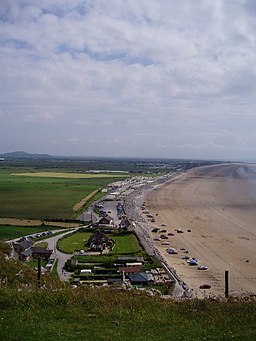
![]() Explore this beautiful natural pier and enjoy wonderful coastal views on this walk on the Somerset coast. The promontory stands at 318 feet (97 m) high and is a continuation of the Mendip Hills. As such there is some climbing involved but you are rewarded with wonderful views of the Bristol Channel, south Wales and Weston Super Mare. At the seaward end you will find Brean Down Fort which was built in 1865 and then re-armed in the Second World War.
Explore this beautiful natural pier and enjoy wonderful coastal views on this walk on the Somerset coast. The promontory stands at 318 feet (97 m) high and is a continuation of the Mendip Hills. As such there is some climbing involved but you are rewarded with wonderful views of the Bristol Channel, south Wales and Weston Super Mare. At the seaward end you will find Brean Down Fort which was built in 1865 and then re-armed in the Second World War.
The area is a nature reserve and has an abundance of interesting flora and fauna. Look out for birds including peregrine falcon, dunnock and kestrel. Butterfly species include chalkhill blue, dark green fritillary, meadow brown and marbled white. In the summer months there are lots of pretty wildflowers and plants including Somerset hair grass, wild thyme, horseshoe vetch and birds-foot-trefoil.
This circular walk starts at the car park and takes you to the fort, Howe Rock and Sprat Beach at the end of the promontory. You return on an alternative path. There is a cafe at car park where you can enjoy refreshments after your walk.
If you'd like to cycle to the reserve then you could follow National Cycle Route 33 from Burnham-on-Sea or Weston-super-Mare.
The West Mendip Way starts from Uphill next to the down. You could pick this up and head to the nearby Bleadon Hill to extend your walk. To the south east you will find the prominent hill of Brent Knoll. The hill summit provides fine views across to the down.
Just to the north of Weston-Super-Mare you will find the wonderful Sand Point. This is a similar area to Brean Down with a beautiful peninsula jutting out into the Bristol Channel.
Postcode
TA8 2RS - Please note: Postcode may be approximate for some rural locationsBrean Down Ordnance Survey Map  - view and print off detailed OS map
Brean Down Open Street Map  - view and print off detailed map
*New* - Walks and Cycle Routes Near Me Map - Waymarked Routes and Mountain Bike Trails>>
Brean Down OS Map  - Mobile GPS OS Map with Location tracking
Brean Down Open Street Map  - Mobile GPS Map with Location tracking
Explore the Area with Google Street View 
Further Information and Other Local Ideas
The Burnham on Sea Walk starts from the nearby town and takes you north along the lovely wide beach and up onto the Down. It's a fine stretch of coast which passes the distinctive 19th century Burnham Lighthouse and the noteworthy 13th century church at Brean village.
Just to the east is the delightful Uphill Nature Reserve. The reserve is well worth exploring with great views from the high point at Uphill Beacon and lots of interesting flora and fauna.
For more walking ideas in the area see the Somerset Walks and the Mendip Hills Walks pages.
Cycle Routes and Walking Routes Nearby
Photos
Steep Holm & Flat Holm from Brean Down.


