Mendip Hills Walks

Explore these magnificent limestone hills in Somerset and enjoy fabulous views, fascinating geological features and interesting historical sights.
Use the links to view full route information including elevation profiles, interactive maps and GPS downloads.
You can also view an overview map of all the routes in the using the Mendip Hills Walk Map>>
*New* - Walks and Cycle Routes Near Me Map - Waymarked Routes and Mountain Bike Trails>>
| Route Name | Photo | Distance | Description |
| Axbridge | 9.1 miles (14.7 km) | This Somerset based town is in a great location for exploring the wonderful Cheddar Gorge and Cheddar Reservoir. The town itself is also a lovely place for a stroll with a medieval town square and many old black and white timber framed buildings to admire. View Full Details>> | |
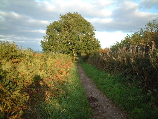
| Beacon Batch | 4 miles (6.5 km) | Enjoy a climb to this lovely viewpoint on this circular walk in the Mendip Hills. Black Down is the highest hill in the Mendip Hills, with Beacon Batch the summit point. This route is the shortest ascent from the Burrington Combe car park just to the north of the hill. The walk makes use of the Limestone Link and the Mendip Way long distance trails to create a circular route around the hill. The route runs for just over 4 miles and includes a moderate climb. Starting from the Burrington Combe car park off the B3134 you pick up a section of the Limestone Way, heading south. Other paths then take you south west up to the Beacon Batch summit which stands at a height of 325 m (1,066 ft). There's lovely views over the countryside below including the popular Blagdon Lake and Chew Valley Lake. The summit is also notable as the site of several bronze age round barrows, one of which anchors a concrete trig point. All of the barrows show signs of being opened in the past, but the only recorded excavation was done in 1820. The route then descends across Black Down which is a moorland area, with its steeper slopes covered in bracken and its flatter summit in heather. During World War II a bombing decoy town was constructed on Black Down, which was intended to represent the blazing lights of a town which had omitted to follow black-out regulations. The descent takes you north west to Hill Farm where you pick up the Limestone Way. Follow it east and you will soon come to Read's Cavern where traces of Iron Age occupation have been found. You continue east past a series of other limestone caves before returning to the car park. View Full Details>> | |
| Blagdon Lake | 0.9 miles (1.5 km) | Along the northern end of this large lake you'll find a lovely footpath running along the lake shore and through the lakeside woodland. On open days you can also visit the Discovery Wood where you can see roe deer, badgers, foxes and otters. There are nesting boxes for owls, tits and kestrels too. On the nature trail there are wildflower meadows with Green winged orchid, knapweeds, white ox-eye daisies and pink devils bit. There's also the Blagdon Pumping Station and Visitor Centre with science and environment exhibits, a picnic area and views of the impressive dam. You could also start your walk from the village of Blagdon and pick up a footpath heading east from the village to the lake. This trail will take you past Holt Farm to the southern edge of the lake. You can enjoy a long circular walk around the lake using country lanes and other public footpaths. If you would like to continue your walking in the area then you could head to the nearby Chew Valley Lake where there is a lovely circular nature trail to try. You could follow the waymarked Two Rivers Way east to visit the lake and the attractive village of Chew Magna. View Full Details>> | |
| Bleadon Hill | 2.2 miles (3.5 km) | Enjoy great views to the Somerset Levels and coast on this climb to Bleadon Hill. As well as the views there's lots of flora and fauna to enjoy. Look out for plants including wild thyme, common spotted orchid, pyramidal orchid and bee orchid. You may also see Buzzards flying overhead. The hill is located just to the south east of Weston-Super-Mare. There is roadside parking on the Roman Road running across the hill. From here you can follow country lanes to Upper Canada before picking up footpaths to take you across the woodland on Hutton Hill. You then follow the West Mendip Way along the Roman Road to take you back to the car park. The walk can be extended by heading south towards the village of Loxton. You can follow the West Mendip Way past Loxton Hill and Loxton Wood to the village. Here you will find the Parish Church of St Andrew which dates from the 11th century. You could also head to the larger village of Bleadon just to the south west of the hill. Here you will find the Grade I listed Church of St Peter and St Paul which dates from the 14th century. There are also good options for taking on refreshments after your walk. If you'd like to further extend your walk then head west to the coast and explore the wonderful Brean Down where there are splendid views of the Bristol Channel, south Wales and Weston Super Mare. If you head south east along the trail you can visit the nearby Loxton village, Crook Peak and Wavering Down for more great hill top walking. View Full Details>> | |
| Brean Down | 2.5 miles (4 km) | Explore this beautiful natural pier and enjoy wonderful coastal views on this walk on the Somerset coast. The promontory stands at 318 feet (97 m) high and is a continuation of the Mendip Hills. As such there is some climbing involved but you are rewarded with wonderful views of the Bristol Channel, south Wales and Weston Super Mare. At the seaward end you will find Brean Down Fort which was built in 1865 and then re-armed in the Second World War. The area is a nature reserve and has an abundance of interesting flora and fauna. Look out for birds including peregrine falcon, dunnock and kestrel. Butterfly species include chalkhill blue, dark green fritillary, meadow brown and marbled white. In the summer months there are lots of pretty wildflowers and plants including Somerset hair grass, wild thyme, horseshoe vetch and birds-foot-trefoil. This circular walk starts at the car park and takes you to the fort, Howe Rock and Sprat Beach at the end of the promontory. You return on an alternative path. There is a cafe at car park where you can enjoy refreshments after your walk. If you'd like to cycle to the reserve then you could follow National Cycle Route 33 from Burnham-on-Sea or Weston-super-Mare. The West Mendip Way starts from Uphill next to the down. You could pick this up and head to the nearby Bleadon Hill to extend your walk. To the south east you will find the prominent hill of Brent Knoll. The hill summit provides fine views across to the down. Just to the north of Weston-Super-Mare you will find the wonderful Sand Point. This is a similar area to Brean Down with a beautiful peninsula jutting out into the Bristol Channel. View Full Details>> | |
| Brent Knoll | 3.1 miles (5 km) | This nice circular walk climbs to a prominent hill on the Somerset Levels. The route runs for just over 3 miles, providing fine views to the coast. There's also a visit to the two villages at the foot of the hill which both have interesting old churches to see. The walk starts at the village of Brent Knoll which lies a short distance to the west of Brent Knoll hill. From here you can pick up footpaths heading north east to the 137 m (449 ft) summit of the hill. Here you will find the noteworthy Brent Knoll Camp an Iron Age hill fort, with multiple ramparts (multivallate) following the contours of the hill, broken only by the main entrance on the eastern side. It has been designated as a Scheduled Ancient Monument and is now in the care of the National Trust. There are great views over Burnham on Sea and Brean to enjoy from here too. After exploring the hill top the route descends north to the village of East Brent. Here you can visit the interesting 15th century church which is Grade I listed. It's also a good place to stop for refreshments at what is roughly the half way point on the walk. The Brent Knoll Inn has a good menu and a lovely beer garden to relax in. You can find it just to the east of the village at postcode TA9 4JG. After exploring East Brent the route then picks up footpaths on the northern side of the hill. These bend round to the west to return you to the finish point back in the village. View Full Details>> | |
| Burnham on Sea | 7.5 miles (12 km) | This popular Somerset seaside town sits in a fine spot on the River Brue and on the mouth of the River Parrett at Bridgwater Bay. There's some lovely beach walking and a nice riverside trail to try in the town too. View Full Details>> | |
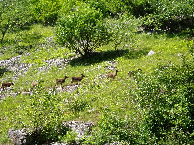
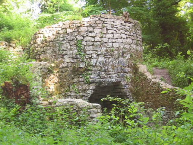
| Burrington Combe | 1.9 miles (3 km) | Explore this fascinating carboniferous limestone gorge on this circular walk in the Mendip Hills AONB. The site is geologically significant with numerous caves, cliffs and interesting rock formations. There is also an Iron Age univallate hill fort known as Burrington Camp and a variety of plants to look out for including Rock-rose, Wild Thyme and Wood Sage. Look out for mountain goats on the precarious cliff edges. The goats were introduced to the area to help reduce scrub and unwanted plants, so preserving the natural habitat. You can start your walk at the car park next to the Rock of Ages on the eastern side of the Coombe. You then climb east across the site reaching a height of nearly 700ft. From the high points there are magnificent views over the Mendips. The area is also popular with mountain bikers with some good trails up to Beacon Batch. To extend your walk you can head west to Mendip Lodge Wood and Dolebury Warren on the Limestone Link. It's a lovely area with an Iron Age hill fort, wildflowers, butterflies and splendid views across North Somerset and the Mendips. Just to the south west you will find miles of woodland trails in Rowberrow Warren Wood. This is another good place for mountain bikers. The West Mendip Way also runs through the southern section of the wood so you can pick this up and head to Shipham. You could also visit the nearby Blagdon Lake where there is a nice waterside footpath at the northern end of the water. The climb to Beacon Batch on Black Down hill starts from the car park. The hill is the highest point in the Mendips and provides great views over the lake. View Full Details>> | |
| Butcombe Trail | 46.6 miles (75 km) | This waymarked circular walk explores the Mendips Hills, visiting several pretty villages and their classic pubs. View Full Details>> | |
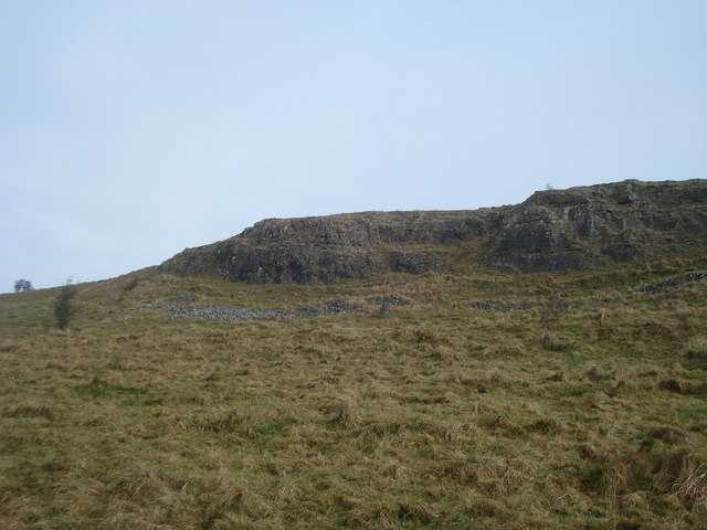
| Cheddar Gorge | 3.7 miles (6 km) | This is a free circular walk around the magnificent Cheddar Gorge in Somerset. View Full Details>> | |
| Chew Magna | 4 miles (6.5 km) | The pretty village of Chew Magna is located close to the northern edge of the Mendip Hills and was designated a conservation area in 1978. There are a number of nice walking trails running through the surrounding area. This circular walk from the village visits the River Chew, Knowle Hill, Chew Valley Lake. It makes use of two of the waymarked long distance trails which runs through the area. You'll follow sections of the Three Peaks Walk and the Two Rivers Way on the 4 mile route which includes some moderate climbs on the way. View Full Details>> | |
| Chew Valley Lake | 0.7 miles (1.2 km) | This walk follows the delightful nature trail which runs along the eastern side of this large lake in Chew Stoke. The trail is well surfaced and offers great views across the lake towards Denny Island, a nesting site for Great Crested Grebe, Tufted Duck and Canada Geese. You will also pass the reed beds where you can look out for Reed Bunting and in the summer, enjoy the purple flowers of March Woundwort. The trail includes an area of woodland with Sweet Chestnut, Beech and Sycamore trees. Look out for Coal Tits, Chaffinches and the brown Tree Creeper in this area. There's also a pond, a wildflower meadow and wonderful views across the lake towards the Mendip Hills. After your walk you can enjoy refreshments in the lakeside cafe. The lake is located just south of Chew Magna and has a car park at the start of this route. You can easily reach the lake from the village by following our Chew Magna Circular Walk which visits the River Chew and Knowle Hill before descending to the lakeside. The Two Rivers Way walking route runs past the lake too so you could pick this up to extend your walk. Heading west takes you towards Buttcombe where you can visit the lovely Blagdon Lake with more nice nature trails to try. You can also pick up the Three Peaks Walk on the eastern side of the water at Hollow Brook. This lovely long distance trail will take you further into the Chew Valley where you could visit High Littleton and Greyfield Woods. View Full Details>> | |
| Community Forest Path | 44.7 miles (72 km) | This is a varied and interesting circular walk taking you on a tour of the countryside, villages and historic estates around Bristol. The walk starts in Keynsham at the confluence of the River Chew and River Avon and begins with a lovely waterside section along the River Avon before joining the Bristol and Bath Railway Path. You continue to Winterbourne, with a short section along the River Frome, and then through Stoke Gifford to Henbury where you will pass the splendid Blaise Castle. Described as 'the finest place in England' in Jane Austen's novel Northanger Abbey, the estate boasts a 19th century mansion, an 18th century castle, a fascinating Victorian museum and 400 acres of parkland. From Henbury you continue through the suburbs of Bristol, crossing the River Avon on the Clifton Suspension Bridge next to the beautiful Avon Gorge Nature Reserve. This diverse ancient broad-leaved woodland is home to many rare plants and animals and is well worth exploring. Soon after you arrive at another walk highlight at the Ashton Court Park. Here you will find 850 acres of woodland and meadows including a deer park, mansions and landscaped gardens. The final section of the walk takes you to Pensford via Dundry Hill, where you will pass the impressive Pensford Viaduct, a Grade II listed building. View Full Details>> | |
| Compton Martin | 6.8 miles (11 km) | This pretty Somerset village is in a fine location for exploring the Chew Valley on foot. In the village there's a signficant Norman church and the picturesque millpond which is the source of the Congresbury Yeo River. View Full Details>> | |
| Congresbury | 4.1 miles (6.6 km) | This pretty village in the Mendip Hills has some lovely riverside trails, large areas of local woodland and a hill climb to an old fort above the settlement. View Full Details>> | |
| Cranmore Tower | 0.9 miles (1.5 km) | Visit the highest point on the Mendip Way and enjoy a stroll through Cranmore Wood on this circular walk in Somerset. The tower is 45 metres (148 ft) tall and dates from the 19th century. You can climb to a viewing platform where you can enjoy views over the Mendip Hills. The surrounding woods have some nice footpaths with beech trees and bluebells in the spring. Look out for badgers, rabbits and deer in this area. The tower has a tea room attached to it for refreshments after your walk. View Full Details>> | |
| Crook Peak | 5.6 miles (9 km) | Climb to Crook Peak from the village of Compton Bishop on this fine circular walk in the Mendip Hills. The hill and the adjacent Wavering Down are a splendid place for a walk with wonderful views over the countryside to the coast. The route uses part of the West Mendip Way to take you across the downs where you will reach a height of nearly 700ft. On a clear day you can see all the way to Brean Down and Porthkerry on the Welsh coast. The area is a designated geological and biological Site of Special Scientific Interest run by the National Trust. It consists of a variety of interesting flora including ancient woodland, calcareous grassland and the pretty Cheddar Pink flower. You can start the walk from the village of Compton Bishop which is only about a mile from Crook Peak. After visiting the peak you head east across Wavering Down passing Compton Hill on the way. At King's Wood you turn south and descend to the village of Cross on some nice woodland trails. At Cross, you turn west and follow footpaths back to Compton Bishop. You can also start the walk from the car park at King's Wood. It's located off Winscombe Hill Road at the eastern side of Wavering Down. The eastern end of the walk also comes close to Axbridge where you can visit Cheddar Reservoir and the spectacular Cheddar Gorge. These are both good options if you wish to extend your walk. Also nearby is the climb to Brent Knoll. View Full Details>> | |
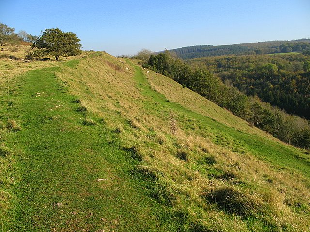
| Dolebury Warren | 2.5 miles (4 km) | This National Trust owned limestone ridge has some nice footpaths to try. There's an Iron Age hill fort, wildflowers, butterflies and splendid views across North Somerset, the Bristol Channel and the Mendips. The site includes an extensive hill fort covering 22 acres and commanding fantastic views of the area. It's surrounded by lots of interesting plants of flowers including bell heather, small scabious, early purple orchid and eyebright flower. These attract a wide variety of butterflies in the summer months. Look out for small blues and marbled whites. The route makes use of the Limestone Link which runs through the site. You can follow it east to Burrington Combe and the popular Blagdon Lake to extend your walk. The limestone gorge consists of numerous caves, cliffs and interesting rock formations. The climb to Beacon Batch on Black Down hill starts from the car park at Burrington Combe. The hill is the highest point in the Mendips and provides great views over the lake. Just to the south you will find Rowberrow Warren with miles of mountain bike trails and woodland walks. View Full Details>> | |
| Draycott Sleights | 4.7 miles (7.5 km) | Enjoy a large variety of flora and fauna in this delightful nature reserve in Somerset. The reserve has some nice footpaths with great views over the Mendip Hills and the Somerset Levels to enjoy. The expansive area of limestone downloand is great for wildlife spotting. Look out for chalkhill blue butterflies, brown hares and birds including skylark and meadow pipit. It's very beautiful in the summer months with wildflowers including bee orchids and horseshoe vetch to enjoy. You can start your walk from the village of Draycott just south of Cheddar. Follow the waymarked West Mendip way up into the reserve which reaches a height of 270 m (890 ft). From these high points there are wide ranging views over the surrounding countryside. The West Mendip Way crosses the reserve so you can pick this up to extend your walking in the area. The Rodney Stoke National Nature Reserve is just to the south while heading north will take you to the wonderful Cheddar Gorge. Also nearby is the lovely limestone nature reserve at Ebbor Gorge. View Full Details>> | |
| East Harptree Woods | 1.4 miles (2.2 km) | This walk explores East Harptree Woods near the village of East Harptree in Somerset. View Full Details>> | |
| East Mendip Way | 18.6 miles (30 km) | This walk takes you through the beautiful Somerset countryside from Wells to Frome along the eastern section of the Mendip Way. You start in the city of Wells near the magnificent cathedral and pass around the moat of the splendid Bishop's Palace. The path then heads towards Shepton Mallet passing through several wooded sections including the National Trust owned woods at Tor Hill, King's Castle Woods and finally Ham Woods. From Shepton Mallet you continue to the hamlet of Chelynch. On this section you'll pass the Charlton Viaduct and Kilver Court where there are some splendid gardens with hostas, day lilies and candelabra primula next to the River Sheppey. The route continues to with a climb of 280 metres (919 ft) taking you to the grade II listed Cranmore Tower which is the highest point on the trail. The final stretch takes you through the delightful Asham Wood and onto the village of Great Elm where there are nice views of the Mells River. You then head into the picturesque town of Frome where the path terminates. View Full Details>> | |
| Ebbor Gorge | 1.6 miles (2.5 km) | This circular walk explores a wonderful limestone gorge near Wookey Hole. In the gorge you will find waymarked woodland trails and a variety of interesting plants and flowers. There's also pretty streams and lots of interesting rock formations. There is some climbing involved with some of the paths reaching a height of over 700ft. From these high points at the top of the gorge there are great views towards Glastonbury and the Somerset Levels. The area is also a designated nature reserve so look out for wildlife including red deer and birds of prey. The site also attracts a large variety of butterflies including white-letter hairstreak, high brown fritillary and chalkhill blue. Flora includes bluebells, wood anemone, ancient woodland and various fungi and ferns. There is a good sized car park just off the Deerleap Road where you can start your walk. You could also follow the West Mendip Way from the nearby town of Wells to the site. It's about a two mile walk, passing Wookey Hole on the way. The West Mendip Way passes through the area so you could pick this up to extend your walk. View Full Details>> | |
| Frome | 9.9 miles (16 km) | The Somerset town of Frome has some lovely trails to follow through the surrounding countryside. There's easy, waterside paths along the River Frome and more challenging climbs up into the Mendip Hills. This circular walk around the town takes in the river and the pretty Orchardleigh Lake before picking up two waymarked trails to take you to some of the nearby villages, before returning to the town. View Full Details>> | |
| Litton Reservoir | 1.9 miles (3 km) | This circular walk visits the Litton Reservoirs in the village of Litton in the Mendip Hills area of Somerset. View Full Details>> | |
| Maes Knoll | 8.1 miles (13 km) | This circular walk climbs to a fine viewpoint and ancient Iron Age Hill fort in Somerset. View Full Details>> | |
| Mells River Walk | 5 miles (8 km) | Enjoy an easy riverside stroll on this walk from the village of Mells to Frome in Somerset. The pretty village is noted for several interesting old buildings including the 16th-century Mells Manor and the Talbot Inn which dates from the 15th century and is Grade II listed. The fine inn was voted Sunday Times Hotel of the Year in 2013. Starting from Mells you follow the river east through the Wadbury Valley to Great Elm, passing the Old Iron Works on the way. The interesting site produced agricultural edge-tools which were exported all over the world. The now ruined buildings are Grade II listed and most of the rest of the site is a Scheduled Ancient Monument. In the village of Great Elm you will find The Church of St Mary Magdalene which dates from the 12th century and is a Grade I listed building. The walk continues east through the Vallis Vale, a geological Site of Special Scientific Interest . This area includes ancient woodland and exposes some of Britain's most classic rock outcrops. You'll pass Bedlam, Hapsford and Spring Gardens before coming into Frome where the River Mell meets with the River Frome. View Full Details>> | |
| Norton St Philip | 7.2 miles (11.6 km) | This charming Somerset village includes a historic church and a notable ancient pub which dates back to the 14th century. For walkers there's some fine country trails with views of the nearby Mendip Hills to enjoy. View Full Details>> | |
| Nunney | 2.5 miles (4 km) | This picturesque Somerset village is a lovely place for a stroll. There's a medieval moated castle, a 12th century church, lots of quaint old cottages and a pretty brook running through the centre of the village. View Full Details>> | |
| Penselwood | 3.7 miles (6 km) | This little village in Somerset has a noteworthy 15th century church and some nice country trails to try. It's also close to the Mendip Hills and the Cranborne Chase AONB where there are numerous footpaths to enjoy. View Full Details>> | |
| Pensford Viaduct | 1.2 miles (2 km) | This short circular walk visits the impressive Pensford Viaduct from the Somerset village of the same name. The route runs for just over a mile, passing the structure with views of the River Chew to enjoy on the way. The walk starts in the pretty little village of Pensford where you can pick up the Two Rivers Way long distance footpath. Follow the trail west and it will take you along the river to the viaduct. The now disused viaduct was built in 1874 to carry the Bristol and North Somerset Railway over the valley of the River Chew. The Grade II listed building is 995 feet (303 m) long, reaches a maximum height of 95 feet (29 m) to rail level and consists of sixteen arches. The route continues west to Byemills Farm where you can cross the river. Here you can pick up the Three Peaks Walk and follow it east back into the village. View Full Details>> | |
| Priddy | 7.6 miles (12.3 km) | This Somerset based village is a fine place to start a walk with some fascinating ancient sites, wildlife rich nature reserves and murky limestone caverns to explore. View Full Details>> | |
| Rowberrow Warren | 3.4 miles (5.5 km) | Enjoy miles of mountain bike trails and walking trails in these woods near Cheddar. You can start from the village of Rowberrow, just north of Shipham. Just head east from the village and you can pick up the bridleways and tracks through the woods. It's an attractive area with shady clearings, streams and interesting flora and fauna to look out for. The woods are crossed by two long distance footpaths. In the northern end of the woods you can pick up the Limestone Link and follow it to Dolebury Warren and Burrington Combe, where there are more good mtb trails. The climb to Beacon Batch on Black Down hill starts from the car park here. The hill is the highest point in the Mendip Hills and provides great views over the lovely Blagdon Lake. The West Mendip Way also passes along the southern end of the site. You can pick this up to head to Shipham. View Full Details>> | |
| Samaritans Way South West | 103.1 miles (166 km) | Starting at Bristol follow the Samaritans Way to Lynton, in Devon, and visit the Avon Gorge, the Chew Valley, the Cheddar Gorge, the Mendips, the Quantock Hills and the Brendon Hills. The walk also takes you through the beautiful Exmoor National Park where you will visit the lovely Doone Valley. Here you can try our lovely Lorna Doone Walk. View Full Details>> | |
| Sand Point | 3.4 miles (5.5 km) | Enjoy fine views across the Bristol Channel to Wales on this coastal walk on the edge of the Mendip Hills in Somerset. View Full Details>> | |
| Shepton Mallet | 5 miles (8 km) | Visit the Charlton viaduct and the village of Doulting on this circular walk in the Somerset town of Shepton Mallet. Just to the north of the town you can pick up the East Mendip Way on Barren Down. Then follow the path east to the Charlton Viaduct. This section passes close to Kilver Court where there are some splendid gardens with hostas, day lilies and candelabra primula next to the River Sheppey. From the viaduct the route climbs towards Ingsdons Hill which reaches a height of over 700ft. You then descend to Chelynch passing Pitts Wood on the way. From here you turn south to the little village of Doulting. The spring in Doulton is the source of the River Sheppey and named after St Aldhelm who died in the village in 709. The village also includes a tithe barn which dates from the 15th century. The final section of the walk follows a public footpath along the River Sheppey, returning you to the viaduct. View Full Details>> | |
| Stanton Drew | 0.6 miles (1 km) | This short walk visits the Stanton Drew Stone Circles in Somerset. View Full Details>> | |
| Stockhill Woods | 1.2 miles (2 km) | Stockhill Wood in Somerset is a tranquil woodland located near Priddy on the Mendip Hills. View Full Details>> | |
| Three Peaks Walk | 16.8 miles (27 km) | This is a fairly hilly circular route taking you through some of the most peaceful and attractive countryside in Somerset.
The walk starts and finishes in the pretty village of Chew Magna and follows the path to Pensford and then back via Clutton. You will climb Knowle Hill, Maes Knoll, and Blackberry Hill (three peaks) while enjoying excellent views of the Mendip Hills, Dundry Hill and the surrounding Chew Valley countryside. The route also passes very close to the popular Chew Valley Lake where you will find a lovely nature trail on the eastern shores. The trail is well surfaced and offers great views across the lake towards Denny Island, a nesting site for Great Crested Grebe, Tufted Duck and Canada Geese. Near here you will also pass the pretty village of Pensford and the impressive Grade II listed Pensford Viaduct. View Full Details>> | |
| Two Rivers Way | 19.9 miles (32 km) | Starting on Congresbury Bridge over the River Yeo follow the Two Rivers Way through Somerset to Keynsham on the River Avon. The walk passes through Wrington, Chew Stoke, Chew Magna, Compton Dando and Pensford with sections along the River Yeo and River Chew to enjoy. Other highlights on the route include the Stanton Drew Stones which include the Great Circle - the second largest stone circle in Britain (after Avebury Stones). You'll also pass the lovely Chew Valley Lake which has delightful nature trails and a variety of wildlife. Near here there's also the photogenic Pensford Viaduct which is a Grade II listed building, spanning the River Chew near the attractive village of the same name. All the way there's splendid views of the Mendip Hills AONB and the Somerset countryside. View Full Details>> | |
| Uphill | 1.6 miles (2.6 km) | This walk explores the pretty nature reserve in Uphill, just south of Weston-Super-Mare on the Somerset coast. View Full Details>> | |
| Velvet Bottom Circular Walk | 3.1 miles (5 km) | This circular walk explores Velvet Bottom, a nature reserve in a dry limestone valley, located just to the north east of Cheddar Gorge. View Full Details>> | |
| Wells | 6.2 miles (10 km) | The cathedral city of Wells is located in North Somerset in the Mendip Hills AONB. The city includes many historical buildings including the moated Bishop's Palace and the magnificent cathedral. There's lots of good walking opportunities around the city with woodland, nature reserves, hill climbs and parks to visit. This circular walk from the city takes you to two of the highlights to the north of Wells. You'll visit the famous caves at Wookey Hole before continuing on to the Ebbor Gorge Nature Reserve. The route runs for a distance of a distance of about 6 miles using a section of the waymarked West Mendip Way and other public footpaths. View Full Details>> | |
| Wells to Glastonbury Walk | 8.1 miles (13 km) | This walk takes you from the Somerset city of Wells to Glastonbury Tor. The route uses a mixture of waymarked footpaths and quiet country lanes to take you through the countryside between the two settlements. It runs for a distance of about 8 miles along flat paths before a small climb at the end. The walk starts at the historic Wells Cathedral where you can pick up the Monarch's Way and follow it south towards Launcherley. You then head west along the Long Drove before turning south to head through the countryside at the western outskirts of Glastonbury. The route then heads east through the town passing the fascinating Glastonbury Abbey before climbing to the famous hill for great views over the area. View Full Details>> | |
| West Mendip Way | 29.8 miles (48 km) | This splendid walk takes you through the beautiful Mendip Hills Area of Outstanding Natural Beauty from Wells to Uphill. You start in Wells by the impressive cathedral and head west towards Cheddar passing the show caves and paper mill at Wookey Hole and the wonderful limestone nature reserve at Ebbor Gorge. The route continues through Rodney Stoke National Nature Reserve and Draycott Sleights Nature Reserve before coming to the spectacular Cheddar Gorge, voted the second greatest natural wonder in Britain. The next stage takes you through the lovely countryside at Compton Bishop before climbing across Wavering Down to Crook Peak where there are splendid views towards the coast. The final section sees you cross Bleadon Hill and finish by the wharf at Uphill on Weston Bay in Weston-Super-Mare. View Full Details>> | |
| Weston Woods | 2.5 miles (4 km) | These pretty woods in Weston-Super-Mare have a series of good footpaths to try. The woods are also a local nature reserve covering 130 hectares (321 acres) on Worlebury Hill above the town. From the elevated position of the woods there are nice views over Sand Bay towards Wales. There's also an Iron Age hillfort at the western tip of the site where the defensive ramparts can be clearly seen. You can park at the car park on Worlebury Hill Road at the eastern tip of the woods. Then pick up the trails heading west towards the coast. To extend your walking in the area you could pick up the West Mendip Way long distance path and explore the Mendip Hills from Weston-Super-Mare. Just to the north of the woods you will find the splendid Sand Point where you can enjoy fine views across the Bristol Channel on a beautiful coastal peninsula. Just to the south you can enjoy more great coastal views on Brean Down or climb to the nearby Bleadon Hill. View Full Details>> | |
| Wrington | 6.8 miles (11 km) | This Somerset based village is in a lovely spot for exploring the surrounding landscape of the Mendip Hills . There's some nice riverside trails, local expansive woodland and a nearby ancient hill fort to explore. View Full Details>> |