Circular Walk around Bromsgrove
![]()
![]() This circular walk around Bromsgrove makes use of waymarked trails to visit the canal and countryside surrounding the town. You'll follow a section of the long distance Monarch's Way to visit the popular Tardebigge Locks on the Worcester and Birmingham Canal.
This circular walk around Bromsgrove makes use of waymarked trails to visit the canal and countryside surrounding the town. You'll follow a section of the long distance Monarch's Way to visit the popular Tardebigge Locks on the Worcester and Birmingham Canal.
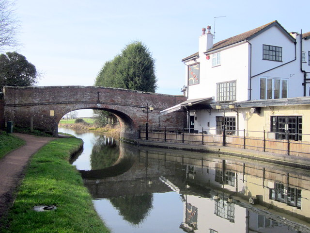
The route starts on the western side of the town where you can pick up the waymarked Monarch's Way footpath. Follow it south and then east through Charford to Aston Fields and then out into the countryside. The trail follows a country lane east to Cherry Trees Farm where you can pick up the canal. Follow the towpath west and you will pass Tardebigge Reservoir before coming to the impressive Tardebigge Locks flight. Here you will find the largest flight of locks in Britan, comprising 30 narrow locks on a 2.25 mile (3.6 km) stretch along the canal. At nearby Stoke Pound there is a nice canalside pub where you can sit out and enjoy refreshments.
The route continues west past Stoke Pound Bridge to Stoke Wharf where you leave the towpath. Head north towards Stoke Heath, crossing the River Salwarpe before returning to Charford and the town centre.
To continue your walking in the area follow the canal north east to Barnt Green and try our Barnt Green Circular Walk which visits Lickey Hills Country Park and the prety Bittell Reservoirs.
Bromsgrove Ordnance Survey Map  - view and print off detailed OS map
Bromsgrove Open Street Map  - view and print off detailed map
Bromsgrove OS Map  - Mobile GPS OS Map with Location tracking
Bromsgrove Open Street Map  - Mobile GPS Map with Location tracking
Walks near Bromsgrove
- Tardebigge Locks - Visit the largest flight of locks in Britain on this circular walk around Tardebigge Locks on the Worcester and Birmingham Canal
- Worcester and Birmingham Canal - Follow the Worcester and Birmingham Canal from the vibrant centre of Birmingham, through the green hills of Worcestershire, to the cathedral city of Worcester
- Monarch's Way - This incredible 615-mile walk approximates the escape route taken by King Charles II in 1651 after being defeated in the Battle of Worcester
- Barnt Green Circular Walk - This 4 mile circular walk takes you around the village of Barnt Green in Worcestershire
- Redditch - This lovely figure of eight walk takes you along the Miller's Trail to Arrow Valley Country Park in the Worcestershire town of Redditch
- Lickey Hills Country Park - Explore 524 acres of country park at Lickey Hills near Birmingham
- Bittell Reservoirs - This walk visits the Upper and Lower Bittell Reservoirs in Barnt Green, near Birmingham
- Arrow Valley Country Park - Enjoy waterside cycling and walking in this splendid country park in Redditch
- Royal Hunters Walk - This circular walk explores the countryside and woodlands to the west of Bromsgrove in the West Midlands.
Pubs/Cafes
The Old Post Office - Bromsgrove’s former post office was turned into a stunning ground floor pub in 2019. They have kept the traditional frontage of the post office, complete with clock. There is a lovely roof terrace to sit out on during warmer days. You can find them on the High Street at postcode B61 8AA.
There's also the Crabmill Inn with its pleasant decor and U-shaped area divided into distinct sections. You can find them at postcode B61 0DF. They are dog friendly.
On the route you could you could enjoy a pit stop at the canalside Queens Head in Stoke Pound. There's a charming interior including Victorian floor tiles with beaten copper and the natural textures of wood and stone. Outside there is an attractive landscaped garden with a tepee which can be booked for private parties. You can find them at postcode B60 3AU for your sat navs. The inn includes car parking and is also dog friendly.


