Bittell Reservoirs Walk
![]()
![]() This walk visits the Upper and Lower Bittell Reservoirs in Barnt Green, near Birmingham. There's much to enjoy with countryside views and lots of birdlife to look out for on the water.
This walk visits the Upper and Lower Bittell Reservoirs in Barnt Green, near Birmingham. There's much to enjoy with countryside views and lots of birdlife to look out for on the water.
The walk starts from Barnt Green train station and follows footpaths through the countryside to Lower Bittell Reservoir. Tracks take you along the western side of the water to the Upper reservoir, with views of the River Arrow as you go. You can then pick up a section of the North Worcestershire Path along the northern end.
On the eastern side of the reservoirs you can pick up the Worcester and Birmingham Canal to extend your walk. Following it south will take you through Alvenchurch to Tardebigge Locks.
You could also follow the North Worcestershire Path west and visit the splendid Lickey Hills Country Park for great views over the area. The Barnt Green Circular Walk visits both the park and the reservoirs, with lovely views of the surrounding Worcestershire countryside.
Postcode
B45 8BH - Please note: Postcode may be approximate for some rural locationsBittell Reservoirs Ordnance Survey Map  - view and print off detailed OS map
Bittell Reservoirs Open Street Map  - view and print off detailed map
Bittell Reservoirs OS Map  - Mobile GPS OS Map with Location tracking
Bittell Reservoirs Open Street Map  - Mobile GPS Map with Location tracking
Further Information and Other Local Ideas
The Alvechurch Walk visits the reservoirs from the nearby village. It takes you along the canal to the reservoirs before climbing up to Lickey Hills. It's a nice way of visiting the lakes by public transport as there is a train station in Alvechurch. The historic settlement is a nice place for a stroll too with a 13th century church, several medieval half-timbered buildings and a rather fine canalside pub.
Head south into Redditch and you could enjoy lakeside paths and a walk along the River Arrow in the pretty Arrow Valley Country Park.
For more walking ideas in the area see the Worcestershire Walks page.
Cycle Routes and Walking Routes Nearby
Photos
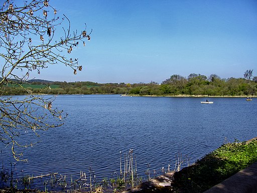
Barnt Green Sailing Club, Upper Bittell Reservoir. Upper Bittell Reservoir was constructed in the early 19th century to supply the Worcester & Birmingham Canal. Today the reservoir is home to the Barnt Green Sailing Club. General public access is restricted - a public footpath runs across the dam, from which this photo was taken. Access to the east bank is restricted as this is a SSSI.
Lower Bittell Reservoir. Looking south from Bittell Farm Road which separates the lower part of the reservoir from Mill Shrub Pool. This reservoir was built in 1837 along with the neighbouring Upper Bittell Reservoir, in the valley of the River Arrow, to supply the Worcester and Birmingham Canal. The Lower reservoir acts as a compensation reservoir, and is used for private fishing. There is no general public access.


