Calderdale Way

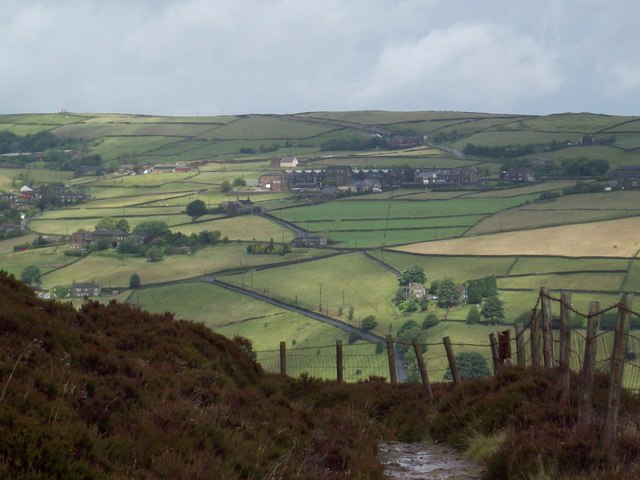
 The Calderdale Way is a walking circuit around the beautiful district of Calderdale in West Yorkshire. The walk passes through exposed moorland and woodland paths, while there are also waterside sections along the Rochdale Canal, the River Calder and around Withens Clough Reservoir and Warlands Reservoir. The walk officially starts at Greetland and passes through Ripponden, Mankinholes, Todmorden, Heptonstall, Holdsworth, Shelf and Brighouse.
Highlights on the route include the beautiful wooded valley at Hardcastle Crags and the attractive heathland on Norland Moor near Sowerby Bridge.
Calderdale Way Ordnance Survey Map  - view and print off detailed OS map
Calderdale Way Open Street Map  - view and print off detailed map
Calderdale Way OS Map  - Mobile GPS OS Map with Location tracking
Calderdale Way Open Street Map  - Mobile GPS Map with Location tracking
Pubs/Cafes
Near Withens Clough we recommend stopping for refreshments at the The Hinchliffe Arms pub. There's great food and a nice outdoor seating area to relax in at this walker/cyclist friendly pub. You can find it on Church Bank Ln, Cragg Vale, HX7 5TA.
The Millers Bar in Brighouse is another fine option. There's a good menu and a lovely canalside beer garden to relax in on warmer days. From the garden you can also watch as climbers dare to risk the UKs tallest outdoor climbing wall, ROKTFACE which is located right next to the pub. It's a fine, award winning place and can be found at a postcode of HD6 1EB for your sat navs.
The Top Brink pub is another wonderfully positioned pub on the trail. The traditional original pub includes stone features, beamed ceilings, brassware & pottery, and a light airy large conservatory to the front with panoramic views. Outside there are several outside eating areas, including a large decked area and a lovely garden area with pretty flower baskets. It's a great place to relax and enjoy the countryside views with your meal. You can find the pub in an elevated position at Lumbutts near to the Stoodley Pike monument. Postcode is OL14 6JB for your sat navs.
The route passes through the noteworthy little village of Cragg Vale near Mytholmroyd. It has an interesting history connected with the The Cragg Vale Coiners, a band of counterfeiters that produced fake gold coins in the late 18th century to supplement small incomes from weaving. In the village you'll find The Hinchliffe Arms. They do really excellent food and also have outside seating and an outside veranda. The inn can be found at Church Bank Lane with a postcode of HX7 5TA for your sat navs. There is ample parking at the pub too.
Further Information and Other Local Ideas
For more walking ideas in the area see the South Pennines Walks page.
Cycle Routes and Walking Routes Nearby
Photos
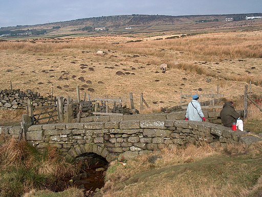
A footbridge over a pretty stream and waterfall on the Calderdale Way at the edge of Warley Moor near Wainstalls.
The Long Stoop, on the Calderdale Way. An ancient guidepost across the moors and a crossing point of the Calderdale and Pennine Ways.


