Centenary Way
![]()
![]() Follow the Centenary Way from Ilkeston to Ashbourne on this 25 mile walk through the Derbyshire countryside. The walk visits several pretty villages including West Hallam, Duffield , Brailsford, Edmaston, Shirley and Osmaston.
Follow the Centenary Way from Ilkeston to Ashbourne on this 25 mile walk through the Derbyshire countryside. The walk visits several pretty villages including West Hallam, Duffield , Brailsford, Edmaston, Shirley and Osmaston.
Highlights on the route include the delightful Kedleston Hall which is just to the south of the trail near Duffield.
You'll also pass the lovely Osmaston Park where there's a lake, woodland and traces of the old 19th century manor which is now demolished.
Centenary Way Ordnance Survey Map  - view and print off detailed OS map
Centenary Way Open Street Map  - view and print off detailed map
Centenary Way OS Map  - Mobile GPS OS Map with Location tracking
Centenary Way Open Street Map  - Mobile GPS Map with Location tracking
Pubs/Cafes
In Osmaston we recommend a pit stop at the Shoulder of Mutton. The pub dates back to at least 1783 and serves good quality dishes. They have a particularly lovely, large lawned garden area with views of the surrounding countryside. You can find them on Moor Lane at postcode DE6 1LW for your sat navs.
Cycle Routes and Walking Routes Nearby
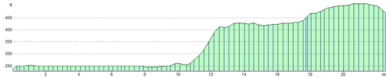
Elevation Profile