Clitheroe - Castle and River Walk
![]()
![]() Explore the Lancashire town of Clitheroe on this lovely walk in the Ribble Valley. The walk explores the historic castle before heading to the River Ribble and the pretty Cross Hill Nature Reserve.
Explore the Lancashire town of Clitheroe on this lovely walk in the Ribble Valley. The walk explores the historic castle before heading to the River Ribble and the pretty Cross Hill Nature Reserve.
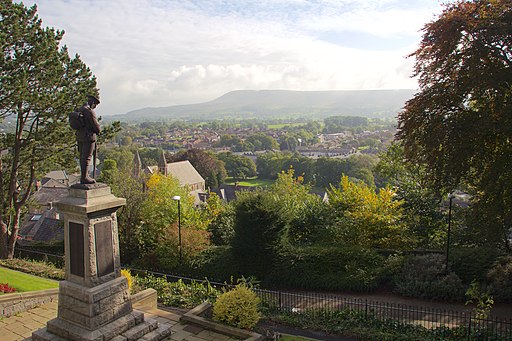
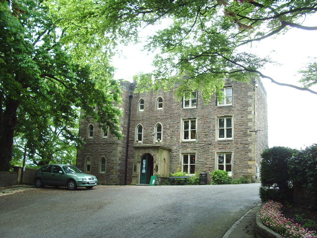
The walk starts at the very fine Clitheroe Castle, located close to the train station in the town centre. The ruined medieval castle is thought to date from the 12th century and includes extensive grounds which are also a public park. Here you will find a fine war memorial with wonderful views towards Pendle Hill. There's also a fascinating Castle Museum housed in a Grade II listed 18th century building.
Here you can see collections of natural history, local art and period costume, and an archaeology collection including items recovered from excavations on the site.
After exploring the castle grounds the route then heads to the river where you can see a photogenic weir and salmon leap. Turn right and follow the river path past Brungerley Bridge to Brungerley Park.
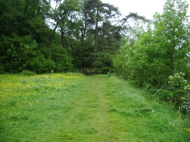
Continue towards Horrocksford and you can visit the Cross Hill Nature Reserve. Here you will find some nice woodland trails, meadows, wildflowers and wildlife spotting opportunities. Look out for Blackcap, Willow Warbler, Chiffchaff and Herons around the river.
After exploring the pretty reserve the walk returns to the castle using the same paths.
You can extend your walk by continuing along the Ribble Way long distance footpath. Following the riverside trail east will take you to West Bradford and Chatburn. Heading south from Eddisford Bridge will take you to Great Mitton and Hurst Green where you can pick up the Tolkien Trail. The literary trail explores an area connected with the Lord of the Rings trilogy.
The town is also on the edge of the Forest of Bowland AONB. Just to the west you can enjoy a climb to Longridge Fell and enjoy fabulous views over the area. Around here you can also pick up the Forest of Bowland Walk which takes on a tour of the AONB.
Whalley Abbey and the historical Roman village of Ribchester are also nearby.
Clitheroe Ordnance Survey Map  - view and print off detailed OS map
Clitheroe Open Street Map  - view and print off detailed map
Clitheroe OS Map  - Mobile GPS OS Map with Location tracking
Clitheroe Open Street Map  - Mobile GPS Map with Location tracking
Walks near Clitheroe
- Ribble Way - Follow the River Ribble through the beautiful Ribble Valley from its mouth at Longton, near Preston, to the source at Gayle Moor in Yorkshire.
You start at Longton just to the west of Preston and follow the river through Ribchester and Clitheroe, before reaching Gisburn - Ribchester - Enjoy a stroll through the historical Lancashire village of Ribchester before following a section of the Ribble Way to Hothersall
- Forest of Bowland Walk - A circular walk around the Forest of Bowland AONB in Lancashire
- Longridge Fell - Enjoy a walk to the summit of England's most southerley fell on this wonderful circular walk in the Forest of Bowland
- Whalley Abbey and the River Calder - Visit the fascinating remains of this former Cistercian abbey and enjoy a waterside stroll along the Calder River on this lovely circular walk in the Lancashie village of Whalley.
- Spring Wood Whalley - Follow the nature trail through delightful woodland on this easy walk in Whalley
- Pendle Hill - This walk climbs to the summit of Pendle Hill in Lancashire
- Tolkien Trail - This literary trail explores an area of the Ribble Valley thought to have inspired some of the landscapes from J.R.R Tolkien's 'Lord of the Rings' trilogy
- Pendle Hill Witches Walk - This double looped trail travels through the area associated with the Pendle Witch Trials of 1612
- Eddisford Bridge - Enjoy a lovely riverside walk along the River Ribble on this walk from Eddisford Bridge in Clitheroe
- Parlick and Fair Snape Fell - This walk from Parlick Fell to Fair Snape Fell is considered one of the loveliest in the Forest of Bowland
- Beacon Fell Country Park - Explore 271 acres of woodland, moorland and farmland in the Forest of Bowland AONB
- Sawley - This walk explores the area around the Lancashire village of Sawley, visiting the historic Sawley Abbey and a particularly scenic stretch of the River Ribble.
- Brock Bottom - This walk visits Brock Bottom near Garstang in the Forest of Bowland AONB
- Waddington - This delightful Lancashire village sits on the southern edge of the Forest of Bowland AONB in the beautiful Ribble Valley
- Bolton by Bowland - This delightful Lancashire village is in a great location for exploring the scenery of the lovely Forest of Bowland and Ribble Valley
Pubs/Cafes
Head to Holmes Mill for some refreshment after your walk. The extensive complex is housed in an old textiles mill and includes a beer hall, hotel, bistro and a food hall. It's described as 'celebration of Lancashire food' with a variety of options to tempt your palate. There's also a series of historic buildings so it's a nice place to browse around even if you're not felling hungry. You can find them on Greenacre Street with a postcode of BB7 1EB for your sat navs.
Dog Walking
The area makes for a lovely dog walk with dogs allowed in the castle grounds. Holmes Mill is also dog friendly in the beer hall and outside. Water and treats are available here.
Further Information and Other Local Ideas
One nice idea is to follow the Ribble Way north and visit the pretty village of Sawley. Here you can visit the ruins of the 12th century Sawley Abbey which is run by English Heritage. The river is particularly scenic here and there's also a splendid riverside pub for post walk refreshments. On the way you would pass close to the neighbouring village of Waddington. The village is very pretty and a regular winner of the Lancashire Best Kept Village awards. A stroll along the Waddington Brook and through the delightful Coronation gardens is recommended here. To the east is Gisburn with its fine 18th century coaching inn and views of the Stock Beck.
For more walking ideas in the area see the Ribble Valley Walks and the Lancashire Walks page.
Photos
Parlick Fell through the arch from the castle. Parlick as seen through the arch looking in a westerly direction. Parlick is the large mole hill on the sky line right of centre. To the right of Parlick on sky line is Wolf Fell then Saddle Fell, they all melt into one another. This photo is taken from Clitheroe Castle grounds on Wednesday 06/01/2010 at 4.27pm. The little hump on the horizon at the left of the picture is part of the famous Beacon Fell Country Park.
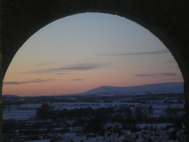
Stone framed Dusk - Kemple End, Beacon Fell, Parlick. This photo was taken at 4.32pm looking through the stone frame at the top of the steps next to Clitheroe Castle Keep. In the dusk from left to right we see Kemple End (the local name for the eastern end of Longridge Fell), the small hump in the centre is Beacon Fell which looks like a whale back when seen closer rising out of the lower land around. Lastly we have Parlick. Snow is on the ground which can be seen on the roofs of the houses in the town of Clitheroe.


