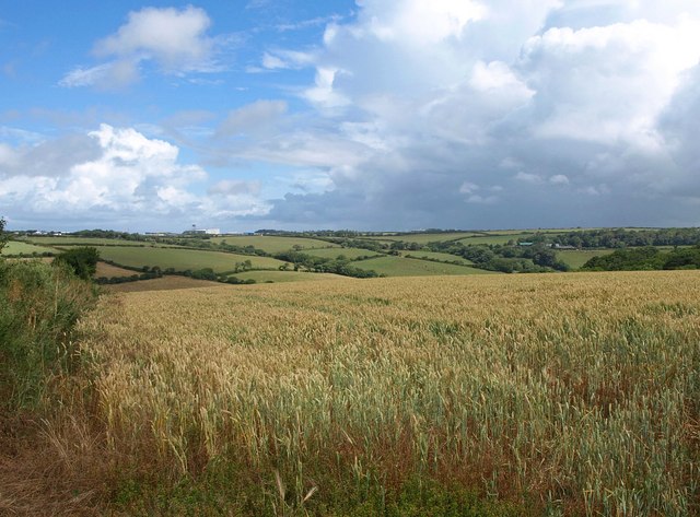
Colan Woods
![]()
![]() A circular walk around the village of Colan near Newquay. The walk takes you around the woodland and country lanes surrounding Porth Reservoir on the Colan Estate. The area is quite hilly so its an undulating walk with nice views across the reservoir from the high points. The parish also used to be a mining settlement so you may see several derelict buildings as you make your way through the area.
A circular walk around the village of Colan near Newquay. The walk takes you around the woodland and country lanes surrounding Porth Reservoir on the Colan Estate. The area is quite hilly so its an undulating walk with nice views across the reservoir from the high points. The parish also used to be a mining settlement so you may see several derelict buildings as you make your way through the area.
The walk starts from Colan Church which dates from the thirteenth century. The trail then heads north east to Nanswhyden before turning east to Trebarer. Quiet country lanes then return you to the finish point at the church.
To extend the walk you can pick up the circular trail around the pretty Porth Reservoir where there's an impressive dam and lots of wildlife to look out for.
Postcode
TR8 4NB - Please note: Postcode may be approximate for some rural locationsColan Woods Ordnance Survey Map  - view and print off detailed OS map
Colan Woods Open Street Map  - view and print off detailed map
Colan Woods OS Map  - Mobile GPS OS Map with Location tracking
Colan Woods Open Street Map  - Mobile GPS Map with Location tracking
Further Information and Other Local Ideas
A few miles to the south east you can pick up the Goss Moor Trail. This shared cycling and walking trail explores the expansive Goss Moor National Nature Reserve where there's a number of rare plant and wildlife species to look out for.
Just south of Newquay you can pick up the Holywell to Crantock Circular Walk to visit the lovely Holywell Bay and the secluded beach at Porth Joke.
To the north of Newquay there's Watergate Bay where you will find a wonderful 2 mile long surfind beach and a footbridge over to the splendid Porth Island headland.
For more walking ideas in the area see the Cornwall Walks page.
Cycle Routes and Walking Routes Nearby
Photos
Melancoose Mill. Now a private house. Hard by the lane from Colan to Trebarber. By 1972 the mill appeared to be derelict*, but has since been converted and the waterwheel restored, although it will never fully operate again since the construction of Porth Reservoir upstream has deprived it of its leat.


