Crowden and Black Hill Walk
![]()
![]() The hamlet of Crowden is a popular start point for exploring a stunning area of the Pennines. There's a handy car park and camping site where many fine walks can be started.
The hamlet of Crowden is a popular start point for exploring a stunning area of the Pennines. There's a handy car park and camping site where many fine walks can be started.
This circular walk from Crowden climbs to the nearby Black Hill. It's a popular and quite challenging climb using a section of the Pennine Way and other public footpaths.
The walk starts from the Crowden car park which is located on the northern side of the Longdendale Reservoirs. From here it is a short stroll west to pick up the Pennine Way. Follow the waymarked trail north west and it will take you past Black Tor, Laddow Rocks, Black Chew Head, Near Broadslate, Red Ratcher, Meadowgrain Clough and Holme Edge before arriving at the Black Hill summit. This stands at a height of 582 metres (1,908 feet) and is the highest point of the historic county of Cheshire, lying at the tip of what was once known as the Cheshire Panhandle.
The route then descends south to Tooleyshaw Moss, White Low, Westend Moss and Hey Edge before returning to the car park. This descent can be boggy after wet weather so you may want to just descend on the Pennine Way if you prefer.
Postcode
SK13 1HZ - Please note: Postcode may be approximate for some rural locationsCrowden Ordnance Survey Map  - view and print off detailed OS map
Crowden Open Street Map  - view and print off detailed map
Crowden OS Map  - Mobile GPS OS Map with Location tracking
Crowden Open Street Map  - Mobile GPS Map with Location tracking
Pubs/Cafes
Head west from the car park and you will soon come to Tintwistle near Bottoms Reservoir. Here you can enjoy some well earned refreshments at the historic Bull's Head. The 16th century pub does very good food and has a nice cosy fire for winter days. You can easily find the pub in the village at a postcode of SK13 1JY for your sat navs. It's also very dog friendly if you have your canine friend with you.
Further Information and Other Local Ideas
On the southern side of the reservoirs you can pick up the Longdendale Trail. This shared cycling and walking trail will take you along a series of picturesque reservoirs including Torside Reservoir, Woodhead Reservoir and Bottoms Reservoir.
To the west you can pick up the Pennine Bridleway and follow it to Stalybridge Country Park.
At the eastern end of Woodhead Reservoir there's a car park where you can start the Middle Black Clough Waterfall Walk. The area is a bit of a hidden gem with walks along the River Etherow to some beautiful waterfalls and wonderful rock formations.
For more walking ideas in the area see the Derbyshire Walks and Peak District Walks pages.
Cycle Routes and Walking Routes Nearby
Photos
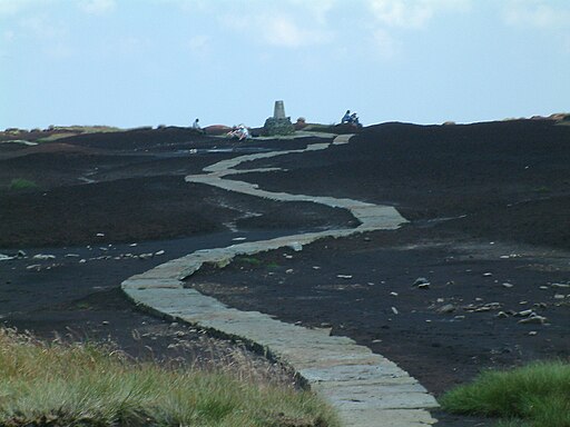
The Pennine Way on the summit of Black Hill (Peak District). The triangulation column and highest point on Black Hill is on a small elevated mound, called Soldiers' Lump. According to Alfred Wainwright's Pennine Way Companion the support timbers for the Ramsden theodolite, used by the Royal Engineers in the original Ordnance Survey, were still to be found here many years later.
Laddow Rocks. Crowden Castles can be seen centre right in the photo. The Pennine Way is directly above the rocks.
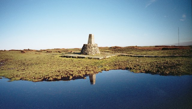
Black Hill (Holme Moss) Ordnance Survey Triangulation Pillar. At 582 metres (1,908 feet) above sea-level, Black Hill (Holme Moss) was once "the highest hill in old Cheshire" before local government re-organisation in 1974. On the OS map, the locality is alternatively known as "Soldier’s Lump", this being a reference to the 18th century visits of the Royal Engineer surveyors who first used it as a surveying point. Just to the east is the Holme Moss transmitter.
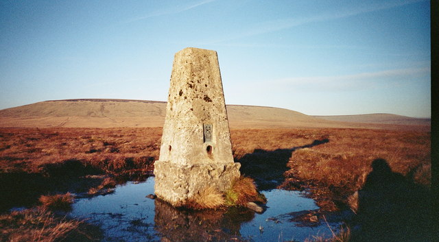
Hey Edge Ordnance Survey Triangulation Pillar. The Flush Bracket Base Plate number is S2640. Unusually, the pillar is not shown as a blue triangle on Ordnance survey maps; this is because although the Ordnance Survey obviously built it, they never actually took observations from here.
Woodhead Reservoir Overflow Channel. This picture shows a brimfull Woodhead Reservoir overflowing into the overflow channel located at the Western end of the reservoir. The dam wall and the concrete overflow channel just downstream of here was substantally strengthened in the late 1980's. In the background is the B6105 road which joins the A628 trunk road at the top of the rise.
Torside Reservoir. The road is the A628 at the side of the old YHA Crowden, which is to the right of pic. The reservoir is located just south of the car park with the Pennine Way running along the its northern edge.


