Cwmbran Canal Walk
![]()
![]() Enjoy an easy walk along the Monmouthshire and Brecon Canal on this easy waterside walk in Cwmbran. The route runs from the town towards Pontypool where you have the option of catching the train back or continuing on a short way to the pretty Pontypool Park.
Enjoy an easy walk along the Monmouthshire and Brecon Canal on this easy waterside walk in Cwmbran. The route runs from the town towards Pontypool where you have the option of catching the train back or continuing on a short way to the pretty Pontypool Park.
The walk starts on the canal in Old Cwmbran and heads north along the towpath to Sebastopol. The route continues past Griffithstown before coming to the Pontymoile canal basin, a pleasant spot on the canal.
Near here you can catch the train back to Cwmbran at the Pontypool and New Inn Station or return on the same paths. You could also carry on a little further west and visit Pontypool Park where there's some nice footpaths to follow around the mature trees and open meadowland in the park. The main park starts at Pontymoile Gates near New Inn and Pontymoile Basin and has footpaths leading into the Brecon Beacons National Park. Other highlights include the Italian Gardens and the Nant-y-Gollen Ponds.
To continue your walking in the area head east from Pontypool to Llandegfedd Reservoir. There's a lovely, long walking trail heading around the perimeter of the beautiful lake.
A few miles south west of the town you will find Cwmcarn Forest. There's miles of woodland trails to try here. Also near the woods is the lovely Ebbw Vale which you can explore on the waymarked Ebbw Valley Walk. The Sirhowy Valley Ridgeway Walk and Sirhowy Valley Country Park can also be explored in this area.
Cwmbran Ordnance Survey Map  - view and print off detailed OS map
Cwmbran Open Street Map  - view and print off detailed map
Cwmbran OS Map  - Mobile GPS OS Map with Location tracking
Cwmbran Open Street Map  - Mobile GPS Map with Location tracking
Walks near Cwmbran
- Monmouthshire and Brecon Canal - Follow the Monmouthshire and Brecon Canal from Brecon to Newport on this super waterside walking and cycling route
- Llandegfedd Reservoir - Enjoy a long circular walk around this beautiful reservoir near Cwmbran and Newport
- Cwmcarn Forest - This large country park has miles of fantastic walking and cycling trails to explore
- Sirhowy Valley Country Park - Explore 1000 acres of woodland and meadows in this beautiful country park in Risca
- Sirhowy Valley Ridgeway Walk - This walk runs through the beautiful Sirhowy Valley in south Wales
- Pontypool - This Torfaen county based town has a fine local park and waterside trails along the local river and canal.
- Blaen Bran Reservoir - This circular walk visits the Blaen Bran Reservoirs near Cwmbran in Torfaen county.
- Goytre Wharf - This circular walk from the Goytre Wharf takes you along a section of the Monmouthshire and Brecon Canal before exploring the countryside to the west of the wharf.
Further Information and Other Local Ideas
On the north western edge of the town you'll find Blaen Bran Reservoir. There's some nice community woodland here with a waterfall and excellent views down to the two reservoirs from the surrounding hills.
Photos
Five Locks Basin, Cwmbran The main line of the Monmouthshire Canal ends here at Five Locks Basin, Cwmbran
Glenside Community Centre, Cwmbran. Viewed across the former Monmouthshire & Brecon canal, from the towpath, now part of National Cycle Route 46.
Two Locks Church, Cwmbran. Viewed across Two Locks Road. Two Locks Church is a non-denominational, independent, Christ-centred, Bible-based church. Located on the west bank of the disused Monmouthshire & Brecon Canal, the building was erected in 1860 as Ebenezer Baptist Chapel.
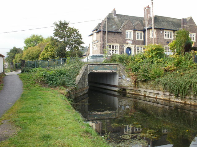
Crown Bridge, Sebastopol. Pontypool Crown Bridge is numbered 48 on the Monmouthshire & Brecon canal. It was rebuilt in 1994. The Crown Inn is in the upper right of the photo.


