Diggle Canal Walk

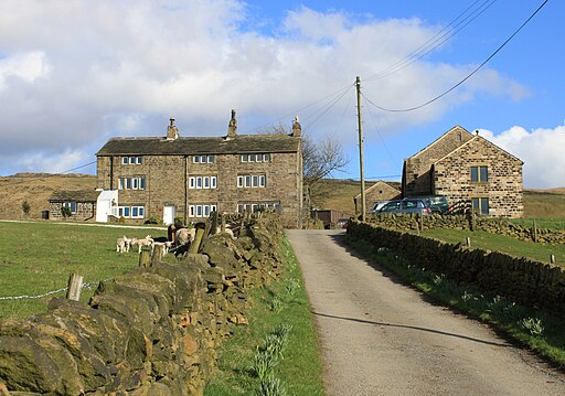
 This Greater Manchester village is located near Oldham in the Pennine Hills. It's also positioned at one end of the Standedge Tunnel and the Standedge Trail long distance walk.
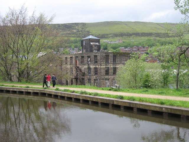
This walk from the village takes you along a section of the Huddersfield Narrow Canal to nearby Saddleworth and Uppermill. Along the way there are pretty locks, historic old mills, lots of wildlife and fine views over Saddleworth Moor.
Please scroll down for the full list of walks near and around Diggle. The detailed maps below also show a range of footpaths, bridleways and cycle paths in the area.
Postcode
OL3 5PJ - Please note: Postcode may be approximate for some rural locationsDiggle Canal Walk Ordnance Survey Map  - view and print off detailed OS map
Diggle Canal Walk Open Street Map  - view and print off detailed map
Diggle Canal Walk OS Map  - Mobile GPS OS Map with Location tracking
Diggle Canal Walk Open Street Map  - Mobile GPS Map with Location tracking
Walks near Diggle
- Uppermill - The pretty village of Uppermill is in a lovely location on the Huddersfield Narrow Canal and the River Tame
- Huddersfield Narrow Canal - Follow the Huddersfield Narrow Canal from Greater Manchester into the Peak District on this easy waterside walk
- Saddleworth Moor - Enjoy a walk across this atmospheric moor in the Peak District
- Castleshaw Reservoir - These two reservoirs in Oldham have some nice walking trails to try
- Oldham Way - Enjoy the canals, reservoirs and countryside around Oldham on this splendid circular walk
- Crompton Circuit - This circular walk takes you around Shaw near Oldham.
- Rochdale Way - A fabulous circular walk around Rochdale which visits a series of lovely reservoirs and includes a section along the River Roch
- Ogden Reservoir and Piethorne Reservoir - Explore this area of the Piethorne Valley on this circular walk in the Metropolitan Borough of Rochdale, Greater Manchester
- Marsden Moor - This circular walk explores the wonderful Marsden Moor Estate in the Pennines
- Pule Hill - This circular walk climbs to Pule Hill on the wonderful Marsden Moor Estate in the South Pennines
- Redbrook Reservoir - This walk visits Redbrook Reservoir and Black Moss Reservoir in Kirklees
- March Haigh Reservoir - This circular walk visits the viewpoint at Buckstones Edge and March Haigh Reservoir on Marsden Moor.
- Strinesdale Reservoir and Country Park - This circular walk explores the Strinesdale Country Park and reservoirs in Oldham.
- Pennine Bridleway - This fabulous 120 mile long trail runs through the beautiful Derbyshire Peak District, through Lancashire and on into Yorkshire.
It is suitable for mountain bikers, horse riders and walkers taking you on a tour through some of the most beautiful parts of the country
Pubs/Cafes
The Diggle Lock is a fine place for some refreshment. It's located in a re-purposed textile mill near to the canal. They have a fine menu and can be found at Warth Mill, OL3 5PJ.
Further Information and Other Local Ideas
The Pennine Bridleway and the Oldham Way also pass through the immediate area.
You could create a circular walk from the village making use of these waymarked trails to visit Castleshaw Reservoir where there are some pleasant waterside trails and fine views of the surrounding moors.


