Downham Circular Walk
![]()
![]() A lovely circular walk from the Lancashire village of Downham, visiting the countryside to the east of the village.
A lovely circular walk from the Lancashire village of Downham, visiting the countryside to the east of the village.
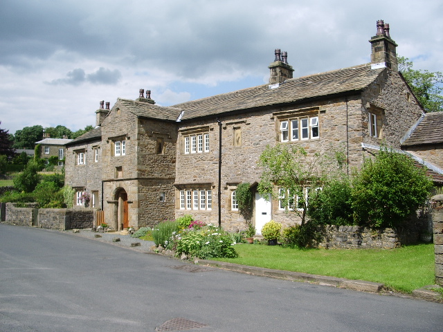
The village is one of the prettiest in the county and has been used as a location in TV and film. There's great views of the nearby Pendle Hill from the country footpaths surrounding the village. It's also within the bounds of the Forest of Bowland AONB and the Ribble Valley where there are fine walking opportunities.
This circular walk starts from the Downham Village Car Park where there's free parking and an information centre. From here you can pick up footpaths heading south east, passing close to the Downham Beck on the way. The walk then heads through farmland towards Twiston Mill, passing Twiston Beck on the way. The paths pass the old cotton mill heading north to Torrid Bank Wood before heading west to Wooly Hill before returning to Downham. On this last stretch you will pass Downham Mill which was in use up to the early 1900s. There is a pretty millpond and views of the Ings Beck in this area.
Postcode
BB7 4BN - Please note: Postcode may be approximate for some rural locationsDownham Ordnance Survey Map  - view and print off detailed OS map
Downham Open Street Map  - view and print off detailed map
Downham OS Map  - Mobile GPS OS Map with Location tracking
Downham Open Street Map  - Mobile GPS Map with Location tracking
Pubs/Cafes
Next to the car park there's Downham Ice cream where you can purchase some hot drinks and snacks after your exercise.
Head west of the village and you will find the Greendale View Kitchen where there are some nice tea rooms. You can enjoy afternoon tea with fresh baked scones with views of the surrounding hills. You can find them at Downham Road, Chatburn, with a postcode of BB7 4DL for your sat navs.
Dog Walking
The country and woodland trails make for a fine dog walk and the Greendale View Kitchen mentioned above is also dog friendly.
Further Information and Other Local Ideas
A few miles to the south east you will find the village of Barley where you can enjoy a walk around Black Moss Reservoir and the nearby Ogden Reservoirs. In this area you can also pick up the long distance Pendle Way.
For more walking ideas in the area see the Ribble Valley Walks, the Forest of Bowland Walks and the Lancashire Walks page.
Cycle Routes and Walking Routes Nearby
Photos
Downham Beck, bridge and village. Downham is said to be one of the most beautiful of Lancashire's villages; even on a dull November day, I would agree. As well as being featured in the BBC TV series, "Ormston", part of the film "Whistle down the wind" was also filmed here.


