Barley Walks
![]()
![]() This attractive Lancsahire village is located in a scenic spot within the Forest of Bowland Area of Outstanding Natural Beauty. It's a splendid spot with picturesque stone cottages, a lovely picnic area, two excellent pubs and the pretty Barley Water running through the village.
This attractive Lancsahire village is located in a scenic spot within the Forest of Bowland Area of Outstanding Natural Beauty. It's a splendid spot with picturesque stone cottages, a lovely picnic area, two excellent pubs and the pretty Barley Water running through the village.
It's a fine place to start a walk with a series of local reservoirs and the Pendle Way long distance trail running through the area.
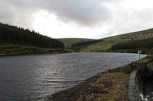
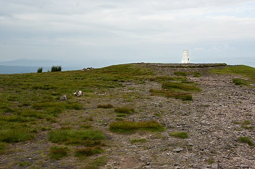
This circular walk from the village makes use of the trail to climb to the viewpoint at Pendle Hill before visiting Ogden Reservoirs. The walk then returns to the village where there's an optional extension to Black Moss Reservoir. You can start the walk from the car park and picnic area near Barley Green.
Please scroll down for the full list of walks near and around Barley. The detailed maps below also show a range of footpaths, bridleways and cycle paths in the area.
Postcode
BB12 9JX - Please note: Postcode may be approximate for some rural locationsBarley Ordnance Survey Map  - view and print off detailed OS map
Barley Open Street Map  - view and print off detailed map
Barley OS Map  - Mobile GPS OS Map with Location tracking
Barley Open Street Map  - Mobile GPS Map with Location tracking
Walks near Barley
- Black Moss Reservoir - Enjoy a waterside walk around these two reservoirs near the Lancashire village of Barley
- Pendle Way - Follow the Pendle Way through Lancashire and visit Barnoldswick, Thornton-in-Craven, Wycoller, Reedley, Newchurch and Pendle Hill on this challenging walk
- Pendle Hill - This walk climbs to the summit of Pendle Hill in Lancashire
- Downham - A lovely circular walk from the Lancashire village of Downham, visiting the countryside to the east of the village
- Sawley - This walk explores the area around the Lancashire village of Sawley, visiting the historic Sawley Abbey and a particularly scenic stretch of the River Ribble.
- Bolton by Bowland - This delightful Lancashire village is in a great location for exploring the scenery of the lovely Forest of Bowland and Ribble Valley
- Clitheroe - Explore the Lancashire town of Clitheroe on this lovely walk in the Ribble Valley
- Pendle Hill Witches Walk - This double looped trail travels through the area associated with the Pendle Witch Trials of 1612
- Pendle Hill Walk From Sabden - This walk climbs to Pendle Hill from the village of Sabden in Lancashire
- Gisburn - The Lancashire village of Gisburn is located in a lovely spot in the Forest of Bowland AONB and the Ribble Valley.
Pubs/Cafes
The Pendle Inn is a fine place for some post walk refreshments. There's a lovely interior with many original features in the pub frontage and there is a large dining conservatory to the rear. You can find them at postcode BB12 9JX. The pub is dog friendly.
At the picnic site there's also the Cabin Cafe. The cafe is set in a log cabin and sells a good range of meals and snacks.
Photos
Picnic Area, Barley Car Park. As well as this picnic area, the car park boasts a cafe, toilets, plenty of space and an honesty box for the £1 parking.


