GPS Cycle and Walking Routes

Drymen to Balmaha Walk

8 miles (12.6 km)

This route takes you along a section of the West Highland Way from Drymen to Balmaha.
The walk runs for just under 8 miles following the waymarked trail west through Gardhban Forest in the Queen Elizabeth Forest Park. You then have the option of descending to Balmaha via Milton of Buchanan or ascending to the viewpoint at Conic Hill. The route shown on the maps below takes the latter of these two options.
The finish point is Balmaha on the shores of Loch Lomond. Here you can enjoy a boat trip to the tranquil Inchcailloch Island or explore the Balmaha Forest on a number of woodland trails.
To continue your walking along the trail pick up the next leg on the Balmaha to Milarrochy Bay and Rowardennan Walk. The preceding section is the Milngavie to Drymen Walk which takes you to the trail head at Milngavie.

Drymen to Balmaha OS Map - Mobile GPS OS Map with Location tracking

Drymen to Balmaha Open Street Map - Mobile GPS Map with Location tracking

Photos

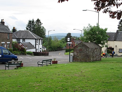
Village green, Drymen - geograph.org.uk - 4070749

Village green, Drymen

West Highland Way in Garadhban Forest - geograph.org.uk - 3987512

West Highland Way in Garadhban Forest

Part of Garadhban Forest - geograph.org.uk - 3987526

Part of Garadhban Forest

The West Highland Way heads northeast - geograph.org.uk - 1048211

The West Highland Way heads northeast. The long distance footpath can be seen heading along the side of the Burn of Mar towards Milngavie.

The West Highland Way heading towards Breac Leac - geograph.org.uk - 3988207

The West Highland Way heading towards Breac Leac

Approaching Conic Hill - geograph.org.uk - 4013574

Approaching Conic Hill

View from Conic Hill North - geograph.org.uk - 3989077

View from Conic Hill North

Slipway at Balmaha - geograph.org.uk - 2152576

Slipway at Balmaha

Video

GPS Files

GPX File

Drymen to Balmaha.gpx (On Desktop:Right Click>'Save As. On Ipad/Iphone:Click and hold>Share>Save to Files')