West Highland Way
![]()
![]() This is a fabulous long distance walking and cycling* route from Milngavie, north of Glasgow, to Fort William in the Scottish Highlands.
This is a fabulous long distance walking and cycling* route from Milngavie, north of Glasgow, to Fort William in the Scottish Highlands.
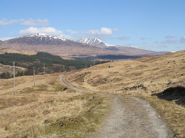
There's stunning scenery to enjoy with Lochs, mountains, rivers and waterfalls all dotted along the route.
The route begins just outside Glasgow at Milngavie and heads north through Mugdock Country Park before reaching Loch Lomond where you enjoy a fantastic waterside section along the shores of the loch with Ben Lomond mountain making a beautiful backdrop. You continue through Glen Falloch and Strathfillan, passing the lovely Falls of Falloch, Loch Tulla, Glen Orchy and crossing Rannoch Moor. The path then takes you through the stunning Glencoe, climbing the Devil’s Staircase, before crossing the River Leven at the head of Loch Leven. The final section takes you past Lairigmor and Glen Nevis and finishes at Gordon Square in Fort William.
The route is well signposted throughout.
*For cyclists please be aware that while much of the route makes for fantastic cycling some sections are extremely challenging and are only suitable for experienced mountain bikers. Even then you will have to carry your bike over certain sections. Please see this discussion thread for more information.
We've split up the route into several sections which can be walked in a day. Click on the links below to see a description, photos and a map for each section.
West Highland Way Sections
- Milngavie to Drymen
- Drymen to Balmaha
- Balmaha to Milarrochy Bay and Rowardennan
- Rowardennan to Inversnaid
- Inversnaid to Tyndrum
- Tyndrum to Bridge of Orchy
- Bridge of Orchy to Kingshouse
- Kingshouse to Kinlochleven
- Kinlochleven to Fort William
Please click here for more information
West Highland Way Ordnance Survey Map  - view and print off detailed OS map
West Highland Way Open Street Map  - view and print off detailed map
West Highland Way OS Map  - Mobile GPS OS Map with Location tracking
West Highland Way Open Street Map  - Mobile GPS Map with Location tracking
Pubs/Cafes
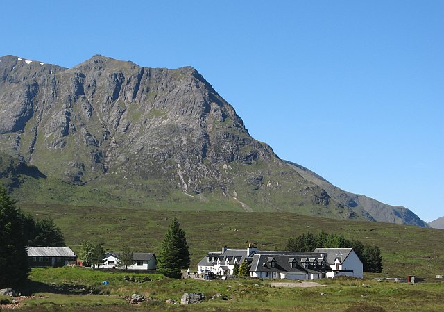
The historic Kings House Hotel is a popular place for a pit stop on the route. The inn dates from the 17th century making it one of the oldest in Scotland. It has an interesting history having been used as a barracks after the Battle of Culloden in 1745. The Kings officers used it to patrol and keep the"Highlanders" under control. They serve quality food and have a nice warm fire to warm yourself by on colder days. The hotel is also often surrounded by several deer, adding to the spectacular view. It's located in a fabulous spot in Glencoe at postcode PH49 4HY for your sat navs.
The Rowardennan Hotel sits in a great location on the banks of Loch Lomond, with fine views over the water. The hotel dates back to 1696 but has been recently refurbished in a contemporary Scottish style.
Inside there's a cosy wood burning fire for colder days. Outside there's a Beer Garden and a little beach by the loch. They serve good wholesome food and can be found at postcode G63 0AR for your sat navs. The hotel is also dog friendly.
Cycle Routes and Walking Routes Nearby
Photos
West Highland Way walkers, Kingshouse. A short tarred section along a road that was once, before modernisation in the 1930s part of the A82. Until recently the road was a loop, taking in the Kingshouse Hotel, but now just serves Black Corries Lodge, becoming private just east of here. The trail is very popular and a major economic force in the area. At its inception it was feared that it may be a Trojan Horse for the restricted access lobby, but it has successfully worked alongside other outdoor activities for 30 years now. Glencoe in the background.
Dun Deardail. At the summit of this small hill is a vitrified hill fort. A vitrified fort is where rocks are fused by heat to strengthen the walls. Taken from above the pass now taken through the forest by the trail.
A braided river, Auch. The Allt Kinglas, emerging from the Auch Glen takes a braided course on the flat floor of the glen. The surrounding land is used for cattle grazing.
Kings House Hotel. The Kingshouse (Glencoe), is reputed to be Scotland's oldest hotel. A popular staging post on the trail. View from the Black Corries road with Sròn na Crèise in the background.
Elevation Profile


