Eccleshall Walks
![]()
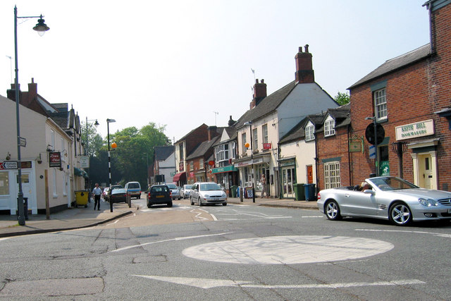
![]() This historic small town is located close to Stone and Stafford in the county of Staffordshire. The town has a particularly interesting high street with a number of Georgian buildings to admire. There's also a noteworthy 12th century church and a 13th century castle.
This historic small town is located close to Stone and Stafford in the county of Staffordshire. The town has a particularly interesting high street with a number of Georgian buildings to admire. There's also a noteworthy 12th century church and a 13th century castle.
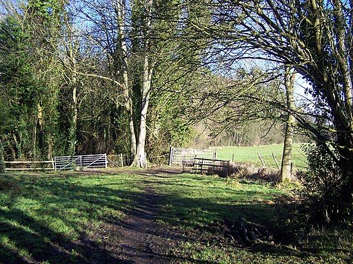
This walk from the town visits Eccleshall Castle, Elford Heath and the pretty Cop Mere to the west of the settlement.
The walk starts at Eccleshall Castle which is located just to the north west of the town centre. The castle is not open to the public but a public footpath runs past the southern side of the site. The castle dates from the 13th century and is a Scheduled Ancient Monument and a Grade II* listed building.
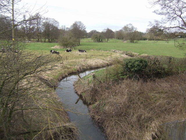
The route then heads west past Elford Heath and Pershall where you can enjoy views of the River Sow. You continue past Platt Bridge before coming to Cop Mere where there is a woodland footpath running along the northern side of the water.
Postcode
ST21 6BW - Please note: Postcode may be approximate for some rural locationsEccleshall Ordnance Survey Map  - view and print off detailed OS map
Eccleshall Open Street Map  - view and print off detailed map
Eccleshall OS Map  - Mobile GPS OS Map with Location tracking
Eccleshall Open Street Map  - Mobile GPS Map with Location tracking
Walks near Eccleshall
- Aqualate Mere - Enjoy a peaceful walk through this lovely nature reserve near Newport, Staffordshire
- Downs Banks - Enjoy a circular walk around this pretty area of woodland and heathland near Stone, in Staffordshire
- Shugborough Park - This circular walk uses public footpaths and the Staffordshire Way to take you around Shugborough Park in Great Haywood
- Stone - This Staffordshire based market town has some nice canal side walks to try
- Stafford - Stafford is the county town of Staffordshire and has some nice waterside walking trail along the canal, river and nature reserve in the town centre
- Trent and Mersey Canal - Follow the Trent and Mersey Canal through Derbyshire, Staffordshire and Cheshire on this long distance waterside walk
- Trentham Gardens - This circular walk in Staffordshire takes you around the beautiful Trentham Gardens and Trentham Lake
- Downs Banks - Enjoy a circular walk around this pretty area of woodland and heathland near Stone, in Staffordshire
- Hanchurch Woods - These woods near Trentham have three nice waymarked trails to try
- Staffordshire and Worcestershire Canal - Follow the Staffordshire and Worcestershire Canal from Stourport-on-Severn to Great Haywood on this easy waterside walking and cycling route
- Staffordshire Way - Travel through Staffordshire, Cheshire, Derbyshire, Worcestershire and enjoy canals, lakes, country parks and a series of pretty towns and villages
- Cannock Chase Country Park - This huge country park has 3000 acres of cycling and walking trails to explore
- Belvide Reservoir - Enjoy a circular walk around Belvide Reservoir in South Staffordshire on this easy route
- Sabrina Way - This route is part of the National Bridleroute Network and primarily designed for horse riders but can be used by walkers and cyclists also
- Wolverhampton Canal Walk - Explore the Birmingham Canal on this short walk through the centre of Wolverhampton.
- Penkridge - This Staffordshire based market town is in an ideal spot for exploring the countryside and woodland of the Cannock Chase AONB
- Milford Common - This walk takes you around Milford Common near Stafford
- Shropshire Union Canal - Travel from the ourskirts of Wolverhampton to Ellesmere Port on this long distance waterside walk along the Shropshire Union Canal.
The route starts at Autherley Junction in the Oxley area of Wolverhampton - Shugborough Park - This circular walk uses public footpaths and the Staffordshire Way to take you around Shugborough Park in Great Haywood
Pubs/Cafes
The Royal Oak is a good choice for some post walk refreshment. The old coaching in includes a fine courtyard style garden and a large covered Coach House area with plenty of seating. You can find them on the High Street at postcode ST21 6BW for your sat navs.
Dog Walking
The countryside trails make for a fine dog walk and the Royal Oak mentioned above is also dog friendly.
Further Information and Other Local Ideas
Head into nearby Stone and you could enjoy an easy waterside stroll along the Trent and Mersey Canal to the splendid Trentham Gardens.
Head west and you could pick up the Shropshire Union Canal.
Just to the south there's the lovely Aqualate Mere. There's a pleasant waterside path to pick up at this large, scenic lake. The site is one of the area's highlights and notable as the largest natural lake in the English Midlands. Just to the west of here there's the market town of Newport where you can enjoy another waterside stroll along the old Newport Canal.
For more walking ideas in the area see the Staffordshire Walks page.


