Erbistock Walks
![]()
![]() This pretty village in Wrexham County lies in a delightful spot on the River Dee.
This pretty village in Wrexham County lies in a delightful spot on the River Dee.
It's a pleasant place for a walk with fine scenery and two historic local pubs for some refreshment afterwards.
This circular walk starts from the 17th century Boat Inn and takes you along the river before heading into the surrounding woodland and countryside. On the way you will also pass the weir at Erbistock Mill and the Grade II listed St Hilary's church. The area around the church is particularly lovely with peaceful riverside trails and evidence of the old ferry which once took passengers to the opposite side.
The Maelor Way and the Wat's Dyke Way Heritage Trail run through the village. These long distance walking trails are a great way of further exploring the area.
Postcode
LL13 0DL - Please note: Postcode may be approximate for some rural locationsErbistock Ordnance Survey Map  - view and print off detailed OS map
Erbistock Open Street Map  - view and print off detailed map
Erbistock OS Map  - Mobile GPS OS Map with Location tracking
Erbistock Open Street Map  - Mobile GPS Map with Location tracking
Walks near Erbistock
- Wrexham - This circular walk explores the countryside to the south of Wrexham
- Chirk Aqueduct - This walk takes you to the Chirk Aqueduct and Viaduct in Wales.
- Chirk Castle - Explore the gardens an wider estate surrounding this 13th century castle in Wrexham.
- Llangollen Canal - Enjoy a waterside walk or cycle along the Llangollen Canal
- Llangollen Round - Explore the beautiful area around the town of Llangollen, in Denbighshire, on this circular walk, devised to raise funds for the Cancer Research UK charity
- Ellesmere Lake - Enjoy a short walk along Ellesmere Lake in this Shropshire based country park
- Colemere Country Park - Enjoy a peaceful circular walk around the pretty Cole Mere in Shropshire
- Maelor Way - This splendid walk takes you from the Shropshire/Cheshire border into Wales.
The path starts at Grindley Brook near Whitchurch and heads west to Penley in Wales, passing around the pretty Hanmer Mere on the way - Wat's Dyke Way Heritage Trail - A new walking route running through the pastoral countryside near the Welsh-English border
- Fenns Whixall and Bettisfield Mosses - This walk explores the Fenns, Whixall and Bettisfield Mosses National Nature Reserve near Whixall in Shropshire and Bettisfield in Wales.
Pubs/Cafes
The Boat Inn is a splendid old riverside inn where you can relax after your exercise. The building dates back to the 1600s and is known for its association with the old ferry and as part of the collection of buildings which form the Erbistock conservation area.
They serve high quality dishes which you can enjoy in the lovely outdoor seating area overlooking the river.
Postcode for sat navs is LL13 0DL.
Dog Walking
The riverside and woodland trails make for a fine dog walk. The Boat Inn mentioned above is also dog friendly.
Photos
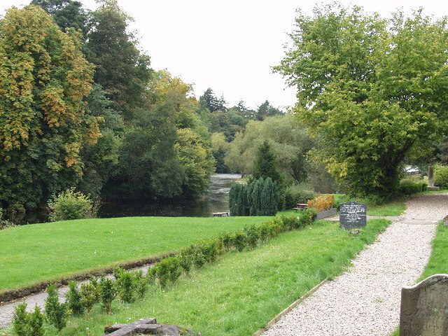
Afon Dyfrdwy from the graveyard of St. Hilary Erbistock Ford. What a delightful spot this is, taken from the bank above the river in the graveyard of the parish church looking down towards the famous Boat Inn. There used to be a ferry at this point, hence the name of the inn. A long vanished ford is also there somewhere.
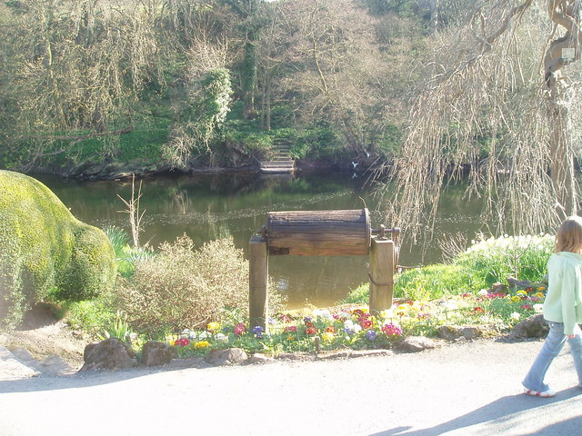
The Boat Inn, Erbistock. Situated alongside the river Dee, it's at the end of a long, single track road which passes the church and leads to a dead end.


