Fairlop Waters Country Park
![]()
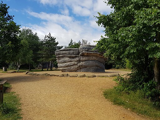
![]() This large park in Ilford includes sailing and angling lakes, an 18-hole golf course, a boulder park, an outdoor activity centre and a number of newly developed footpaths.
This large park in Ilford includes sailing and angling lakes, an 18-hole golf course, a boulder park, an outdoor activity centre and a number of newly developed footpaths.
It's also good for wildlife spotting with several species of water loving bird visiting the lakes.
The park is located close to Fairlop tube station which is in Zone 4 on the Central line of the London Underground.
Just over a mile to the north east you can continue your walking around Hainault Forest Country Park. There's over 300 acres to explore by bike or on foot in this popular park. The epic London Loop can also be picked up here.
Postcode
IG6 3HN - Please note: Postcode may be approximate for some rural locationsFairlop Waters Country Park Ordnance Survey Map  - view and print off detailed OS map
Fairlop Waters Country Park Open Street Map  - view and print off detailed map
Fairlop Waters Country Park OS Map  - Mobile GPS OS Map with Location tracking
Fairlop Waters Country Park Open Street Map  - Mobile GPS Map with Location tracking
Pubs/Cafes
There's an on site cafe and restaurant in a lovely spot right next to the water.
Dog Walking
The lakeside trails make for a pleasant walk with your dog. It's a popular location so you'll probably make friends with other owners on the way.
Further Information and Other Local Ideas
One nice idea is to head a little to the north and pick up the London Loop and follow it to Havering Country Park.
Just to the south there's Valentines Park. The parkland and gardens here surround the 17th century Valentines Mansion.
The circular walk from Loughton explores the area to the north of the park from the nearby town's London Underground station. It's an attractive place worthy of exploration with dozens of historic listed buildings and three conservation areas. The route also visits the Roding Valley Meadows nature reserve on the River Roding, the aforementioned Hainault Forest Country Park and part of Epping Forest.
For more walking ideas in the area see the London Walks page.
Cycle Routes and Walking Routes Nearby
Photos
Fairlop Peri? This is a concrete path that encircles much of 111601 which is strong circumstantial evidence that this is the remains of the perimeter track of RAF Fairlop that formerly occupied the site.
RAF Fairlop Survivor? This asbestos building was built on the site of RAF Fairlop. The airfield opened as RFC Hainault Farm to counter the treat of Zeppelin raids in WW1, the base closed in 1919. The City of London Corporation bought the site before WW2 intending it to be London Airport but the site was requisitioned by the air ministry and a military base constructed. Operations began in November 1941 the base was used by Spitfires, Hurricane (fighter bomber version) and Typhoons it closed in 1946. I may be a tad romantic thinking this is a wartime survivor it is more likely to be associated with the gravel extraction that destroyed almost all vestiges of the aerodrome and created the lakes


