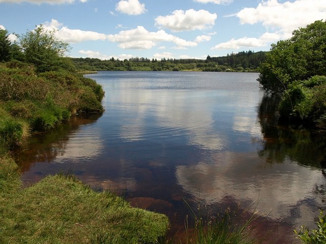
Fernworthy Reservoir
![]()
![]() This walk takes you around the lovely Fernworthy Reservoir and into Fernworthy Forest in Dartmoor. There's a nice waterside path to take you around the reservoir with the option of extending your walk into the adjacent Fernworthy Forest, where you will find miles of delightful woodland trails. It's a really pretty area with a variety of birdlife to look out for on the tranquil waters of the reservoir. You may also see some Dartmoor ponies cooling off in the summer! The area has good facilities with toilets, a catering van and parking on the south side of the reservoir.
This walk takes you around the lovely Fernworthy Reservoir and into Fernworthy Forest in Dartmoor. There's a nice waterside path to take you around the reservoir with the option of extending your walk into the adjacent Fernworthy Forest, where you will find miles of delightful woodland trails. It's a really pretty area with a variety of birdlife to look out for on the tranquil waters of the reservoir. You may also see some Dartmoor ponies cooling off in the summer! The area has good facilities with toilets, a catering van and parking on the south side of the reservoir.
This walk starts at the car park and takes you along the reservoir and into Fernworthy Forest. You'll also visit the Fernworthy Stone Circle where you will find a Bronze Age circle of 27 granite slabs standing in a clearing on a plateau of land. There are splendid views of Thornworthy Tor and the South Teign River at the eastern end of the reservoir.
If you'd like to continue your walk then you could pick up the Two Moors Way which runs through the area. You could follow it south to visit the fascinating Bronze Age settlement at Grimspound.
The reservoir is located near Chagford.
Postcode
TQ13 8EA - Please note: Postcode may be approximate for some rural locationsFernworthy Reservoir Ordnance Survey Map  - view and print off detailed OS map
Fernworthy Reservoir Open Street Map  - view and print off detailed map
Fernworthy Reservoir OS Map  - Mobile GPS OS Map with Location tracking
Fernworthy Reservoir Open Street Map  - Mobile GPS Map with Location tracking
Pubs/Cafes
Head a couple of miles south of the reservoir and you could visit the noteworthy Warren House Inn, one of the highest pubs in England. The 19th century inn is one of the most famous on Dartmoor, sitting in an isolated position some 1425ft (434m) above sea level. Originally built to serve the busy local tin mining community, the Inn was always a favourite haunt with miners from the neighbouring Tin Mines, including Golden Dagger, Vitifer and Birch Tor Mines. From the elevated position of the inn there are breathtaking views over the area. Indoors there's a cosy interior with oak beams and open fires. They do great food and are also dog friendly. The Warren House Inn lies at the very centre of Dartmoor between Moretonhampstead and Princetown on the B3212 with a postcode of PL20 6TA.
Dog Walking
The reservoir and the surrounding woods are ideal for dog walking. The Warren House Inn mentioned above is also dog friendly.
Further Information and Other Local Ideas
Just to the north you'll find the noteworthy Scorhill Stone Circle. The site is an English Heritage scheduled monument and has been described as Devon's finest, most intact stone circle. There's also the ancient Wallabrook Clapper Bridge to visit in this area.
For more walking ideas in the area see the Dartmoor Walks page.
Cycle Routes and Walking Routes Nearby
Photos
Fernworthy Reservoir. construction started in 1937 and was completed in 1942. It provides water to Torbay
Fernworthy stone circle. This fine Bronze Age Stone Circle consists of twenty-seven granite slabs and blocks that stand in a clearing on a plateau of land within Fernworthy Forest. You can find the historic site just to the west of the reservoir.
Warren House Inn. At this point in the day, the sun's angle picks out the painted stonework on the facade. The Two Moors Way can be followed south to reach the historic pub near Water Hill.


