Greenhithe Walks
![]()
![]() This Kent based village has some pleasant waterside walking and an historic abbey park to explore. Greenhithe is located on the River Thames Estuary between Dartford and Gravesend.
This Kent based village has some pleasant waterside walking and an historic abbey park to explore. Greenhithe is located on the River Thames Estuary between Dartford and Gravesend.
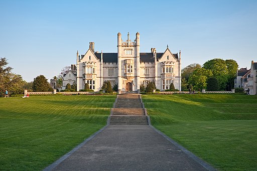
This circular walk in the village takes you to Ingress Abbey before heading to up to the riverside Ingress Park.
The walk starts in the Ingress Abbey heritage park, just south of the river. You can follow some pleasant footpaths around the ancient site which includes a photoegnic Neo-gothic Jacobean-style country house and a grotto known as the cave of the seven heads. The interesting piece is thought to have come from the medieval London Bridge. There's other old stone relics, wide grassy areas and woodland to explore here.
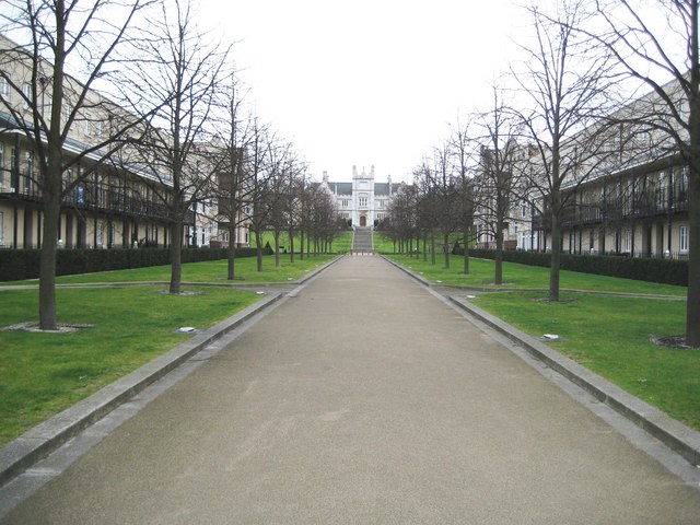
The walk then heads north along the boulevard to the river where there are pleasant surfaced footpaths with views towards London.
To continue your walking in the area head south to visit Beacon Wood Country Park. There's miles of peaceful woodland trails with countryside views to enjoy here.
Greenhithe Ordnance Survey Map  - view and print off detailed OS map
Greenhithe Open Street Map  - view and print off detailed map
Greenhithe OS Map  - Mobile GPS OS Map with Location tracking
Greenhithe Open Street Map  - Mobile GPS Map with Location tracking
Walks near Greenhithe
- Beacon Wood Country Park - This country park has a number of peaceful woodland walks to enjoy
- Darenth Country Park - This country park in Dartford has some nice cycling and walking trails to try
- Darent Valley Path - Travel through the Kent Downs AONB and along the Darent River on this beautiful walk.
You start off near Sevenoaks Railway Station and head north through the delightful tranquility of the Sevenoaks Wildlife Reserve - Greenwich to Gravesend - Starting in Greenwich on the banks of the river Thames follow National Cycle Route 1 to Gravesend via Dartford.
- Dartford Heath - This easy circular walk takes you around the pretty Dartford Heath in the London Borough of Dartford
- Gravesend - This town on the Thames has a very pretty riverside park, nice walking trails along the sea wall and a worthy nearby nature reserve to explore
Photos
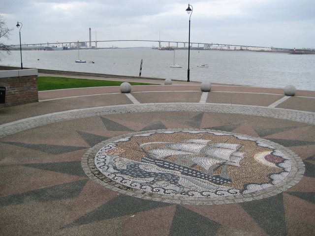
Greenhithe: Ingress Park & the River Thames. The mosaic is at the riverward end of Ingress Park and shows HMS Worcester which was the ship used by the Thames Nautical Training College whose shore base was at Ingress Park. In the distance upstream is the QEII bridge and you may just be able to make out the guylines fanning out from the two main bridge supports. In the very far distance to the left is the chimney of Littlebrook power station.


