Hagley Hall Park Walk
![]()
![]() Explore the area around Hagley and Park on this walk around the historic Worcestershire village of Hagley.
Explore the area around Hagley and Park on this walk around the historic Worcestershire village of Hagley.
The walk uses the North Worcestershire Path and other public footpaths to take you through the woodland and countryside surrounding the park. There is also an iron-age hill-fort on Wychbury Hill and fabulous views of the Malvern Hills, the Clee Hills, Abberley Hills, The Wrekin and, on a clear day as far as The Black Mountains of Wales.
The park is located about 12 miles from Birmingham city centre. Clent Hills Country Park is adjacent to Hagley Hall so is a great option if you would like to continue your walk. The North Worcestershire Path also runs past the park.
Please note the park itself is not open to the public though the hall is open for tours on certain days. Please see the link below for details. You can extend the walk with a stroll around Hagley village where there is a noteworthy 13th century church.
Please click here for more information
Hagley Park Ordnance Survey Map  - view and print off detailed OS map
Hagley Park Open Street Map  - view and print off detailed map
Hagley Park OS Map  - Mobile GPS OS Map with Location tracking
Hagley Park Open Street Map  - Mobile GPS Map with Location tracking
Further Information and Other Local Ideas
Uffmoor Wood is located just a couple of miles east of the hall. There's some nice peaceful woodland trails to follow here.
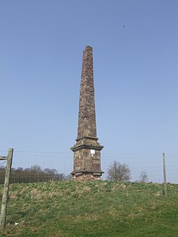
To the north there's the climb to Wychbury Hill. Here you'll find an Iron Age hillfort and the Wychbury Obelisk. The Grade II listed structure stands at a height of 84 feet (26 m). It was commissioned as a family memorial and completed in 1758 at the same time as Hagley Park was being redeveloped in the fashionable neoclassical style.
If you head north into Stourbridge you can pick up the Stourbridge Canal and enjoy a waterside stroll along to Hinksford.
For more walking ideas in the area see the Worcestershire Walks page.
Cycle Routes and Walking Routes Nearby
Photos
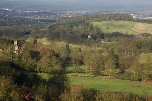
Hagley Park, the grounds of Hagley Hall viewed from near the Four Stones folly on the Clent Hills. Hagley Castle in the left foreground is a folly as is the Whichbury Obelisk (right middle distance).
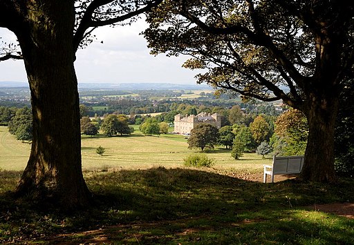
The back facade (facing north-east) of Hagley Hall, Worcestershire. Hagley Hall and Park was largely the creation of one man, George, 1st Lord Lyttelton (1709-73), secretary to Frederick, Prince of Wales. The final designs were drawn up by the gentleman-architect Sanderson Miller of Radway in Warwickshire and the Hall was built between 1754 and 1760. The view is of the back of the hall taken from near the Parish Church.
Hagley Castle in the grounds of the hall, on the flanks of the Clent Hills, built by Sanderson Miller for George, Lord Lyttleton in the middle of the 18th century. One of many such mock castles designed and built by Sanderson Miller.
St John the Baptist Church in Hagley village. The church's origins go back to medieval times or even further, since there has been a church on this site since late Saxon times. The de Hagley family was responsible for enlarging and rebuilding the church in the 14th century. Evidence of this period is to be seen in three arches of the south aisle, built in the Decorated style, c.1300. A wooden board near the present entrance door lists the Rectors of the parish from 1285. The north aisle was enlarged in the early 19th century, and the church was further enlarged and virtually rebuilt in 1856, when its interior assumed its present day shape. The imposing tower was added in 1865 and a peal of 8 bells was hung.


