Worcestershire Walks

Use the filter to show walks of a certain type such as woods, reservoirs, hills, long distance, country parks, canals and rivers.
In the spring walkers flock to the beautiful bluebell woods in the Worcestershire area. Click the 'Woodland' button below to see these.
Use the links to view full route information including elevation profiles, interactive maps and GPS downloads.
You can also view an overview map of all the routes in the using the Worcestershire Walk Map>>
*New* - Walks and Cycle Routes Near Me Map - Waymarked Routes and Mountain Bike Trails>>
| Filter: |
| Route Name | Photo | Distance | Description |
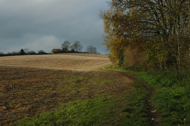
| Abberley Circular Walk | 4.1 miles (6.6 km) | This waymarked circular walk takes you through the countryside surrounding the pretty Worcestershire village of Abberley. The varied route runs for about 4 miles and includes woodland trails and a climb to Abberley Hill where you can enjoy splendid views of the surrounding countryside. The walk starts from the village green and then follows path through the village. You continue north east to Netherton House where you pick up the Worcestershire Way. This leads you south east to Shavers End where you climb through woodland toward Abberley Hill. Standing at a height of 283 metres (928 ft) the hills commands fine views over the Abberley and Malvern Hills Geopark. After taking in the views the route descends back down to the village where you can enjoy refreshments at one of the nice pubs or cafes. View Full Details>> | |
| Ankerdine Hill | 0.6 miles (1 km) | Climb to this hill in Knightwick on this walk in the Malvern Hills. There's a nice waterside stretch along the River Teme, woodland trails and great views from the high points. The circular walk starts in the village of Knightwick and heads to Horsham Farm along the River Teme. You then climb through Hay Wood to Ankerdine Hill which reaches a height of well over 400ft. On the hill there's some nice woodland trails and great views over the Worcestershire countryside. View Full Details>> | |
| Arley Arboretum | 0.6 miles (1 km) | These delightful gardens near Kidderminster are perfect for a peaceful afternoon stroll. There's well laid out footpaths taking you around the compact site. Highlights include the towering Crimean Pines, a Magnolia Garden and an Italian Garden with water features and a pretty fountain. There's also lovely tree lined paths and nice views of the River Severn and the Severn Valley Railway steam trains. View Full Details>> | |
| Arrow Valley Country Park | 3.7 miles (6 km) | Enjoy waterside cycling and walking in this splendid country park in Redditch. The park includes the large Arrow Valley Lake and the River Arrow with walking and cycling trails running alongside both. View Full Details>> | |
| Barnt Green Circular Walk | 4 miles (6.4 km) | This 4 mile circular walk takes you around the village of Barnt Green in Worcestershire. You'll visit the popular Lickey Hills Country Park and the prety Bittell Reservoirs, with lovely countryside views to enjoy on the way. The walk starts in the centre of Barnt Green, close to the train station. From here you pick up footpaths heading north west into Lickey Hills. There's miles of woodland trails, hill climbs and wildlife to see in the park. Keep your eyes peeled for deer, badgers and a variety of birdlife. Near the visitor centre you follow a footpath east past Cofton Hackett to the reservoirs which are a great place for birdwatching. Follow the trails south along the water before turning south west to return to Barnt Green. View Full Details>> | |
| Bewdley | 2 miles (3.2 km) | The Worcestershire town of Bewdley is in a great location for exploring the popular Wyre Forest where there are miles of fine woodland trails to try. There's also lovely riverside paths along the River Severn and the nearby Ribbesford Woods. This walk uses a section of the Severn Way to take you to the Blackstone Riverside Park, just to the south of the town. View Full Details>> | |
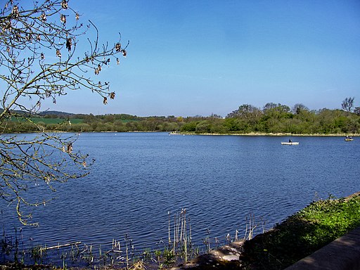
| Bittell Reservoirs | 3.7 miles (6 km) | This walk visits the Upper and Lower Bittell Reservoirs in Barnt Green, near Birmingham. There's much to enjoy with countryside views and lots of birdlife to look out for on the water. The walk starts from Barnt Green train station and follows footpaths through the countryside to Lower Bittell Reservoir. Tracks take you along the western side of the water to the Upper reservoir, with views of the River Arrow as you go. You can then pick up a section of the North Worcestershire Path along the northern end. View Full Details>> | |
| Bredon Hill | 4.7 miles (7.5 km) | Climb to the 299 m (981 ft) summit of this hill in the Cotswolds and enjoy fine views over the surrounding countryside. The walk starts from the Worcestershire village of Overbury and climbs to Bredon Hill on good footpaths, passing woodland and streams on the way. At the summit you will find the Iron Age Hill Fort of Kemerton Camp and a small stone tower known as Parsons Folly or Banbury Stone Tower. There's also Roman earthworks and several ancient standing stones. The hill is also a nature reserve so there is a wide variety of flora and fauna to look out for. This includes wild thyme, common rock rose, pyramidal orchid and dwarf thistle. These attract butterflies such as marbled white, brown argus and dingy skipper. Bredon hill is mentioned in a poem of A. E. Housman's anthology A Shropshire Lad: 'In summertime on Bredon, The bells they sound so clear, Round both the shires they ring them, In steeples far and near, A happy noise to hear.' The whole of this circular walk is more suited for walkers as it uses some public footpaths but much of it uses bridleways which cyclists can also use. The Wychavon Way long distance footpath passes close to the hill so you could pick this up to extend your walking. View Full Details>> | |
| Bringsty Common | 1.9 miles (3 km) | This large area of common land near Bromyard is a great place for walkers. The area covers over 200 acres with lots of footpaths to follow to the common's lakes, streams and pockets of woodland. Look out for pretty bluebells in the spring and a variety of birdlife on your walk. There's also splendid views towards the Malvern Hills and the surrounding Worcestershire and Herefordshire countryside. You can enjoy refreshments in the common-side cafe or pub after your exercise. It's easy to extend your walk by heading to the Brockhampton Estate which is right next to the common. The 1,700 acre estate has lots of good walking trails, a lake, streams and woodland to explore. The Worcestershire Way runs through Knightwick, just to the east of the common. The path will take you south to Ravenshill Wood and the Suckley Hills. Head north and you can visit Woodbury Hill, the River Teme valley and Abberley. View Full Details>> | |
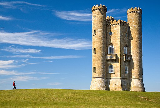
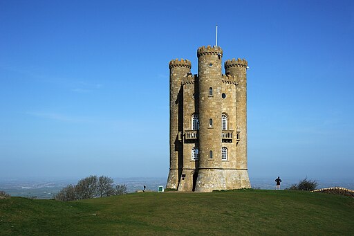
| Broadway Tower Country Park | 4.7 miles (7.5 km) | Enjoy fabulous views of the Cotswolds AONB in this beautiful park in Broadway, Worcestershire. This 5 mile circular walk takes you up to the focal point of the park at the 65ft high Broadway Tower. The tower was the brainchild of Capability Brown and designed by James Wyatt in 1794 in the form of a Saxon castle. It is the second highest point in the Cotswolds so there are wonderful views as far as the Welsh Mountains in one direction and Buckinghamshire in the other. From the top of the tower, on a clear day, as many as 16 English counties can be identified. The park is also home to a herd of Red Deer and includes several peaceful woodland trails. The circular trail starts from the Fish Hill car park, just to the north east of the tower, at a postcode of WR12 7LD for your sat navs. From here you can pick up the Cotswolds Way National Trail to take you south up to the tower before exploring the woodland and country trail around the wider park. The Cotswold Way provides and opportunity for continuing your walking in the area. The nearby Chipping Campden is a good option or you could visit the delightful Snowshill village and manor house on the Broadway to Snowshill Circular Walk. Our 10 mile Cotswold Way Circular Walk from Chipping Campden uses a lovely section of the national trail to visit the tower and nearby Dover's Hill. View Full Details>> | |
| Bromsgrove | 9 miles (14.5 km) | This circular walk around Bromsgrove makes use of waymarked trails to visit the canal and countryside surrounding the town. You'll follow a section of the long distance Monarch's Way to visit the popular Tardebigge Locks on the Worcester and Birmingham Canal. The route starts on the western side of the town where you can pick up the waymarked Monarch's Way footpath. Follow it south and then east through Charford to Aston Fields and then out into the countryside. The trail follows a country lane east to Cherry Trees Farm where you can pick up the canal. Follow the towpath west and you will pass Tardebigge Reservoir before coming to the impressive Tardebigge Locks flight. Here you will find the largest flight of locks in Britan, comprising 30 narrow locks on a 2.25 mile (3.6 km) stretch along the canal. At nearby Stoke Pound there is a nice canalside pub where you can sit out and enjoy refreshments. The route continues west past Stoke Pound Bridge to Stoke Wharf where you leave the towpath. Head north towards Stoke Heath, crossing the River Salwarpe before returning to Charford and the town centre. View Full Details>> | |
| Chaddesley Wood | 2.5 miles (4 km) | This circular walk takes you to the Chaddesley Wood nature reserve from the village of Chaddesley Corbett in the Wyre Forest District of Worcestershire. The attractive coniferous woodland is covered in pretty bluebells in the spring. There's also streams, ponds and a variety of wildflowers in the summer. Look out for wildlife including woodcock, chiffchaff, crossbill and blackcap. You can park in the village of Chaddesley Corbett to start your walk. Then follow footpaths east through the countryside to the woods. It's about a one mile walk from the village. You can continue your walk in the adjacent Nutnells Wood at Woodcote Green along the waymarked Royal Hunters Forest Walks. The Monarch's Way long distance footpath runs right through Chaddesley Corbett so you could pick this up to continue your walk. If you follow it west you will pass the moated medieval and Elizabethan manor house of Harvington Hall. If you head a few miles north you can visit a number of excellent country parks with good walking trails. These include Lickey Hills Country Park, Clent Hills Country Park and Waseley Hills Country Park. They all have climbs to viewpoints with great views over the surrounding countryside and hills. View Full Details>> | |
| Chipping Campden to Broadway Tower Cotswold Way Walk | 10.3 miles (16.5 km) | This splendid circular walk uses the Cotswold Way and the Donnington Way to explore the countryside and landmarks surrounding the Cotswold villages of Chipping Campden and Broadway. It's a great one to try if you are staying in either of these villages as it uses well maintained waymarked footpaths to take you to such highlights as Broadway Tower Country Park and Dover's Hill. The route runs for just over 10 miles taking you through some beautiful Gloucestershire and Worcestershire countryside. View Full Details>> | |
| Clent Hills Country Park | 2.8 miles (4.5 km) | This country park in Clent has miles of footpaths and bridleways with breathtaking panoramic views over the Cotswolds, Shropshire Hills and Welsh borders. The park is run by the National Trust who have devised several excellent walking trails through the park. There are also cycling trails that are best suited to mountain bikers. The park is located 10 miles south-west of Birmingham city centre, not far from Stourbridge. The North Worcestershire Path walking route runs through the park if you would like to continue your walk. Hagley Park and hall are also adjacent to the park - here you will find some great footpaths through landscaped parkland. Just a mile to the east you'll find Uffmoor Wood where there are waymarked walking trails in shady bluebell woods. View Full Details>> | |
| Cotswold Round | 216.9 miles (349 km) | Travel through some of the most beautiful countryside and prettiest villages in England on this circular walk. You will visit a series of classic Cotswolds towns and villages including Cheltenham Spa, Winchcombe, Stanton, Broadway, Chipping Campden, Moreton-in-Marsh, Stow on the Wold and Bourton on the Water (video below). There is much to enjoy with lush green countryside, historic houses, beautiful parks, woodland sections and homely country pubs for refreshments. View Full Details>> | |
| Croome Court | 3.1 miles (5 km) | Explore the extensive landscaped parkland surrounding this mid 18th century Neo-Palladian mansion near Pershore. View Full Details>> | |
| Donnington Way - Cotswolds Pub Walk | 61.5 miles (99 km) | Visit the 15 pubs of the Donnington Brewery on this super pub walk through the Cotswolds. The walk starts in Stow on the Wold and heads to a series of delightful Cotswold villages including the famous picture postcard settlement of Bourton on the Water. View Full Details>> | |
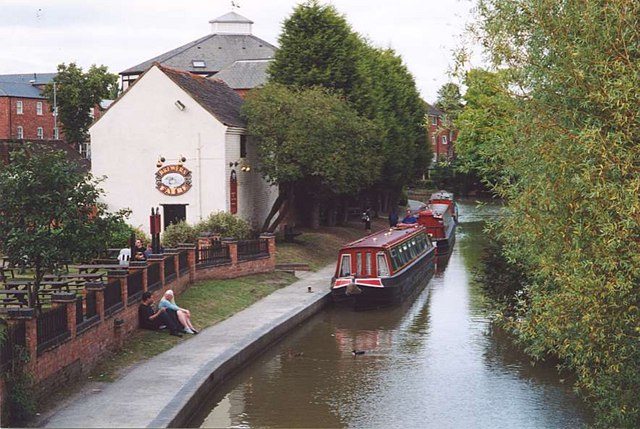
| Droitwich Canal | 7 miles (11.2 km) | Enjoy an easy stroll along the Droitwich Barge Canal and the Droitwich Junction Canal, on this waterside walk in Worcestershire. There's much to enjoy with views of the River Salwarpe, pretty villages and the attractive countryside of the Wychavon district of Worcestershire. The walk starts where the canal meets the Worcester and Birmingham Canal just to the east of Droitwich (you could also start in Droitwich, if you prefer and miss out the first mile). The canal then heads west passing Hanbury Wharf and heading through the town. Just to the south there's the option of taking a small detour and visiting the Droitwich Spa Lido Park, one of the few remaining inland, open-air salt-water swimming pools in the UK. At Westacre the canal turns south west, heading to the village of Salwarpe by the river of the same name. The final section runs to Hawford where the canal joins with the River Severn. Here you have the option of extending your walk by picking up the Severn Way and following it south into Worcester. View Full Details>> | |
| Evesham Country Park | 1.7 miles (2.8 km) | Enjoy an easy circular walk around this pretty country park located just to the north of Evesham. There's nice footpaths taking you to wide lawns, orchards, a lake and along the River Avon which runs through the eastern side of the park. You can also enjoy fine views of the surrounding countryside of Evesham Vale. The park is attached to the Valley Shopping area where you'll find a garden centre with a farm shop, clothing stores and eateries, plus a miniature railway. View Full Details>> | |
| Geopark Way | 111.2 miles (179 km) | Meandering its way for 109 miles through the Abberley and Malvern Hills Geopark from Bridgnorth to Gloucester, the Geopark Way passes through stunning countryside as it explores 700 million years of geological history. The trail offers varied walking alongside rivers, through forests, along ridges and across valley floors; all with majestic views to match. Passing through an assortment of habitats there is a plethora of wildlife adding to the occasion. Quaint villages and towns dot the route bringing further elements of exploration and enchantment. Highlights on the route includes a stretch through the lovely Eastnor Deer Park next to the 19th century mock castle. The climb through the Malvern Hills is also wonderful with splendid views over the countryside of Herefordshire, Worcestershire and Gloucestershire. View Full Details>> | |
| Hagley Park | 2.2 miles (3.5 km) | Explore the area around Hagley and Park on this walk around the historic Worcestershire village of Hagley. View Full Details>> | |
| Hanbury Circular Walk | 6.5 miles (10.5 km) | This circular walk in Droitwich visits the Worcester and Birmingham Canal and Hanbury Hall Park. There's much to enjoy with lovely countryside views, some moderate hill climbs, canalside paths, woodland, parkland and gardens. The walk starts at the car park near Hanbury Wharf, just to the east of Droitwich Spa. From here you pick up the Droitwich Canal and follow it east to where it meets with the Worcester and Birmingham Canal. You then follow this north to Astwood Lane Bridge where you turn east to follow footpaths through the countryside to Piper's Hill. You then turn south to Hanbury Hill Church where you'll find the St Mary the Virgin church which dates from 1200. The grounds includes a viewpoint with a toposcope displaying all the sites you can see from the elevated position. This includes the Cotswolds, the Forest of Dean and the Malvern Hills. After taking in the views the route descends to Hanbury Hall. The 18th century hall is surrounded by beautiful gardens and parkland. There's also an orangery and a walled orchard containing a wide range of traditional English fruit varieties. The park is run by the National Trust so for a fee you can gain access to more walks around the hall. The final section of the walk runs from the hall to Lady Wood and Summer Hill before returning to the car park. View Full Details>> | |
| Hanbury Hall Park | 3.7 miles (6 km) | A walk around the delightful Hanbury Hall Park in Droitwich Spa, Worcestershire. The 18th century hall is surrounded by beautiful gardens and parkland. There's also an orangery and a walled orchard containing a wide range of traditional English fruit varieties. The park is run by the National Trust so for a fee you can gain access to more walks around the hall. This route takes you through the delightful gardens and then into the countryside park where you will cross the Worcester and Birmingham Canal. View Full Details>> | |
| Hartlebury Common | 1.9 miles (3 km) | Hartlebury Common and Hillditch Coppice cover 229 acres of lowland heath in Stourport-on-Severn. The area is criss crossed with a number of lovely waymarked walking paths where you can see many varieties of wild plants and insects, especially butterflies and moths. There are a number of habitats to enjoy including woodlands, heather covered hills, an acid bog, a pool and brook. Hartlebury Castle is located right next to the common so you could easily visit this interesting Grade I listed building on your walk. It was originally built in the mid-13th century as a fortified manor house. It now houses the Worcestershire County Museum where you can find out about the history of the area. Inside there are period room displays including a schoolroom, a nursery and a scullery, while outside in the grounds there is a cider mill and transport display with a fire engine, hansom cab, bicycles, carts and Gypsy caravans. View Full Details>> | |
| Illey Way | 3.7 miles (6 km) | The Illey Way runs along an old railway line from Waseley Hills Country Park to Woodgate near Halesowen. The well defined trail runs through some nice countryside and woodland passing Illey Pastures and Illey. You can start the walk from the Waseley Hills car park. It's a lovely park with 150 acres of rolling hills, pastures and woodland with panoramic views over Worcestershire from Windmill Hill. The trail then heads north through the countryside, passing the village of Illey before finishing at Woodgate near the pretty Woodgate Valley Country Park. Here you will find 450 acres of rich meadows, woodland and small ponds with the Bourn brook running through the heart of the park. View Full Details>> | |
| Inkberrow | 7.1 miles (11.5 km) | This pretty Worcestershire village includes a picturesque village green, a historic church and a fine local pub. The settlement is notable as the model for Ambridge, the setting of BBC Radio 4's long-running series The Archers. View Full Details>> | |
| John Corbett Way | 6.8 miles (11 km) | This walk runs from Stoke Prior to Droitwich Spa along the John Corbett Way. View Full Details>> | |
| Kidderminster | 15.2 miles (24.4 km) | This Worcestershire based town has some nice trails along the canals and rivers which run through the area. It's also near to the woodland of the Wyre Forest and the popular walking trails at Kinver Edge. This circular walk from the town takes you along a section of the Staffordshire and Worcestershire Canal to the nearby village of Kinver. Here you enjoy a climb to Kinver Edge before a visit to the adjacent Kingsford Country Park. It's a nice varied route with easy waterside sections, peaceful woodland trails and a climb to a splendid viewpoint. View Full Details>> | |
| Kingsford Country Park | 4.3 miles (7 km) | Explore 200 acres of woodland and heathland in this Worcestershire based forest park. Terrain in the park consists of hills and cliffs, with sandy paths crossing the area. The park has 4 waymarked trails of varying lenghts to explore. The route below also visits the National Trust owned Kinver Edge. This woodland sandstone ridge offers dramatic views across surrounding counties and miles of heathland walking. Kingsford park is located about four miles west of Stourbridge, and four miles north of Kidderminster. There are three great options for continuing your walk through this lovely part of England. The Staffordshire Way, the North Worcestershire Path, and the Worcestershire Way all run past the park. View Full Details>> | |
| Kinver Edge | 2.5 miles (4 km) | This National Trust owned woodland escarpment has miles of good walking trails to try. It's excellent walking country with lovely heathland, woodland trails and magnificent views over the surrounding Staffordshire and Worcestershire countryside. The sandstone ridge also includes an Iron Age Hill Fort and fascinating red sandstone formations. You can stop and admire the views from a number of seats dotted along the ridge top path. This circular walk around the site starts from the parking area off Compton Road next to the Holy Austin Rock. You then follow a nice way marked trail along Kinver Edge to Nanny's Rock. You can actually explore this fascinating sandstone rock house with its five empty rooms and the 'devil's' chimney. Just after Nanny's Rock the path heads north east through some pretty bluebell woods before returning to Holy Austin Rock House. This rock house has been restored by the National Trust so you can see how it would have looked when people lived in them. The houses are carved right into the rock and were inhabited right up until the 1960s. The area is great for wildlife watching with highlights including green hairstreak butterflies, willow warbler and cuckoo. It's also great for flora with yellow gorse and lovely purple heather in the late summer months. The long distance Staffordshire Way, Worcestershire Way and North Worcestershire Path all pass the site. You can easily pick up any of these trails to extend your walking in the area. Heading south will take you through Kingsford Country Park to Drakelow where there is a small multivallate Iron Age hillfort. Continuing along the Worcestershire Way will take you to Shatterford Lakes Wildlife Sanctuary, Eymore Wood and Trimpley Reservoir. Heading north from the edge along the Staffordshire Way will take you to Enville. Cookley village on the River Stour can be also be easily reached by descending along the North Worcestershire Path. These are all nice places to visit if you feel like stretching your legs further. For cyclists National Cycle Network Route 54 passes through Cookley just to the east of the site. If you are coming from Kidderminster you could follow the route north to Cookley and then follow country lanes east to each Kinver Edge. View Full Details>> | |
| Lickey Hills Country Park | 3.4 miles (5.5 km) | Explore 524 acres of country park at Lickey Hills near Birmingham. There are a number of woodland trails to follow and a climb up Beacon Hill with fabulous views of the surrounding countryside. Also look out for deer, badgers and a variety of birdlife as you go. The park has an excellent visitor centre with an exhibition, leaflets and information on nature trails and guided walks. The park is very popular, particularly in springtime when the woodland is covered in an impressive display of bluebells. If you would like to continue your walk you could follow the North Worcestershire Path towards the nearby Waseley Hills Country Park or the Bittell Reservoirs in the other direction. The Barnt Green Circular Walk visits the park and the reservoirs and can be started from the visitor centre. At the Lower Bittell reservoir you can also pick up the Worcester and Birmingham Canal and enjoy a waterside walk to the splendid Tardebigge Locks. If you were to head a few miles to the south west you could visit the lovely Chaddesley Wood National Nature Reserve. The reserve has some nice woodland trails with a wide variety of flora and fauna to look out for. Lickey Hills is located on the south west tip of Birmingham near to Bromsgrove. View Full Details>> | |
| Malvern Common | 2.5 miles (4 km) | This route takes you across the Peachfield and Malvern Commons in the Malvern Hills AONB. The commons are located just to the south of Great Malvern and include a number of easy footpaths to try. There's also great views of the hills which are just to the west of the site. You can start the walk from the car park on Peachfield Common just off Peachfield Road. The site also includes interesting flora with species-rich grassland supported by a number of pretty wildflowers. Look out for lady’s bedstraw, common knapweed, bird’s-foot-trefoil and various orchids. In the summer months you can see lots of pretty butterflies fluttering around the flowers. Just a short distance to the west you will find Worcestershire Beacon. You could extend the walk to climb to this popular summit. From the 425 metres (1,394 ft) peak you can see 13 counties of England on a clear day. For a longer walk you can try the Malvern Hills Walk which runs along the whole length of the AONB. View Full Details>> | |
| Malvern Hills | 8.1 miles (13 km) | This walk takes you the full length of the Malvern Hills from End Hill in North Malvern to Chase End Hill at the southern end. The Hills divide the counties of Herefordshire and Worcestershire and are covered with numerous footpaths and bridleways. The start point for the walk is the car park at North Malvern in the 19th century spa town of Great Malvern. You then pass End Hill, Table Hill and Sugarloaf Hill on your way to Worcestershire Beacon. At 425 m (1,394 ft) the Beacon is the highest point in the Malverns and offers fabulous views of Worcestershire, Herefordshire, Gloucestershire, the Cotswolds, the Welsh Mountains and the Severn Valley. You can climb to the beacon from Great Malvern on our circular walk. The route continues to Jubilee Hill, Black Hill and Herefordshire Beacon where you will find the noteworthy British Camp Iron Age hill fort and reservoir of the same name. Next you come to Hangman's Hill, and Swinyard Hill before arriving at the interesting Midsummer Hill where you will find an Iron Age hill fort which spans Midsummer Hill and Hollybush Hill. There are also splendid views of Eastnor Deer Park and the castle grounds. The final section takes you over Raggedstone Hill to the finish point at the end of the range, known as End Hill. It's a delightful walk on good footpaths with fabulous views throughout. Also look out for the springs and fountains dotted along the hills. If you would like to try a longer walk try our Malvern Hills Circular Walk which takes you along a section of the old Worcestershire Way long distance trail. View Full Details>> | |
| Malvern Hills Circular Walk | 13 miles (21 km) | This long route makes use of the Three Choirs Way and the old route of the Worcestershire Way to create a circular walk through the Malvern Hills Area of Outstanding Natural Beauty. There's fabulous views over the counties of Herefordshire, Gloucestershire and Worcestershire throughout. The walk starts North Malvern at the main parking area next to the hills. You then follows footpaths up to Table Hill and Sugarloaf Hill before coming to the high point at the range at Worcestershire Beacon. You continue south past Summer Hill, Black Hill and Jubilee Hill before coming to Herefordshire Beacon and British Camp where there's a fascinating Iron Age Hillfort. View Full Details>> | |
| Martley Circular Walk | 6.2 miles (10 km) | This lovely waymarked walk explores the Teme Valley around the Worcestershire village of Martley. There's beautiful countryside, traditional orchards, riverside paths and woodland trails to enjoy on the way. The route runs for about 6 miles on fairly flat paths with some small climbs. Start the walk in the centre of the village and follow the footpaths north past the The Chantry School towards the orchards around Alden's Farm and Prickley Green Farm. The path then turns west towards Rodge Hill Farm where you pick up a section of the Worcestershire Way long distance trail. You then climb south to Rodge Hill and Pudford Hill where there are splendid views over the surrounding countryside. From this high point of the walk you descend to Hambridge Farm where you pick up a riverside path along the River Teme, passing the woodland on Kingswood Common before turning east to return to the village. Back in Martley you can enjoy refreshments at the local pub and pay a visit to the interesting Norman Church of St Peter. The church includes a complete set of 17th century bells and some medieval wall paintings inside. View Full Details>> | |
| Midland Link | 19.9 miles (32 km) | Enjoy lakes, canals, woodlands and historic villages on this waymarked walk through the Worcestershire and Warwickshire countryside. The walk begins at the Forehill picnic site, just outside Birmingham, and heads to Tanworth-in-Arden on country lanes and footpaths. This section of the walk passes the three man-made reservoirs at Earlswood Lakes and the interesting Transport Museum at Wythall with its extensive collection of buses, battery electric vehicles and a miniature steam railway. From Tanworth-in-Arden you continue east towards the village of Lapworth, passing the 17th century Umberslade Hall and Park on the way. The mansion is a a Grade II* listed building and is surrounded by parkland and lakes. At Lapworth you join the Stratford Upon Avon Canal for a short waterside stretch which takes you to Kingswood Junction where the Stratford-upon-Avon Canal meets the Grand Union Canal. A short stroll from Kingswood takes you onto another major highlight on the walk, as you reach the moated manor house of Baddesley Clinton. This medieval manor house dates from the 15th century and includes a pretty garden, lakeside walks and woodland trails in the adjacent Hay Wood. The final section of the walk then takes you to Kenilworth, passing through the peaceful Hay Wood and the village of Wroxhall on the way. View Full Details>> | |
| Monarch's Way | 615.2 miles (990 km) | This incredible 615-mile walk approximates the escape route taken by King Charles II in 1651 after being defeated in the Battle of Worcester. The Monarch's Way starts at Worcester then travels north to Boscobel and then south to Stratford upon Avon. It then continues south through the Cotswolds to Stow on the Wold before turning south west towards Bristol via Cirencester. The route then heads south through the Mendip Hills to Wells and then on through Somerset towards Yeovil and then south west to Charmouth. You then follow the Dorset coast before turning north again to Yeovil, before heading east across the Downs to Brighton and then onto the finish point at Shoreham-by-Sea. The walk also takes you through two World Heritage Sites, one National Park and six Areas of Outstanding Natural Beauty. For those interested in the history of the walk there is ample opportunity to learn and discover more with a series of museums and historical sites dotted throughout the route. The walk is waymarked with a picture of the ship The Surprise, the Prince of Wales crown and the Royal Oak tree at Boscobel House. The route has been split into two separate gpx files. The first includes the section from Worcester to Bridport via the Midlands and Somerset. View Full Details>> | |
| North Worcestershire Path | 31.1 miles (50 km) | This walk runs from Bewdley to Shirley, West Midlands through four beautiful country parks. You start in Bewdley on the River Severn and follow the river to Upper Arley, passing Trimpley Reservoir and the delightful Arley Arboretumon the way. The next section takes you through Eymore Wood and then onto Drakelow before entering Kingsford Country Park. Here you will find the magnificent Kinver Edge and 200 acres of woodland and heathland. You continue east to Cookley, where you will cross the River Stour, and then onto Hagley and the 18th century Hagley Park and gardens. From Hagley you soon come to the next walk highlight at Clent Hills Country Park. This section offers marvellous views of the surrounding countryside. You then continue through Dales Wood to Waseley Hills Country Park and Lickey Hills Country Park with more panoramic views of Worcestershire to enjoy. View Full Details>> | |
| Old Hills and Stanbrook Abbey | 3.7 miles (6 km) | This circular walk climbs to the viewpoint at Old Hills before visiting Stanbrook Abbey where you'll find a family fun trail. View Full Details>> | |
| Pershore | 6 miles (9.7 km) | This circular walk from the market town of Pershore visits some of the highlights of the area. You'll visit Pershore Abbey before enjoying a riverside path along the River Avon. The trail then explores the peaceful woodland trails in Tiddesley Wood before returning to the abbey. View Full Details>> | |
| Redditch | 3.7 miles (6 km) | This lovely figure of eight walk takes you along the Miller's Trail to Arrow Valley Country Park in the Worcestershire town of Redditch. The walk starts from Bordesley Abbey and the Forge Mill Needle Museum in Riverside, just north of the town centre. The abbey ruins date from the 12th century and are accessible to the public. The site includes a visitor centre set in an original reconstructed 16th Century barn, displaying many of the finds that have been excavated over the years. The abbey neighbours the Forge Mill Needle Museum which depicts Redditch's Industrial Heritage. Models and recreated scenes provide a vivid illustration of how the needles were once made. There's also exhibitions, demonstrations, and workshops on how the needles were used in the textile industry. From the visitor centre you can pick up the Miller's Trail footpath and follow it north east to the River Arrow. A nice riverside footpath leads you east and then south to Arrow Valley Country Park. Here you'll find a lovely large lake set in 900 acres of parkland with four waymarked trails to try. This route takes you right around the lake before picking up the river path to return to the abbey. View Full Details>> | |
| River Teme | 11.2 miles (18 km) | A walk through the River Teme valley from Worcester to Knightwick. The walk starts on Worcester Bridge in the centre of Worcester and heads south along the Severn Way to Lower Wick where the River Teme meets the River Severn. You then head west along the river to Upper Wick, Bransford, Leigh and Broadwas before finishing at the village of Knightwick in the Malvern Hills. The route is fairly flat with a few moderate climbs along the way. There's lovely views of the surrounding Worcestershire countryside and the river. At Knightwick you can enjoy a climb to Ankerdine Hill and Hay Wood. You can also pick up the Worcestershire Way and head further into the Malvern Hills. View Full Details>> | |
| Royal Hunters Walk | 11.8 miles (19 km) | This circular walk explores the countryside and woodlands to the west of Bromsgrove in the West Midlands. View Full Details>> | |
| Sabrina Way | 203.2 miles (327 km) | This route is part of the National Bridleroute Network and primarily designed for horse riders but can be used by walkers and cyclists also. The trail starts at the deer park at Great Barrington and heads north to Hartington. The route passes through the Cotswolds, the Malvern Hills, the Wyre Forest and Cannock Chase Forest, before finishing in the Derbyshire Peak District. View Full Details>> | |
| Severn Way | 223.7 miles (360 km) | Follow the River Severn from its source at Plynlimon in Powys, to Bristol, the mouth of the river. You start the walk at Plynlimon in upland Mid Wales, before descending into Llanidloes, Newtown, Powys, and Welshpool. The route then follows the towpath of the Montgomery Canal passing The Wrekin and continuing on through Shrewsbury, the Severn Gorge, and the historic town of Ironbridge. You then cross into Worcestershire passing Bewdley, Stourport-on-Severn, Worcester and Upton-upon-Severn in the Malvern Hills. The next section passes through Gloucestershire and includes a section along the Gloucester and Sharpness Canal which takes you past the fascinating abandoned ships at Purton Hulks. You'll also visit Tewkesbury, Gloucester, the 12th century Berkeley Castle before heading to the Severn Estuary and the mouth of the Severn near Oldbury on Severn. View Full Details>> | |
| Shakespeare's Avon Way | 92 miles (148 km) | This terrific waterside walk follows the River Avon from its source near Naseby to its confluence with the Severn at Tewkesbury.
Starting at Naseby in Northamptonshire the walk heads to Welford,Rugby, Leamington Spa, Warwick, Stratford Upon Avon and Evesham before finishing at Tewkesbury. There are frequent waterside sections alongside the River Avon and also a section along the Grand Union Canal at Warwick. View Full Details>> | |
| Shrawley Woods | 2.5 miles (4 km) | Enjoy a circular walk around this attractive area of woodland near Worcester. There are miles of good woodland trails, a riverside path along the River Severn and several large ponds to enjoy. The woods are very popular with walkers during the springtime as you will find carpets of pretty bluebells. The area near the village hall is known as the grove and has a stream running through a lovely wooded valley, with lots of pretty flowers and vegetation. View Full Details>> | |
| Staffordshire and Worcestershire Canal | 46 miles (74 km) | Follow the Staffordshire and Worcestershire Canal from Stourport-on-Severn to Great Haywood on this easy waterside walking and cycling route. The walk starts at Stourport-on-Severn by the Staffordshire and Worcestershire Canal Basin near to the River Severn. You then head north to Kidderminster with views of the River Stour as you go. You continue to Kinver where you could deviate from the path to visit the splendid Kingsford Country Park and Kinver Edge. The large area of woodland and heathland has miles of walking trails with wonderful views across the region. The next section takes you through Wolverhampton, passing the National Trust owned Wightwick Manor Gardens and the wildlife rich Smestow Valley Nature Reserve. You continue to Stafford before the final stretch to Great Haywood Junction, passing the beautiful Shugborough Park on the way. The 900 acre estate is well worth visiting with its expansive parkland and stunning gardens. At Great Haywood the canal links with the Trent and Mersey Canal. View Full Details>> | |
| Staffordshire Way | 95.1 miles (153 km) | Travel through Staffordshire, Cheshire, Derbyshire, Worcestershire and enjoy canals, lakes, country parks and a series of pretty towns and villages. Highlights on the walk include lovely views of the popular Blithfield Reservoir and the Caldon Canal. View Full Details>> | |
| Stourport | 8 miles (12.8 km) | This walk around Stourport on Severn makes use of the Severn Way and the Geopark Way to create a lovely circular route around the town. It runs for about 8 miles on mostly flat paths with a couple of moderate climbs. On the way you'll enjoy waterside sections along the River Severn and the Staffordshire and Worcestershire Canal. There's also a visit to Hartlebury Common and Leapgate Country Park. View Full Details>> | |
| Stourport to Bewdley River Walk | 4 miles (6.5 km) | This easy walk takes you along the River Severn from Stourport to Bewdley. It's about a 4 mile walk along a fairly flat section of the Severn Way long distance footpath. View Full Details>> | |
| Tardebigge Locks | 5.6 miles (9 km) | Visit the largest flight of locks in Britain on this circular walk around Tardebigge Locks on the Worcester and Birmingham Canal. This circular walk takes you along the impressive structure before heading into the surrounding countryside. The walk also includes a visit to Tardebigge Reservoir towards the end of the route. The walk starts on the bridge at Upper Gambolds where there is limited car parking. You then follow the canal towpath west along the Tardebigge Flight. The site is home to the longest flight of locks in the UK, comprising 30 narrow locks on a 2.25 mile (3.6 km) stretch along the canal. Follow the towpath along the structure to Stoke Pound where there is a nice canalside pub for refreshments. The walk then heads south into the countryside towards Woodgate and Bentley Common. You then turn north and head towards Patchetts Farm before coming to Tardebigge Reservoir. Here you pick up the canal again and head west to return to the parking area. View Full Details>> | |
| Three Choirs Way | 100 miles (161 km) | Visit the cities of Gloucester, Hereford, and Worcester on this long distance circular walk. View Full Details>> | |
| Tyndale Monument | 2.2 miles (3.5 km) | This is a climb to the Tyndale Monument from the popular Cotswolds town of Wotton-under-Edge. It uses a section of the Cotswold Way National Trail to take you from the town to Westridge Woods and then on to the tower. The 19th century monument is an impressive landmark standing at a height of 111 ft (34 m). It was built in honour of William Tyndale, a translator of the New Testament who was born in the area. From the tower viewpoint there are wonderful views across the Cotswold Hills AONB and into south Wales. You can actually climb the spiral staircase of 121 steps for even better views! A topograph displays all the places you can see from the summit. This includes the Somerset Monument at Hawkesbury Upton, another local landmark you can climb to. The site is next to the geologically significant Nibley Knoll which shows a thick section of Lower and Middle Jurassic rocks. After your climb you can descend into the village of North Nibley and enjoy refreshments there. To extend your walking in the area you could try the Wotton-under-Edge circular walk which takes you through the farmland and woodland surrounding the town. It also passes the Newark Park estate with 700 acres of parkland, gardens and lakes to explore. If you follow the Cotswold Way north then you can visit Stinchcombe Hill where there is another great viewpoint. View Full Details>> | |
| Uffmoor Wood | 0.9 miles (1.5 km) | These attractive woods near Romsley cover over 200 acres with miles of waymarked trails to try. The shady paths are particularly lovely in the spring when there are carpets of bluebells to enjoy. There's also pretty little streams with wooden footbridges and lots of wildlife. Look out for fallow deer, foxes and a variety of birdlife as you make your way through the woods. The woods are located very close to the splendid Clent Hills Country Park. Here you'll find miles of National Trust devised footpaths with magnificent views over the Cotswolds, Shropshire Hills and Welsh borders from the high points. About a mile east of the woods you'll find the Illey Way. This dismantled railway line will take you through the countryside to Waseley Hills Country Park and Woodgate near Halesowen. View Full Details>> | |
| Upper Arley Circular Walk | 3.7 miles (6 km) | This easy 4 mile circular walk explores the countryside surrounding the village of Upper Arley in Worcestershire. It's a lovely, varied route with riverside paths, woodland trails, reservoirs and attractive farmland to enjoy. The walk starts on the river in the village, where you can pick up the Severn Valley Railway Walk and follow it south along the Severn. It will soon lead you to Trimpley Reservoir where you can follow a path between the river and the upper and lower reservoirs. View Full Details>> | |
| Warwickshire Millennium Way | 100 miles (161 km) | Follow the Millennium Way through the Warwickshire, Worcestershire and Northamptonshire countryside from Pershore to Middleton Cheney. The walk visits Stoulton, Inkberrow, Henley in Arden, Meriden, Kenilworth, Leamington Spa, Warwick, Long Itchington, Chipping Warden before finishing at Middleton Cheney. View Full Details>> | |
| Waseley Hills Country Park | 1.9 miles (3 km) | Waseley Hills is a country park and Local Nature Reserve located on the south western edge of Birmingham. The park covers 150 acres and consists of rolling open hills, pastures and small pockets of woodland with panoramic views over Worcestershire from Windmill Hill. It also includes the source of the River Rea where there is an information board about the course of the river and its wildlife. View Full Details>> | |
| Witley Court | 3.1 miles (5 km) | Explore the expansive gardens surrounding this palatial 19th century mansion on this delightful walk in Worcestershire. The grounds contain a spectacular lake, a French parterre and a vast fountain of Perseus and Andromeda carved from Portland stone. If you'd like to continue your walking in the area then you could visit Shrawley Woods. View Full Details>> | |
| Worcester and Birmingham Canal | 31.1 miles (50 km) | Follow the Worcester and Birmingham Canal from the vibrant centre of Birmingham, through the green hills of Worcestershire, to the cathedral city of Worcester. After leaving Birmingham you enter the countryside and will encounter a series of locks including Tardebigge Locks. With 30 locks in about 2 miles, Tarddebigge is the longest in the country, and also one of the steepest. This is a nice easy waterside walk, suitable for all walkers. Highlights on the route include the chocolate factory at the pretty model village of Bournville. It's well worth a short detour from the towpath to explore the village with its historic buildings and pretty little park. Around Droitwich Spa the canal links with the Droitwich Canal which will take you west through the town into the surrounding countryside. View Full Details>> | |
| Worcester Riverside Walk | 6.1 miles (9.8 km) | An easy riverside walk along the River Severn from Worcester Cathedral to the nearby village of Hallow. The walk is very flat and lasts for just over 6 miles, there and back. It follows a section of the Severn Way long distance trail which runs through the city. View Full Details>> | |
| Worcester Woods Country Park | 1.2 miles (2 km) | This 100 acre park in Worcester consists of two nature reserves, a huge open field and a busy Countryside Centre with cafe facilities. View Full Details>> | |
| Worcestershire Beacon | 4 miles (6.5 km) | This circular walk takes you to the high point of the Malvern Hills at Worcestershire Beacon. The walk starts in Great Malvern, just to the west of the train station. From the Edward Elgar Statue you can pick up the Worcestershire Way to take you onto the hills. The route then heads to North Hill and Sugarloaf Hill before climbing to Worcestershire Beacon. From the 425 metres (1,394 ft) summit you can see 13 counties of England on a clear day. Other highlights includes views of The Wrekin, Cannock Chase, the Welsh border mountains, the Shropshire Hills and across the valleys of the Severn and Avon to the Cotswold Hills. After soaking in the views the route descends to Lower Wyche before returning to Great Malvern. To explore the full range of this beautiful area try our Malvern Hills Walk. View Full Details>> | |
| Worcestershire Way | 36 miles (58 km) | This walk takes you from Bewdley to Great Malvern where you can enjoy splendid views of the Malvern Hills. The path starts on the River Severn in Bewdley and heads south, passing the villages of Abberley and Martley on your way to Great Malvern. The walk also takes you through the delightful Ravenshill Woodland Reserve and the Teme Valley where you can enjoy a short riverside section along the River Teme. The final section is particularly lovely as you pass through the glorious Malvern Hills before finishing in the town of Great Malvern. You can extend the walk by continuing to the southern end of the Malverns and visiting the British Camp Iron Age Hill Fort on Herefordshire Beacon. View Full Details>> | |
| Wychavon Way | 39.8 miles (64 km) | Follow the Wychavon Way through the Worcestershire countryside on this splendid 40 mile walk. The walk begins at the town of Droitwch Spa, where you can pick up the waymarked trail just to the east of the town centre and train station. You start of heading east along the River Salwarpe before turning south to Hadzor. The route then heads through the countryside to Goosehill Wood, Earl's Common, Flyford Favell, Abberton and Church Lench. This section includes a short stroll along the Worcester and Birmingham Canal and woodland walks through Grafton and Old Yew Hill Woods. At Craycombe Hill you turn west to head through Craycombe Woods towards Wyre Piddle. Here you follow the River Avon to Pershore and Great Comberton. There's nice riverside sections to enjoy here with rushing weirs and lots of wildlife to look out for on the way. The next section takes you past Banbury Stone Tower which is the high point on the walk. There's splendid views over the Cotswolds countryside from the elevated position of the tower. From the tower you descend to the east, toward Ashton Under Hill and Cropthorne whose church dates back to the 12th century. You'll also pass Bredon Hill near Ashton under Hill where you can visit the Iron Age Hill Fort of Kemerton Camp and a small stone tower known as Parsons Folly at the summit. The final section then runs from Ashton to Sedgeberrow and Ashton Somerville before finishing in the popular Cotswolds village of Broadway where you can enjoy a visit to the splendid Broadway Tower Country Park. View Full Details>> | |
| Wyre Forest | 6.8 miles (11 km) | This large forest near Bewdley has miles of super cycling and walking trails to enjoy. View Full Details>> |