Ide Hill Walks

 Ide Hill is charming little village located high on the Greensand Ridge near Sevenoaks in the Kent Downs AONB. The picture postcard village has a pretty village green and the noteworthy St Mary's church. The 19th century church is notable as the highest church in Kent.
This circular walk from the village heads west to visit two of the highlights of the area. You'll enjoy a climb to Toys Hill before heading to the historic Chartwell House.
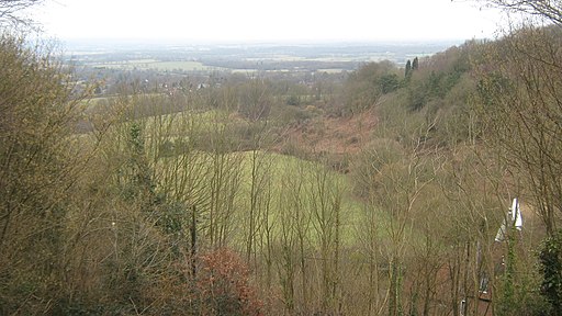
The walk starts in the village where you can pick up the long distance Greensand Way. Follow the waymarked footpath west and it will take you up to Toys Hill where you can enjoy fine views over the surrounding countryside. The area is a notable as being one of the first acquired by the National Trust.
The route then turns north east to French Street and Hosey Common before turning south to visit Mariners Hill. Here you turn east to visit Chartwell House. The house was the family home of former prime minister Sir Winston Churchill and includes some beautiful parkland and gardens.
After exploring the house the route then heads south east to Puddledock Lane which will lead you east to Toys Hill. You then pick up the Greensand Way to return you to Ide Hill.
Ide Hill Ordnance Survey Map  - view and print off detailed OS map
Ide Hill Open Street Map  - view and print off detailed map
Ide Hill OS Map  - Mobile GPS OS Map with Location tracking
Ide Hill Open Street Map  - Mobile GPS Map with Location tracking
Pubs/Cafes
Back in the village you can enjoy some post walk refreshments at the 18th century Cock Inn. They have an outdoor seating area with views over the adjacent village green to the fine church. There's also cosy fires indoors and they do very good food with a fine selection of ales. You can find them at Camberwell Lane with a postcode of TN14 6JN for your sat navs.
Dog Walking
The woodland and hills make for a fine dog walk and the Cock Inn mentioned above is also dog friendly.
Further Information and Other Local Ideas
Head south from the village and you can visit the lovely Bough Beech Reservoir. The large reservoir is a lovely place for walks and birdwatching with many species to see on the water.
Continue west along the Greensand Way and it will take you to Limpsfield Common and Limpsfield Chart in the Surrey Hills. The common has miles of woodland trails with bluebells, wildflowers and a community orchard to see.
For more walking ideas in the area see the Kent Downs Walks page.
Cycle Routes and Walking Routes Nearby
Photos
Hosey Common. To the left is French Street, and straight ahead is the road that takes you to Chartwell


