Ipswich Circular River Walk
![]()
![]() A circular walk around Ipswich with lovely river views and visits to a series of attractive parks. On the way you'll pass the River Orwell, River Gipping, Ipswich Docks, Holywells Park, Landseer Park and Orwell Country Park. The route uses a section of the Suffolk Coast Path so you can follow the waymarkers on the way.
A circular walk around Ipswich with lovely river views and visits to a series of attractive parks. On the way you'll pass the River Orwell, River Gipping, Ipswich Docks, Holywells Park, Landseer Park and Orwell Country Park. The route uses a section of the Suffolk Coast Path so you can follow the waymarkers on the way.
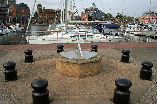
Start the walk in the town centre from Stoke Bridge, where the River Gipping becomes the River Orwell. Follow the path east round the attractive docks and marina. It's an interesting area with hundreds of yachts, an old Custom House, wharves, converted warehouses, new apartments and waterside pubs.
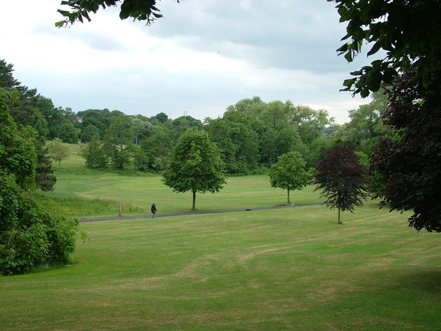
After passing round the docks you soon come to Holywell Park. There's nice footpaths in the park with gardens, ponds, fields, woodland and lots of wildlife to look out for. There's also a visitor centre and cafe where you can stop for refreshments.
The route continues south through Landseer Park where there is more nice scenery in the wide open fields.
Shortly after you come to Orwell Country Park. The 200 acre park has some nice woodland trails and great views towards the river.
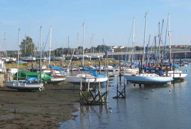
After exploring the park you cross the river on the Orwell Bridge. Follow the riverside path on the western side of the river to Bourne Bridge where there is another pretty marina. You then follow roads back to the docks before returning to Stoke Bridge.
To extend your walking in the Ipswich area you could pick up the Stour and Orwell Walk. Heading east will take you to the lovely Trimley Marshes where there is a huge variety of water loving birdlife to look out for. If you head south along the western side of the river you can visit the delightful hamlet of Pin Mill with its popular 17th century pub.
At Stoke Bridge you can also pick up the Gipping Valley River Path. The nice riverside trail will take you round to Suffolk Water Park, Claydon, Great Blakenham to Needham Market where you can visit the pretty Needham Lake.
Ipswich Ordnance Survey Map  - view and print off detailed OS map
Ipswich Open Street Map  - view and print off detailed map
*New* - Walks and Cycle Routes Near Me Map - Waymarked Routes and Mountain Bike Trails>>
Ipswich OS Map  - Mobile GPS OS Map with Location tracking
Ipswich Open Street Map  - Mobile GPS Map with Location tracking
Walks near Ipswich
- Orwell Country Park - Enjoy fabulous views of the River Orwell in this delightful country park in Ipswich
- Stour and Orwell Walk - Follow the Rivers Orwell and the Stour on this walk through the Suffolk Coast and Heaths Area of Outstanding Natural Beauty
- Trimley Marshes - Follow the circular trail around this lovely nature reserve near Felixstowe
- Gipping Valley River Path - Follow the River Gipping from Stowmarket to Ipswich on this pleasant riverside walk
- Needham Lake - Enjoy an easy stroll around Needham Lake on this short walk in Needham Market
- East Suffolk Line Walks - Follow the 'East Suffolk Line' railway from Ipswich to Lowestoft on this splendid walk through the Suffolk countryside
- Alton Water - Follow a mixture of well surfaced and unsurfaced cycling and walking trails around this large reservoir in Stutton, Ipswich
- Nacton Shores - Enjoy a lovely waterside stroll along Nacton Shores on this easy walk in Suffolk
- Pin Mill - Enjoy woodland trails and riverside paths on this delightful walk in Suffolk
- Sandlings Walk - A walk through the Suffolk Coast and Heaths Area of Outstanding Natural Beauty from Southwold to Ipswich via Woodbridge
- Helmingham Hall - This walk visits the beautiful estate surrounding the 16th century Helmingham Hall in Suffolk.


