Ivanhoe Way Walk with OS Map and GPX
![]()
![]() Travel through the setting of Sir Walter Scott's 19th century novel on this circular walk around Ashby-de-la-Zouch in Leicestershire.
Travel through the setting of Sir Walter Scott's 19th century novel on this circular walk around Ashby-de-la-Zouch in Leicestershire.
The path starts Ashby-de-la-Zouch and first heads to Moira where you will follow the Ashby Canal for a short stretch. The route continues passing Shackerstone, Coalville and Staunton Harold. Highlights on the path include the Ashby Canal, Cliff Hill Quarry and Staunton Harold Reservoir. Also look out for the National Trust owned Calke Abbey Park near the Staunton Harold Reservoir. This Grade I listed country house is slightly off the route but well worth a visit.
Ivanhoe Way Ordnance Survey Map  - view and print off detailed OS map
Ivanhoe Way Open Street Map  - view and print off detailed map
*New* - Walks and Cycle Routes Near Me Map - Waymarked Routes and Mountain Bike Trails>>
Ivanhoe Way OS Map  - Mobile GPS OS Map with Location tracking
Ivanhoe Way Open Street Map  - Mobile GPS Map with Location tracking
Pubs/Cafes
Near Coalville you will pass the high point of Leicestershire at Bardon Hill. After enjoying the views from the the hill you could stop off at The Bulls Head in Abbot's Oak, for some refreshment. They serve good food with particularly fine Italian stone-baked pizzas. There's also a lovely garden area to relax in on warmer days. You can find them at postcode LE67 4QQ for your sat navs.
The Victorian tea room at the old Shackerstone Railway station is a good place for some refreshments and local history. The authentic setting is a lovely way to step back in time while enjoying a fine range of cobs, pasties and delicious cakes. It's very quaint and includes a nostalgic railway museum. You can find them at postcode CV13 6NW for your sat navs.
In the canalside village there's also the Rising Sun. The pub is located near the canal and the station at postcode CV13 6NN. They have a family-friendly conservatory and an attractive garden for warmer days. There's also a car park and restaurant dining area. The pub is dog friendly.
Further Information and Other Local Ideas
In Moira there's the splendid Moira Furnace to visit. There's a fine country park here with woodland and parkland trails surrounding the early 19th century iron furnace. There's also a museum featuring lime kilns and craft workshops. Here you can learn all about Moira's significant part in the industrial revolution. The woods, ponds and mountain bike trails of Hicks Lodge are also located just east of the site.
For more walking ideas in the area see the Leicestershire Walks page.
Cycle Routes and Walking Routes Nearby
Photos
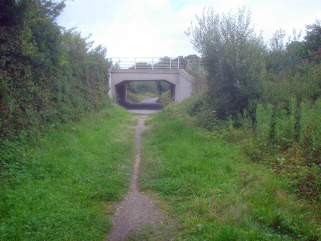
Heading north-east out of Ashby and under the A511. The Ivanhoe Way is a 35 mile circular walk around north Leicestershire, celebrating Sir Walter Scott's 1820 novel 'Ivanhoe'. Scott chose Ashby de la Zouch castle and the surrounding countryside as one of the settings used in the book, having got to know the area whilst staying at nearby Coleorton Hall.
Elevation Profile


